Shutlingsloe Walk
Climb Shutlingsloe – the Cheshire Matterhorn – a shapely peak above Macclesfield Forest
About the walk
Shutlingsloe is a distinctive hill that rises above Macclesfield Forest, and is often referred to as the “Cheshire Matterhorn” due to its shape. The summit offers fantastic views over the Cheshire Plain and into the Peak District.
This 3-mile circular walk – with an “out-n-back” section to the summit – starts quite high up at the free Standing Stone Car Park, and takes you up through woodland and across moorland to reach the summit of Shutlingsloe.
At 506 metres (1,660 feet) above sea level, Shutlingsloe is the highest point in Cheshire East, and the second highest point in Cheshire (after Shining Tor). Additionally, the Peak District Boundary Walk crosses Shutlingsloe summit – the highest point on the Boundary Walk’s 200-mile route.
Need-to-know
- Free parking (no toilet facilities; no height restriction; no overnight parking or camping). Sadly, there’s NO PUBLIC TRANSPORT to this location.
- 3 miles (5 kilometres) circular walk, with an “out ‘n’ back” section to Shutlingsloe summit.
- 500 feet (140 metres) of ascent and descent.
- 1½ to 2 hours at a leisurely pace.
-
Mixed terrain (including steep uneven steps, and boggy ground after rain); the complete route as described is not suitable for wheelchair users or for pushchairs. Smaller children may struggle with some of the rougher and muddier terrain.
If you continue on the main track (wide, and stone surfaced) when you reach the first fork (step 3), you’ll be able to go further into Macclesfield Forest without encountering steeper and rougher ground, but will omit the summit of Shutlingsloe.
- 2 stiles (including a high stone-step stile).
-
Dogs must be kept under effective control (and on a short lead) while walking this route, as it uses Public Rights of Way directly adjacent to Open Access Land, and also crosses Open Access Land with restrictions in place to protect moorland birds. There are also fields containing sheep and other livestock adjacent to the route. Moorland birds (such as Curlew and Lapwing) are easily disturbed by loose dogs.
If you have a dog, it may need some assistance negotiating the steep stone-step stile close to Shutlingsloe summit (see step 16 in the walk description).
Getting there
Start and finish at Standing Stone Car Park (arrowed on the following map).
The following may help if you use a satnav:
- nearest postcode: SK11 0BE (this postcode actually covers a wide area north of Wildboarclough village, about 3 kilometres south of Standing Stone Car Park. You should enter what3words, latitude/longitude or Ordnance Survey grid reference figures into your satnav for a more precise location).
- what3words: blogging.masking.replaces
- Latitude, Longitude: 53.240, -2.035
- Ordnance Survey grid reference: SJ 977 714
Map & directions
This simplified map provides guidance for the route described – the numbers refer to the numbered steps in the walk description. This map is not suitable for detailed navigation, for which you should use a copy of the relevant Ordnance Survey map.
The Ordnance Survey map covers a bigger area along with important information such as place names, official rights of way, and areas of Access Land.
For this walk, the ideal map is the Explorer Series Number OL24: The Peak District - White Peak Area (Buxton, Bakewell, Matlock & Dove Dale), which includes the whole area of the walk at 1:25 000 scale (4 centimetres to 1 kilometre).

Contour interval: 10 metres; index contours, 50 metres. North at top (approximate).
Map data from OpenStreetMap (available under the Open Database Licence). Contains Ordnance Survey data © Crown copyright & database right 2010–2023.
Stage 1: Standing Stone Car Park to Shutlingsloe Summit
-
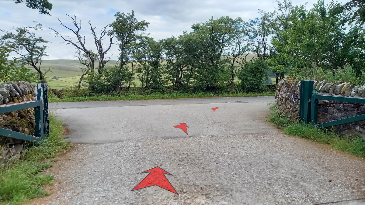
Leave Standing Stone Car Park by the main vehicle entrance (passing an information board) and turn right onto the minor road – Forest Side.
Walk 30 metres to the T-junction with Standing Stone Road.
Before crossing Standing Stone Road, take a moment to notice the plaque to your right, dedicated to Walter Smith (“Historian of Macclesfield”).

-
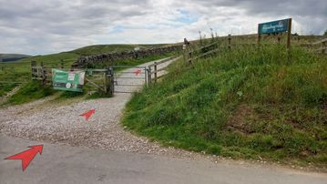
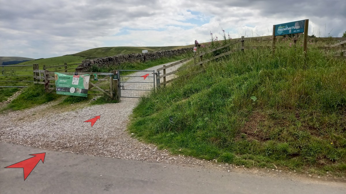
Cross Standing Stone Road and go through the metal gate onto a broad stone-surfaced track that leads you on towards Macclesfield Forest.
Ignore the smaller path that’s signposted to the right here.
-
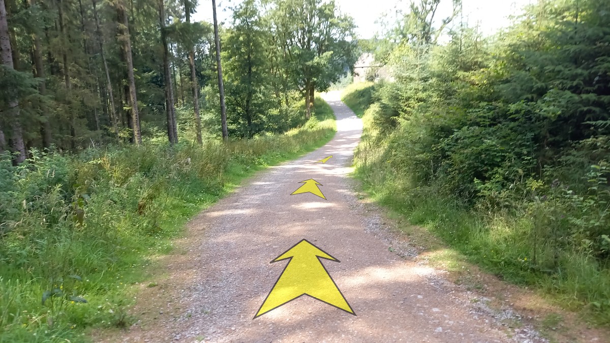
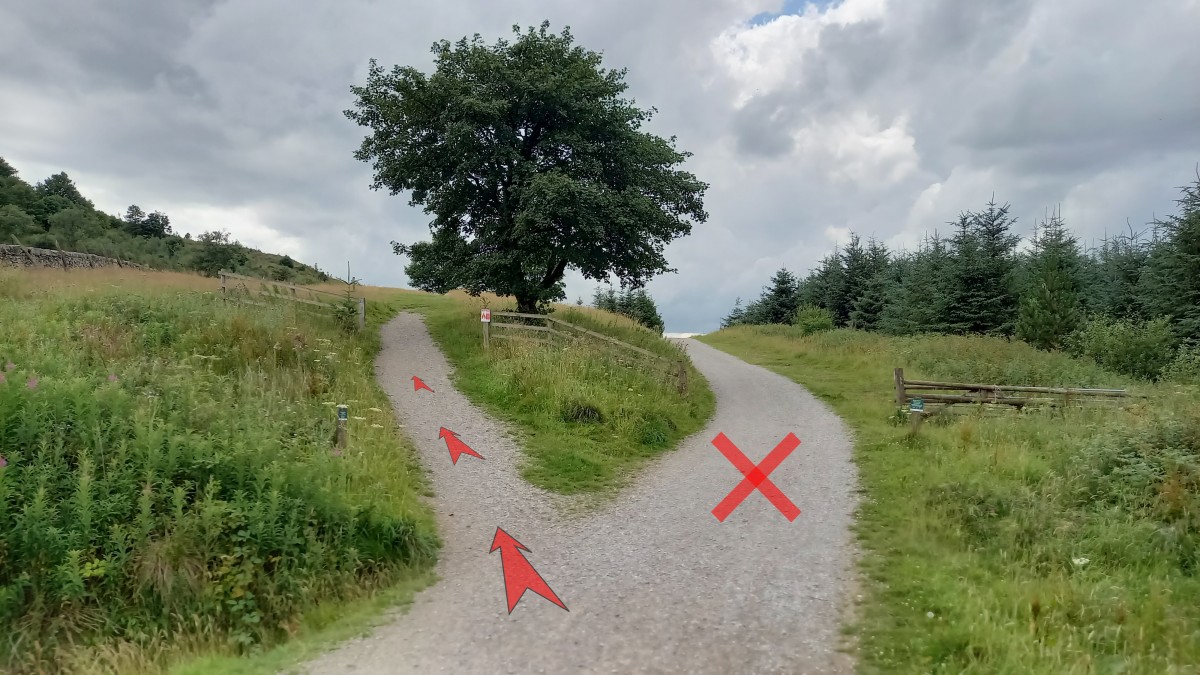
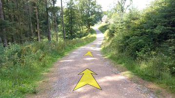
Follow the track – a bridleway – for about 300 metres.
At the obvious fork, take the smaller left-hand stone-surfaced path that leads uphill past an isolated tree.

-
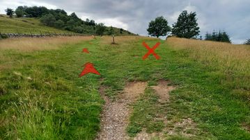
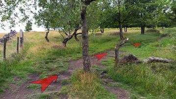
Not far from the fork, as the path turns grassy, reach another fork with a wooden signpost.
Bear left at the fork, continuing to head uphill on a grassy path towards an area of trees on the hillside.
-
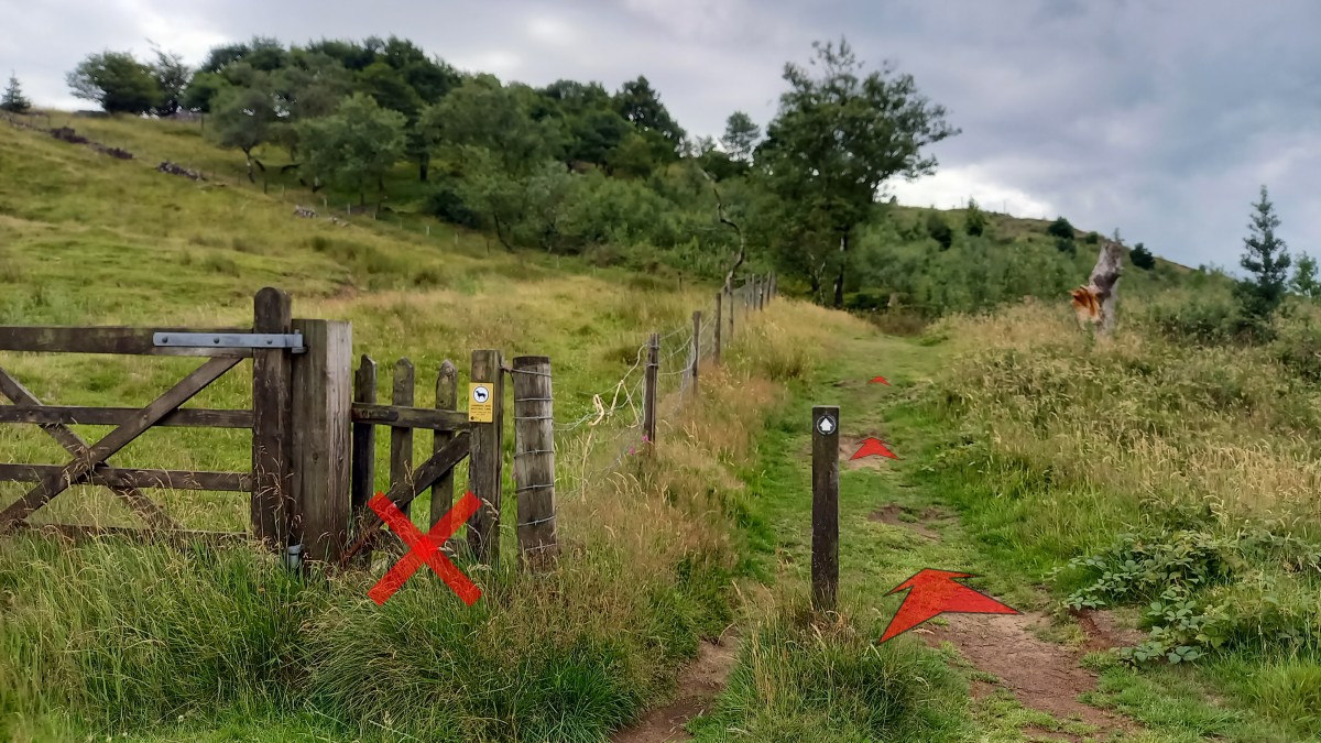
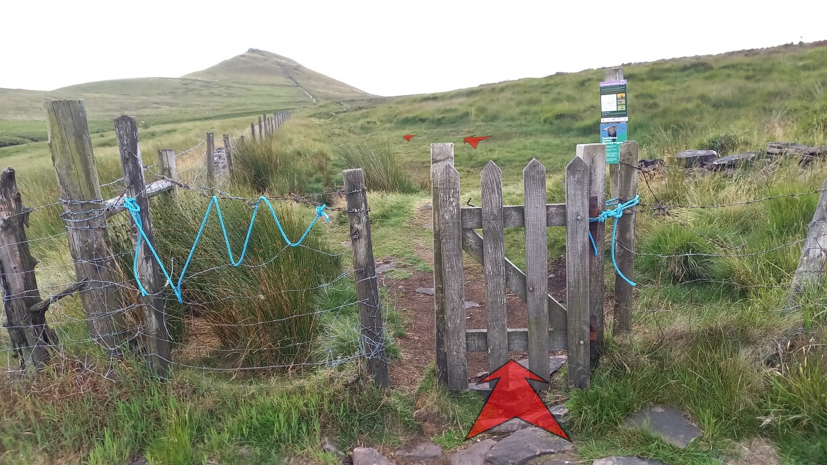
After about 100 metres of gentle uphill you’ll see a small wooden gate to the left, while the grassy path continues ahead past another wooden signpost.
Don’t go through the gate, but instead continue up the grassy path keeping the fence to your left.

-
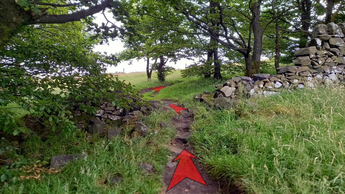
Continue uphill along the path as it enters the woodland. With the fence to your left, climb up along the woodland boundary.
The path soon bears right, away from the fence and into the woodland. Continue to follow the clear, earthy path gently uphill through the woods.
-
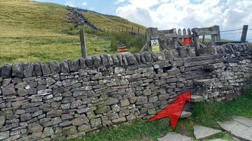
The path turns sharply left, crosses a broken-down stone wall, and then turns right to continue uphill through the woods.

-
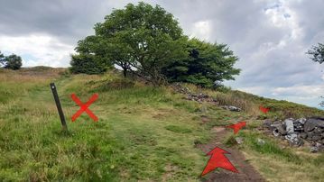
As the path reaches the top of the woodland, a wooden signpost points you to the right. Follow the earthy path right here as it re-crosses the broken-down stone wall and bears left uphill.
Walking along the right side of the ridge affords good views down into Macclesfield Forest, where you can easily make out Trentabank and Ridgegate Reservoirs
-
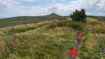
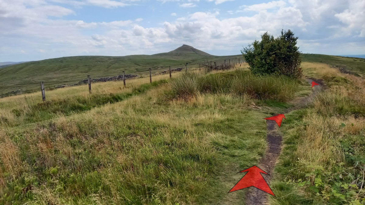
Continue along the grassy ridge of Buxtors Hill. The distinctive shape of Shutlingsloe soon comes into view.
The grassy path from earlier rejoins from the left, and the main path continues alongside a post-and-wire fence.
-
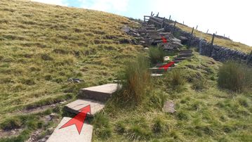
The path now levels off, and soon reaches a wooden stile. This is a little rickety (as of July 2025), so take care as you cross it.

-
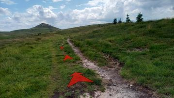
Once over the stile the broad grassy path drops a little, then bears to the left as it continues over this section of moor.
This part of the walk can get quite boggy after wet weather.
-
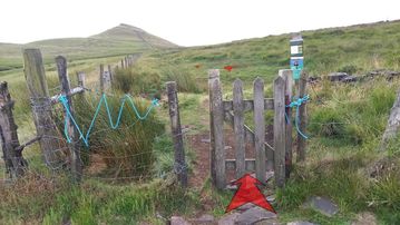
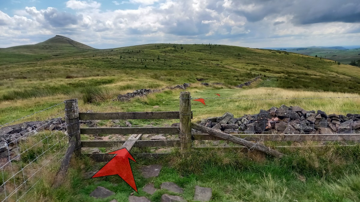
Still walking towards Shutlingsloe, you’ll reach a small wooden gate in a post-and-wire fence.
A sign here indicates areas (hatched in red) that dogs are not allowed on, so as to help conserve the moorland habitat – particularly for ground-nesting birds such as Curlew, Lapwing and Golden Plover during their nesting season (1st March to 31st July).
The route described for this walk does NOT cross any of these areas, so you can safely take your dog with you. However, please ensure that any dogs are kept on a short lead and under close control, as you will be walking directly adjacent to the protected areas.
Go through the gate, and continue along the moorland path. Again, this section can get quite boggy after wet weather.
-
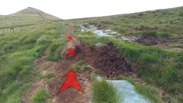
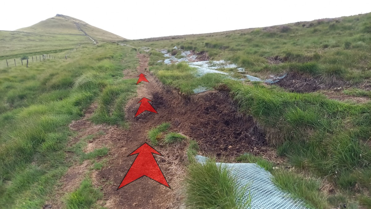
The final section of moorland path has had some remedial work completed (in the form of plastic mesh sheeting, laid to reduce erosion and make the often-boggy ground a little easier to negotiate).
Take care not to catch your feet in the mesh where it has started to degrade and tear.
Continue on across the moor towards Shutlingsloe.
-
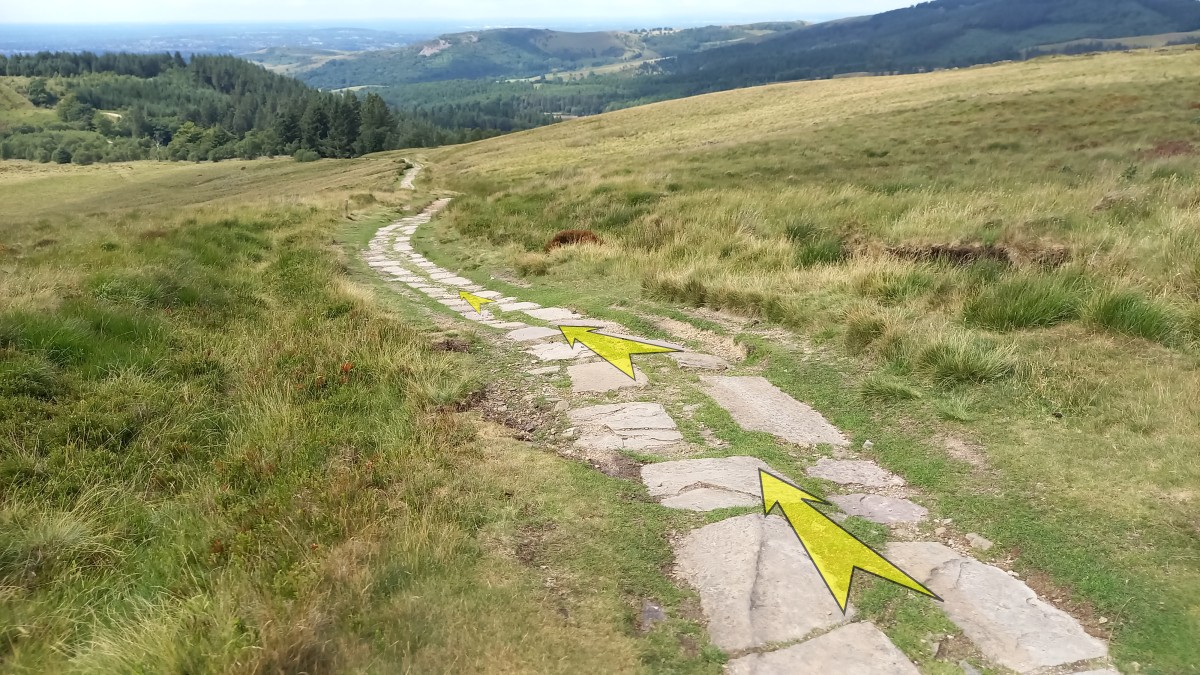
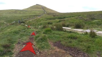
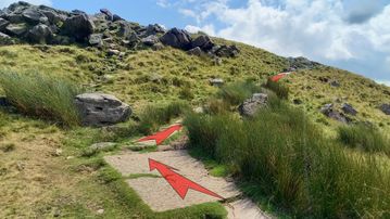
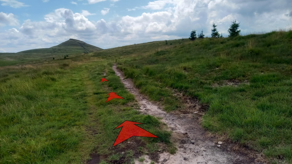
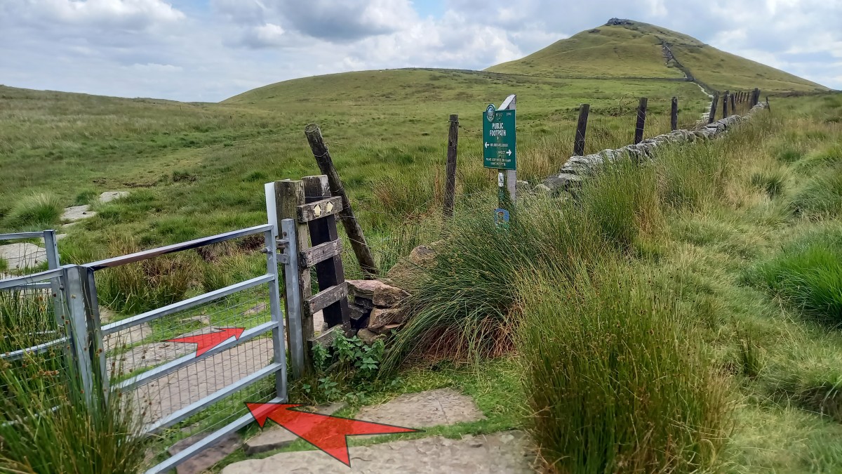
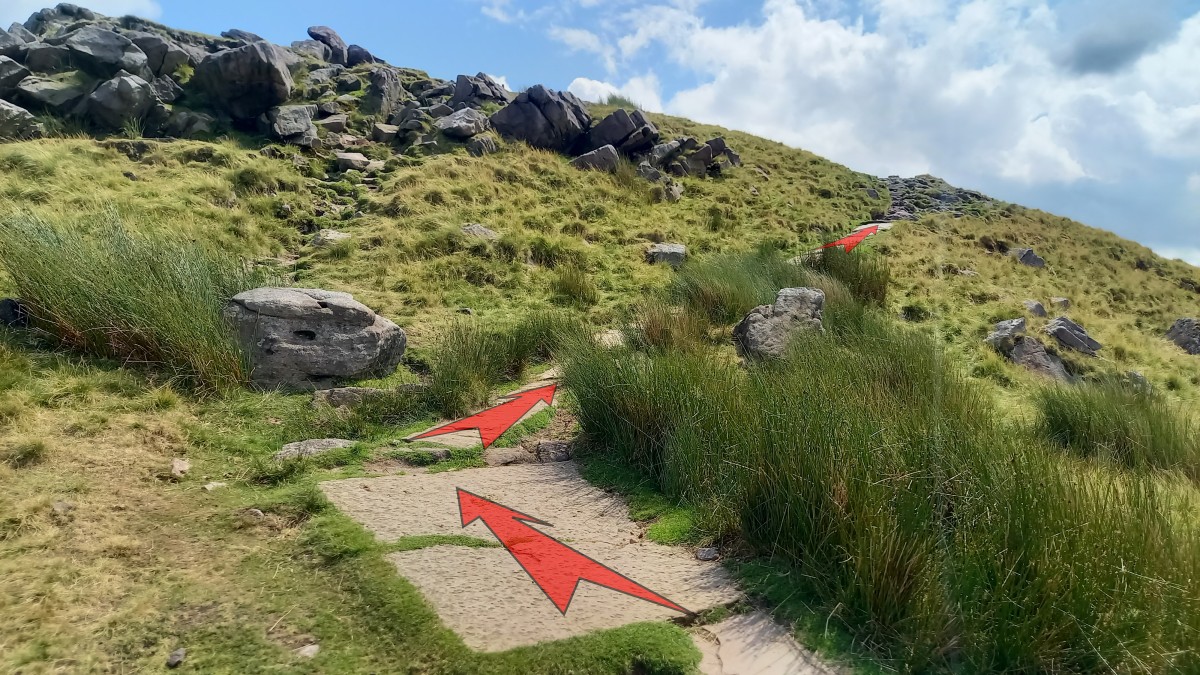
The moorland path finally reaches the main flagged path (a little under 1 km from where you left the top of the woodland).
Turn left onto the flagstones.
-
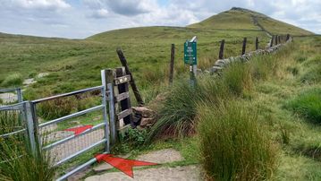
Pass through a metal gate (adjacent to a Peak & Northern Footpaths Society sign – No. 142 to Wildboarclough and Langley) and turn immediately right onto the flagged path that leads towards the summit of Shutlingsloe.
-
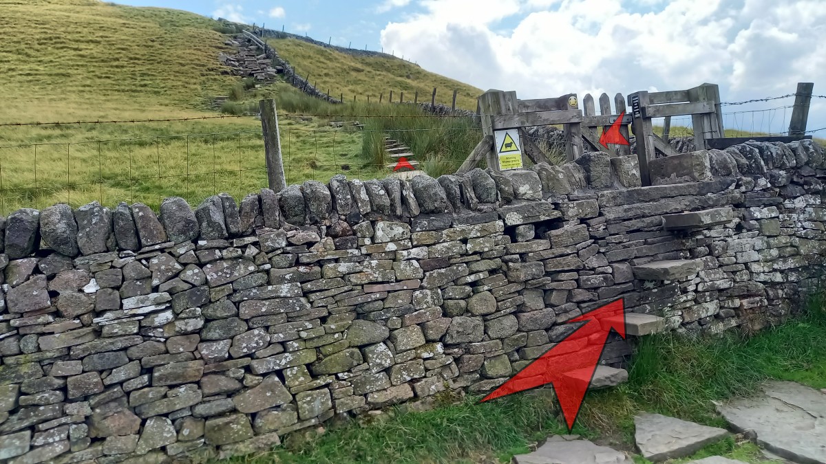
After about 250 metres of flat flagstoned path, you’ll reach a high stone step-stile adorned with a small wooden gate.
Cross this, and continue on towards the summit.
-
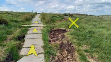
The flagstones continue, gently rising towards a steeper section of widely spaced, rough stone steps.
This is the steepest section of the climb. Take your time, especially if the steps are wet or icy
-
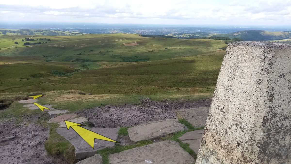
The steepest section of the steps is short-lived. Once you reach the top of this section the gradient eases, and then the flagstones turn sharply to the right.
It’s possible to continue straight ahead here on a rougher, steeper (and unflagged) path that ascends through some boulders, but it’s easier to stick with the flagstones.
-
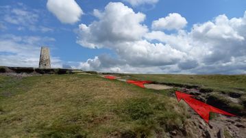
Continue on up the final few metres of flagstones, bearing left near the top to reach the summit of Shutlingsloe.
On a clear and calm day you’ll want to linger near the triangulation point (the white-painted stone pillar), or elsewhere on the grassy summit ridge, enjoying the glorious views out over the Cheshire Plain and in towards the other hills of the Peak District.
A toposcope is mounted to a rock to the south of the summit, which can help you identify some of the distant hills and landmarks.


Stage 2: Shutlingsloe Summit to Standing Stone Car Park
-
The route back down is the same as the route up (as far as the metal gate), so start by picking up the flagstoned path, and carefully making your way back down off the summit of Shutlingsloe.
Continue all the way back to the metal gate, and go back through it.

-
Instead of turning right onto the moorland path after you’ve passed through the metal gate, continue straight on along the flagged path.
This heads slightly uphill initially.
-
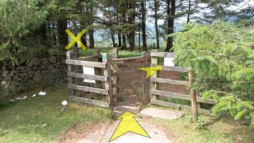
As you crest the rise on the flagged path, you can see it descending ahead towards an area of woodland.
Continue downhill on this very clear path for about ½-a-kilometre, until you reach a wooden kissing gate at the woodland edge.

-
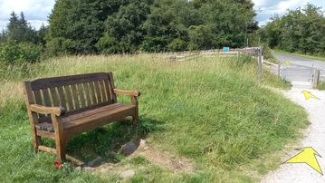
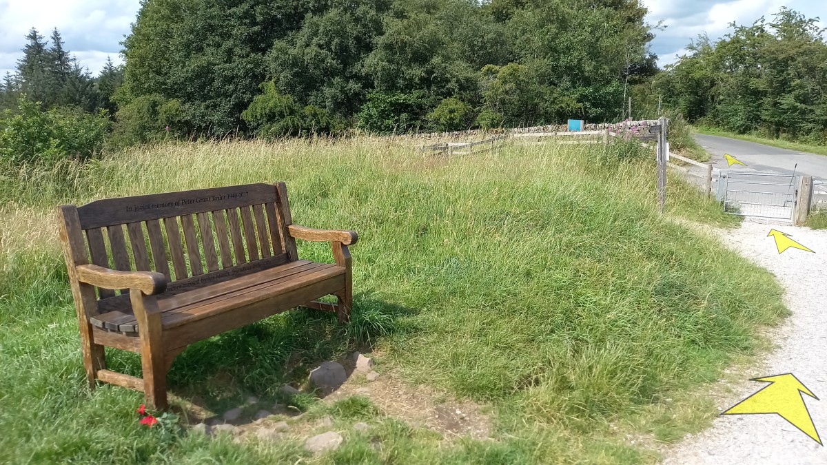
Go through the wooden gate, but instead of bearing left on the obvious track, continue straight ahead through the trees (passing another Peak & Northern Footpaths Society sign) to the obvious bench.
A little beyond the bench, go down the bank to reach the broad, stone-surfaced track that will lead you back to Standing Stone Road.
-
Turn right onto the broad, stone-surfaced track, and start off in the direction of the woodland in the distance.
-
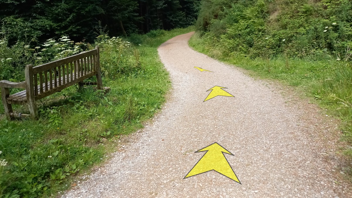
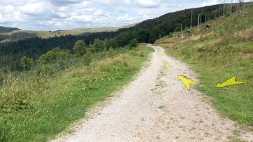
After a couple of hundred metres of gentle downhill, the track enters the woodland.
Pass a bench on your left and continue along the track.

-
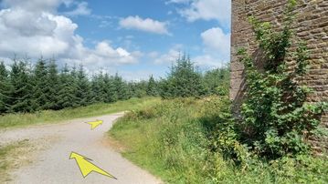
Continue to follow the track (which drops a little more, then starts to climb gently), ignoring an obvious smaller track rising steeply to the right.
About 400 metres from where you joined the broad stony track, you’ll reach a large ruined farmhouse on the right (“Ferriser”).
-
Pass to the left of the farmhouse and stick with the main track as it bears round to the right and climbs a little.
The track then starts to lose height again, and passes the isolated tree that you saw at the fork on the way up.
-
After about 700 metres from the farmhouse, you’ll reach the metal gate that leads onto Standing Stone Road, and back to the Car Park on the far side.