Wildmoorstone Valley Walk
Enjoy splendid views from the disused Cromford & High Peak Railway
About the walk
Step back in time as you take a stroll along part of the route of one of the earliest long-distance railway lines in Britain, or indeed, the world.
The 33-mile Cromford & High Peak Railway was primarily a goods line, opened between 1830 and 1831, and operating with steam locomotives from 1833. Bear in mind that it was only in 1829 that Stephenson’s famous Rocket had won the Rainhill Trials, ushering in the age of mechanised mass public transport on the world’s first formal passenger railway – the Liverpool and Manchester – itself opened in 1830.
Apart from a brief official passenger service between 1874 and 1877, the northern part of the line (part of which you’ll be walking along) remained in use solely as a goods railway until about 1890, by which time it was abandoned (a new connection from Harpur Hill to Buxton effectively superseding this section of the line). Every section of the original line had closed by 1967.
The first part of the walk is an easy stroll along the old track bed – almost completely level – as far as the north portal of the now-closed Burbage Tunnel.
There are glorious views down into the Wildmoorstone Valley from here, and ample grassy banks and benches from which to enjoy them.
The return takes you down into the valley, covering steeper and rougher terrain than the old railway, but rewarding with a real back-of-beyond feel despite being barely more than a mile from the outskirts of Buxton.
Alternatively, you can return the way that you came – along the route of the old railway – and this makes for an accessible outing for those with limited mobility, including wheelchair users. If anything, the views are even better in this direction!
Need-to-know
- Free parking (no toilet facilities; no height restriction; no overnight parking or camping).
- A regular bus service passes the end of Goyt’s Lane, only 1 kilometre from the start. See “Getting there” for more information.
- 2 miles (3 kilometres) circular walk
- 1 to 1½ hours at a leisurely pace
-
Very easy going along the old railway line (Stage 1), suitable for some with limited mobility and wheelchair users.
The return via Wildmoorstone Valley (Stage 2 – OPTIONAL) includes some steep ground (grassy slopes, occasionally rocky) both uphill and downhill, and short sections of very muddy/boggy ground if there’s been recent heavy rain.
This part of the route (which can be avoided by returning the way you came once you’ve reached the Burbage Tunnel portal – step 6 in the accompanying walk description) is not suitable for wheelchair users or for pushchairs.
- No stiles
Getting there
By bus: Bus number 61 (Buxton - New Mills - Hayfield - Glossop) passes the end of Goyt’s Lane on the A5004 Buxton to Whaley Bridge road. You will then need to walk approximately 1 kilometre down Goyt’s Lane (a quiet country road) to reach the start point.
You can download timetables for Derbyshire public transport from travelderbyshire.co.uk/journey
By car: Start and finish at Goyt’s Lane Car Park (arrowed on the following map).
The following may help if you use a satnav:
- nearest postcode: SK17 6GJ (this postcode is actually for the Errwood Sailing Club (private), which is 1 kilometre further by road from Goyt's Lane Car Park. You should enter what3words, latitude/longitude or Ordnance Survey grid reference figures into your satnav for a more precise location).
- what3words: keeps.conducted.slab
- Latitude, Longitude: 53.274, -1.967
- Ordnance Survey grid reference: SK 023 752
Map & directions
This simplified map provides guidance for the route described – the numbers refer to the numbered steps in the walk description. This map is not suitable for detailed navigation, for which you should use a copy of the relevant Ordnance Survey map.
The Ordnance Survey map covers a bigger area along with important information such as place names, official rights of way, and areas of Access Land.
For this walk, the ideal map is the Explorer Series Number OL24: The Peak District - White Peak Area (Buxton, Bakewell, Matlock & Dove Dale), which includes the whole area of the walk at 1:25 000 scale (4 centimetres to 1 kilometre).

Contour interval: 10 metres; index contours, 50 metres. North at top (approximate).
Map data from OpenStreetMap (available under the Open Database Licence). Contains Ordnance Survey data © Crown copyright & database right 2010–2023.
Base map generated by OpenOrienteeringMap (created by Oliver O'Brien). OpenOrienteering map is supported by British Orienteering.
Stage 1: Goyt's Lane Car Park to Burbage Tunnel
-
There are two car parks at the starting point for this walk, just off Goyt's Lane. The one on the right-hand side (coming from the A5004) is more convenient, and provides level access to the start of the trail along the old railway, along with three signed disabled parking spaces. If this car park is full there's a second, larger car park, back towards the A5004 about 50 yards, and on the other side of the road.
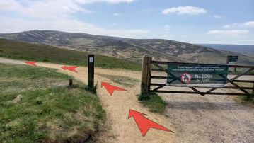
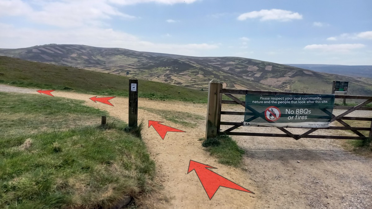
To start the walk, cross the road immediately opposite the main car park and pass around the gate at the start of the trail, then bear left onto the track (the route of the old railway line).
There are two information boards here that describe the history of Goyt's Lane and the Goyt Valley.
-
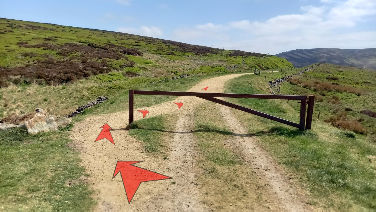
Start off along the route of the old railway line – popular with local dog walkers – which stretches out ahead. After a hundred metres or so, pass round the side of a metal barrier across the track.
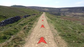
The track surface is firm, level and even, so you can enjoy the extensive views out to your right as you go.

-
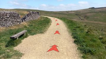
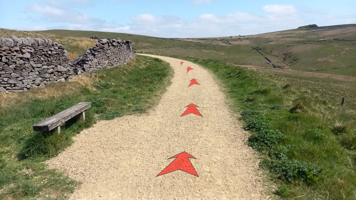
There's a well sited bench not far along the track, just before a left-hand bend. Perhaps not far enough to warrant a sit down yet, but then again… if there's no hurry…
-
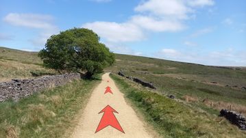
Continue along the track. You'll pass a lone tree on your left, which also has a bench – a great spot to shelter from the sun if it's a hot day.
Not far beyond the tree, pass through a metal gate across the track.
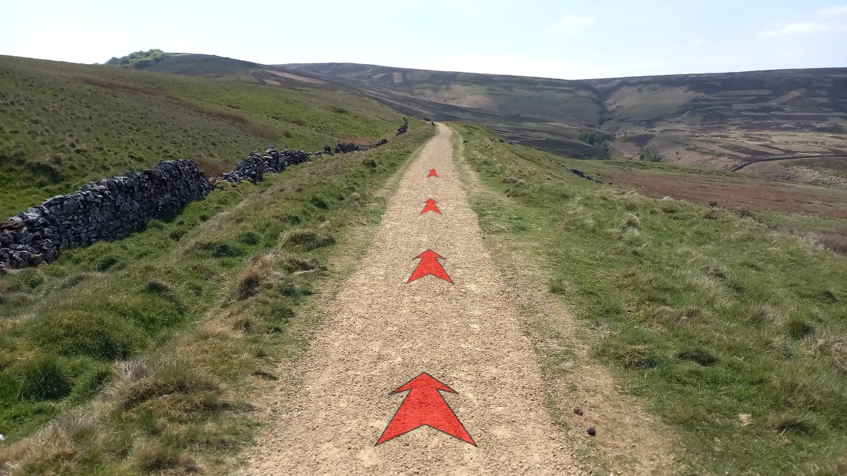
The track now bears right, then starts a long bend to the left before looping back round to the right over a high earth embankment. This was to avoid the railway losing height into the valley ahead.
You can see the track continuing on the other side of this small valley as you look ahead.
-
About 1 kilometre from the lone tree, and having followed the track around the loop, you'll reach another straight section.
A few years ago the track surface was deteriorating at this point, but it's been greatly improved recently.
-
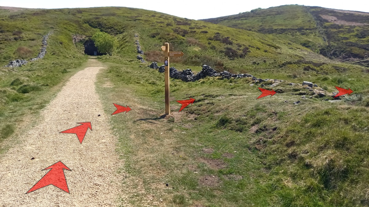
Continue along the track, soon bending to the left, and within 200 metres you'll see that the track ends against the walled-off northern portal of the Burbage Tunnel. (You can go and take a look at the old tunnel entrance, but there's no way through here.)
To continue the circuit, turn right off the track just before the tunnel – a signpost marks the way to "Wildmoorstone Brook".
If you'd prefer to avoid the rougher ground and steep slopes that lie ahead in the Wildmoorstone Valley, you should return the way you came, back along the old railway line.


Stage 2: Burbage Tunnel to Goyt's Lane Car Park
-
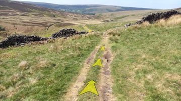
Shortly after leaving the main track, continue along the grassy path ahead, and cross over a ruined stone wall.
Shortly after the wall, the path descends steeply down a grassy slope (take care here if the grass is wet), before the gradient eases a little, and the path bears to the right ahead.
-
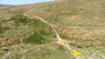
About 350 metres after leaving the route of the old railway, the grassy path you're on drops down to a short wooden bridge. Cross this, climb a short way up the steep slope on the other side and continue to follow the path, which is now more earthy than grassy as it contours the hillside ahead.
Note that the section of path close to the bridge can get very muddy after recent wet weather – take care on these potentially muddy and steep sections.
-
Continue to follow the path, which meanders up and down along the Wildmoorstone Valley (though with a general downward trend).
A couple of short sections of boardwalk have been installed to make it easier to cross what can become very boggy ground after heavy rain. As of July 2025, the second of these sections of boardwalk has sustained some damage, so you'll need to bypass this to one side. Hopefully this will be repaired in the near future.
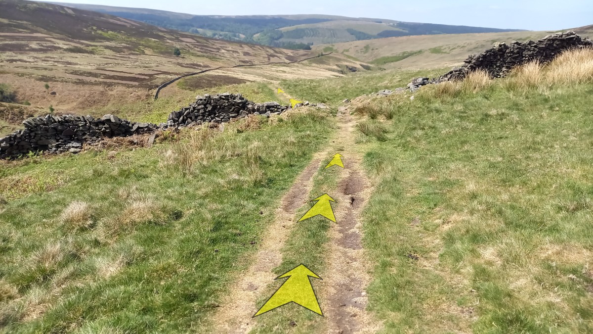
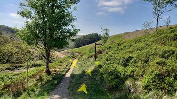
About 700 metres from the bridge you'll reach a path junction with a signpost. Leave the main path here and follow the smaller grassy track up to your right, signed to "Goyts Lane".
-
The grassy track rises quite steeply and soon meets another track. Bear right onto this and continue uphill, quite steeply in places, and over a short section of rocky ground.
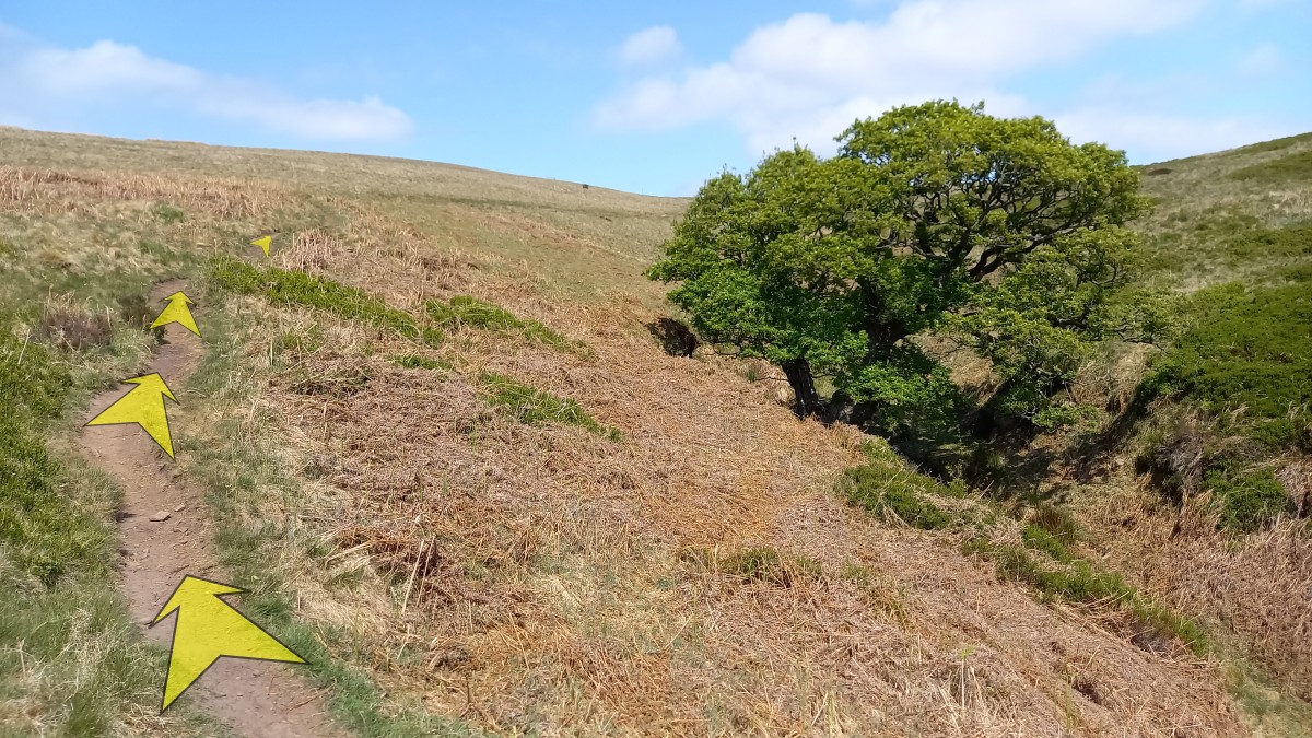
You'll soon rise above the small, deep-cut valley to your right (pictured, with tree), and continue climbing up across more open moorland.

-
Ignore a track branching off to the right not far above the tree, and continue to follow the main track uphill.
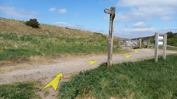
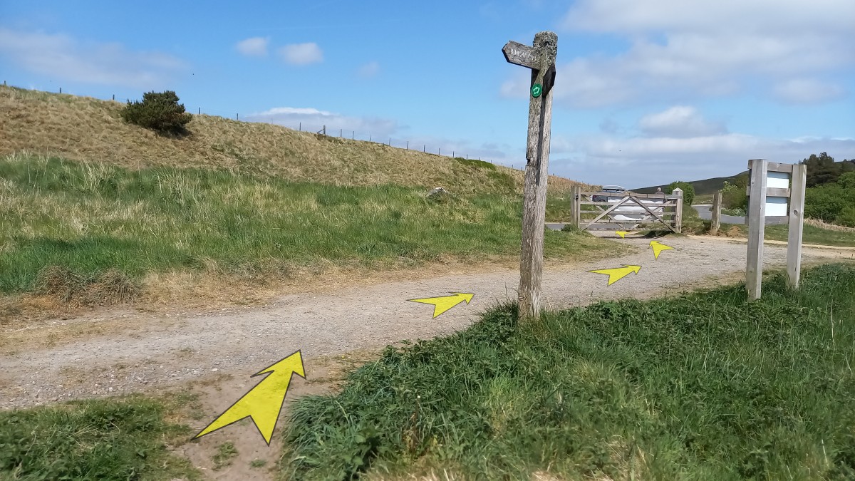
About 400 metres from where you left the main track in the valley, go through a small gate across the track, after which you'll soon reach a junction with a much larger track, close to the start of the old railway.
There's a signpost here (pointing to "Wildmoorstone Brook" in the direction you've just come from).
Turn right here, and within a few strides you're back at the start of the old railway, with the car park directly ahead, just across the road.