Shining Tor Walk
Admire the view from the highest point in Cheshire – see if you can spot Snowdon
About the walk
Shining Tor rises to the West of the Goyt Valley and if starting from the shores of Errwood Reservoir gives a good 300 metres (1000 feet) of ascent. At 3¾ miles, the circuit should take 1¾ to 2¼ hours at a leisurely pace (though if you’re slow on hills allow extra time, as there’s a fair bit of ascent and descent on this walk).
The route shown starts and finishes by the reservoir at Errwood Hall Car Park and circles around Shooter's Clough, visiting Shining Tor summit (559 metres) – the county top of Cheshire – on the way.
The views from the top are superb on a clear day. Looking out over the Cheshire Plain, you'll easily pick out the hills of the Clwydian Range in North Wales and the Wrekin in Shropshire (almost 50 miles distant), as well as numerous local landmarks, including Shutlingsloe, and the large Lovell radio telescope at Jodrell Bank.
Need-to-know
- Free parking (picnic tables close by, but no toilet facilities; no height restriction; no overnight parking or camping).
- Sadly, there’s no public transport available to the start of this walk. However, a regular bus service passes the end of Goyt’s Lane, just over 3 kilometres from the start. See “Getting there” for more information.
- 3¾ miles (6 kilometres) circular walk.
- 1¾ to 2¼ hours at a leisurely pace (but allow longer if you’re slow on hills).
- Mixed terrain (including moderately steep slopes, rough tracks and some boggy ground after rain); not suitable for wheelchair users or for pushchairs.
- No stiles
Getting there
By bus: Bus number 61 (Buxton - New Mills - Hayfield - Glossop) passes the end of Goyt’s Lane on the A5004 Buxton to Whaley Bridge road. You will then need to walk just over 3 kilometres, initially down Goyt’s Lane (a quiet country road), down the steep Bunsal incline, across the dam, then south alongside the shore of Errwood Reservoir to reach the start point.
Remember that you’ll need to reverse this initial walk to return for the bus, which will add a lot of extra distance to the route. The map on the Wildmoorstone Valley walk page shows Goyt’s Lane, and its junction with the A5004 bus route.
You can download timetables for Derbyshire public transport from travelderbyshire.co.uk/journey
By car: Start and finish at Errwood Hall Car Park (arrowed on the following map).
NOTE: Errwood Hall Car Park and the road to it are subject to seasonal closures. See the “IMPORTANT” alert box below for full details.
Also note that the road alongside Errwood Reservoir is ONE-WAY (heading south to Derbyshire Bridge and the A537/A54 Cat & Fiddle road) after the entrance to Errwood Hall Car Park.
The following may help if you use a satnav:
- nearest postcode: SK17 6GJ (this postcode is actually for the private Errwood Sailing Club, which is just over 1 kilometre by road from Errwood Hall Car Park. For a more precice location, you should enter the name – *Errwood Hall Car Park*, what3words, latitude/longitude, or Ordnance Survey grid reference figures into your satnav).
- what3words: yards.behind.tadpole
- Latitude, Longitude: 53.270, -1.983
- Ordnance Survey grid reference: SK 012 748
Map & directions
This simplified map provides guidance for the route described – the numbers refer to the numbered steps in the walk description. This map is not suitable for detailed navigation, for which you should use a copy of the relevant Ordnance Survey map.
The Ordnance Survey map covers a bigger area along with important information such as place names, official rights of way, and areas of Access Land.
For this walk, the ideal map is the Explorer Series Number OL24: The Peak District - White Peak Area (Buxton, Bakewell, Matlock & Dove Dale), which includes the whole area of the walk at 1:25 000 scale (4 centimetres to 1 kilometre).

Contour interval: 10 metres; index contours, 50 metres. North at top (approximate).
Map data from OpenStreetMap (available under the Open Database Licence). Contains Ordnance Survey data © Crown copyright & database right 2010–2023.
Base map generated by OpenOrienteeringMap (created by Oliver O'Brien). OpenOrienteering map is supported by British Orienteering.
IMPORTANT Errwood Hall Car Park (and the road to it) is CLOSED on Sundays and Bank Holidays from 10:30am to 5:30pm. This closure applies from the May 1st to the end of September every year (except for cyclists, horse riders, walkers, emergency services and special permit holders). If you want to do this walk on a day when the road and Errwood Hall Car Park are closed, you should park at The Street Car Park instead. This is 1 kilometre north of Errwood Hall Car Park, along a flat road beside the reservoir.
BAD WEATHER ALTERNATIVE If the weather's poor, the low-level walk around Fernilee Reservoir would be a better option.
Stage 1: Errwood Hall Car Park to Shining Tor summit
-
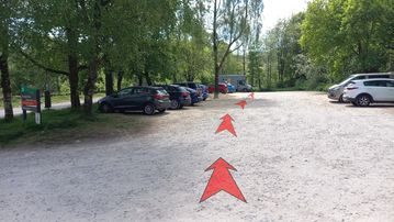
Walk to the far end of the car park (the south end) with the road and Errwood Reservoir on your left. (Ignore the broad track to the right – with a green-painted metal gate – which provides access for forestry vehicles.)
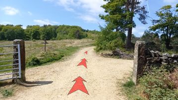
At the end of the car park, walk through the trees a few metres to a signpost (pointing to "Stakeside"), then turn right onto the path that heads uphill through the trees.
-
Head uphill through pleasant woodland on the earthy path. You'll soon meet the forestry vehicle track coming in from the right. Continue uphill on the now stony track.

-
After about 50 metres, you'll reach the top edge of the woodland and pass through an open gateway bordered by two stone pillars.
Cross the track, and continue straight ahead up the hill (passing a signpost on your left pointing towards "Stakeside").
-
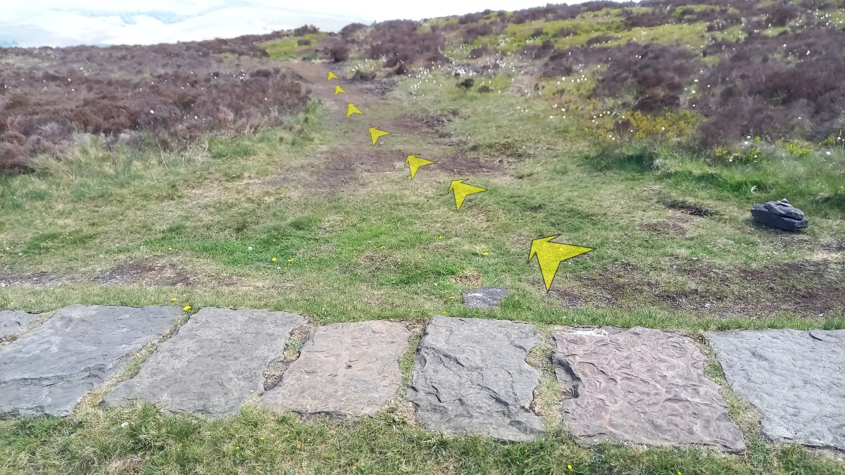
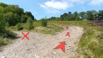
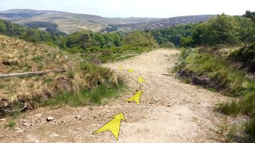
Now the hard work starts! Follow the broad, stony track as it ascends the open hillside. After about 100 metres, as you approach the bottom corner of a forestry plantation on your left, the main track bears left towards the trees. You should bear right here instead, continuing up the open hillside on a clear track.
Take your time on this ascent – there are lovely views back over Errwood Reservoir as you gradually gain height above the lower woodlands. After about 500 metres distance and 100 metres (330 feet) ascent, you'll reach a fence with gateways across the track.
-
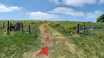
Pass through the gates (the big metal gate is usually left open), and continue on up the track, now more grassy, aiming for a dry stone wall about 250 meters away (just visible on the horizon, over to the right).
-
At the dry stone wall, there is another gateway with a stone pillar. Don't pass through the gateway, but instead bear left to continue following the track uphill – less steeply now – keeping the wall on your right.

-
You're now walking up Stake Side ridge. Continue to follow the obvious track, never far from the stone wall to your right, as it gradually gains height. There are good views left here to the open moorland of Goyt's Moss and Burbage Edge (the regular patterns on the ground are from controlled heather burning).
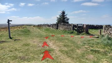
To the right (over the stone wall), you can see Shining Tor itself. Eventually, about 1 kilometre (⅔ mile) from the wall gateway, you'll reach a path junction with a signpost on your left, and a gateway to your right.
Turn right off the main track and pass through the gateway in the direction signed to "Shining Tor".
-
A good path now takes you directly towards the summit of Shining Tor, about 1 kilometre distant (⅔ mile), which you can see ahead in clear weather.
The path stays close to a stone wall on your left, and initially descends a little (about 15 meters/50 feet) to a large isolated conifer before climbing the final 50 metres/165 feet to the top of Shining Tor.

-
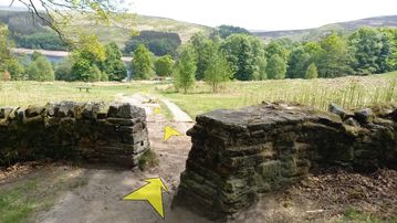
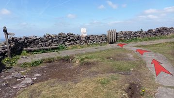
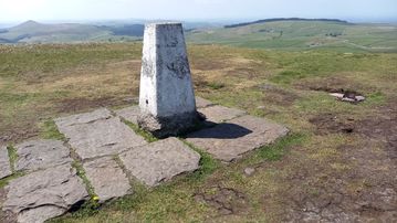
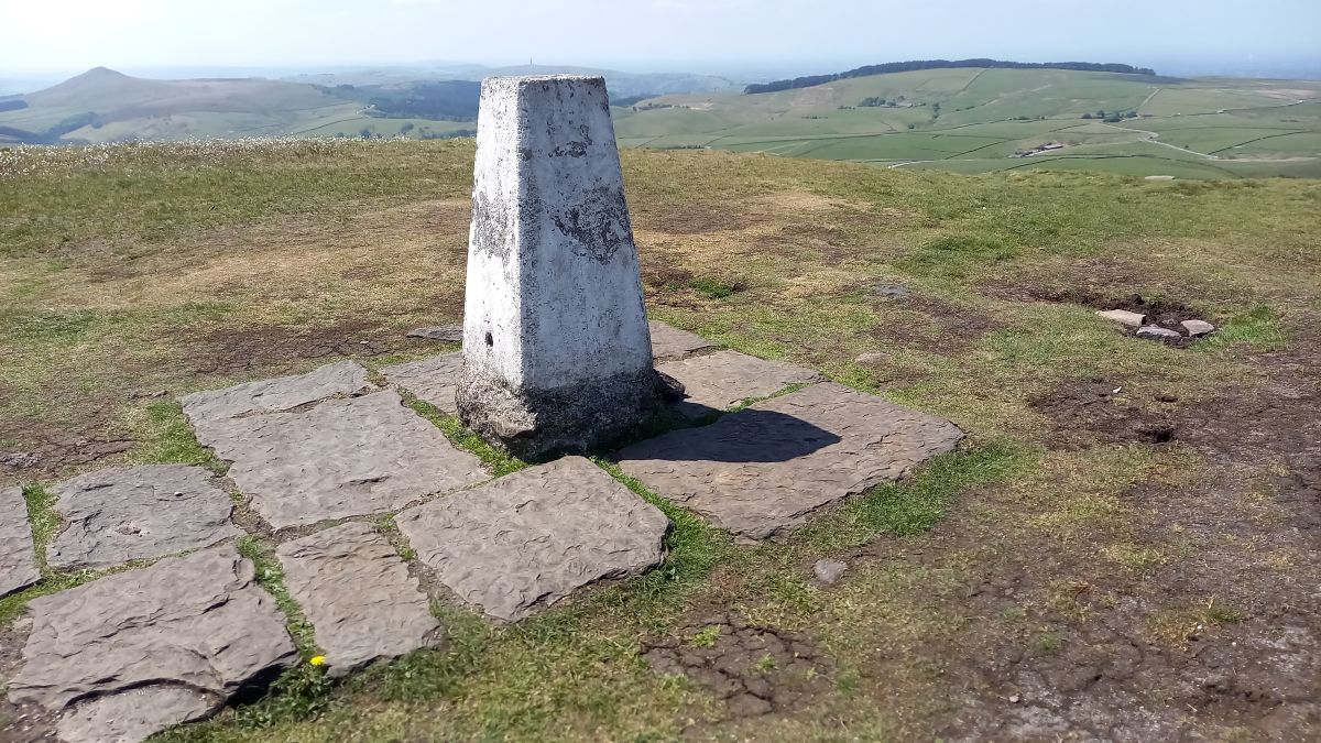
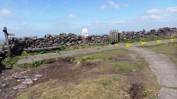
As you approach the summit, pass a signpost and benches on your left (one of which is inscribed with a few lines of doggerel praising National Park Rangers), then go through the narrow gate to reach the triangulation pillar (a square, white-painted concrete survey station, a little over a metre high).
You are now in Cheshire, having crossed over from Derbyshire when you passed through the gate.
-
In fair weather, with good visibility, it's well worth spending some time taking in the view from the summit. This is extensive to the West, looking out over the western fringes of the Peak District (Shutlingsloe is the most obvious nearby hill) and out across the Cheshire plain to the Clwydian Hills in north Wales. In exceptionally clear conditions, the high mountains of Snowdonia may be visible on the horizon.
Before you leave, wander over to the top of the small rock outcrops (just to the west of the triangulation pillar) for an excellent view down to the Cat & Fiddle road below.


Stage 2: Shining Tor summit to Errwood Hall Car Park
-
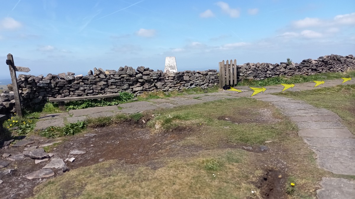
Leave the top of Shining Tor by going back through the gate (noting the attached memorial plaque: "David McKillop 1951–2008 We clamb the hill thegither", a line taken from Robert Burns' poem, "John Anderson, My Jo").
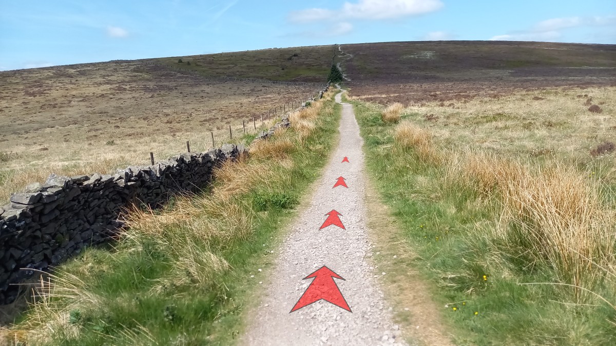
Turn left onto the flagged path that heads roughly north away from the summit, with the stone wall to your left.
-
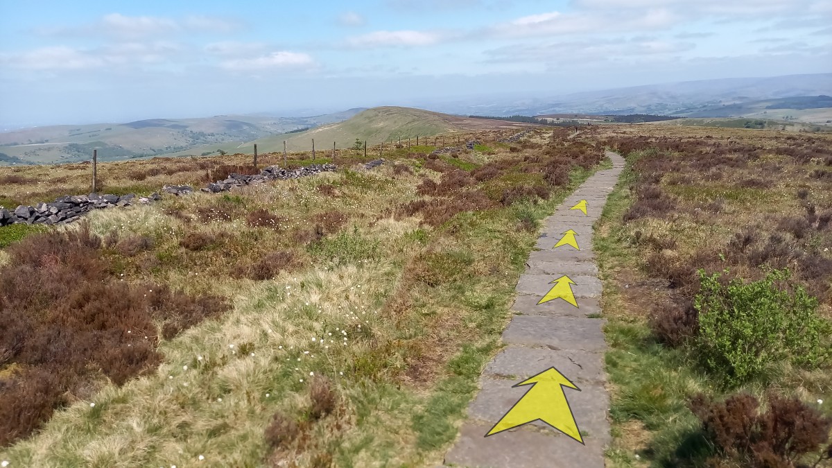
Follow the flagged path as it gradually loses height along the ridge. There are great views all the way along here, including to the higher ground of the Peak District off to the right (Kinder Scout), and out over Manchester to the left.
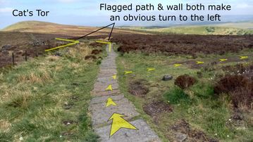
The hill directly ahead is Cat's Tor, but you'll be turning off the main flagged path before you get there.
Continue along the flagged path for just over 1 kilometre (⅔ mile) from the top of Shining Tor, descending all the time.

-
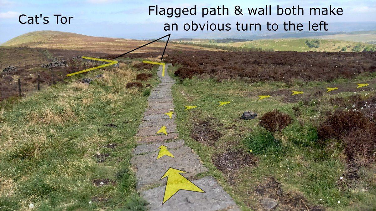
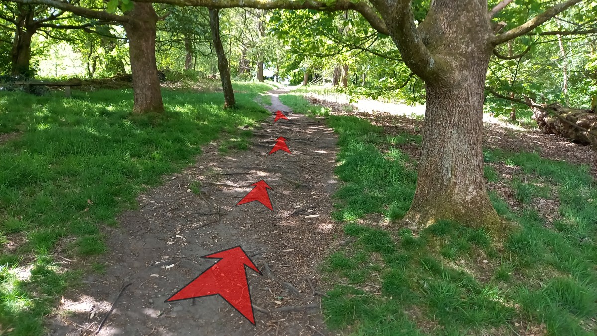
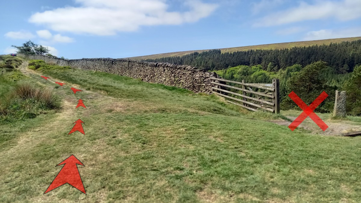
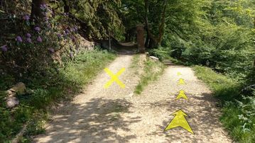
Just after a slightly steeper section of path, you'll notice that the flagged path makes an obvious turn to the left just ahead, as does the fence and dry stone wall (as shown in the photo). This is only a couple of hundred metres before the low point on the ridge between you and Cat's Tor.
Just before this turn to the left, turn right off the flagged path and onto an earthy path. Although it's become clearer over the last few years, this earthy path is still easy to miss, and isn't signposted.
If you are still on the main flagged path when it reaches its low point on the ridge and then starts climbing towards Cat's Tor then you've gone too far, and will have to turn around and try to locate the earthy path.
-
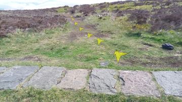
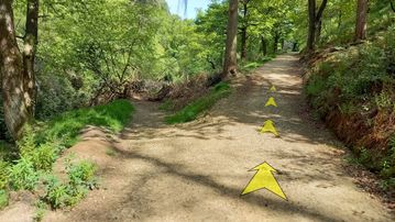
Once you're on it, the earthy path is easy to follow, though can get quite muddy in places after rain.
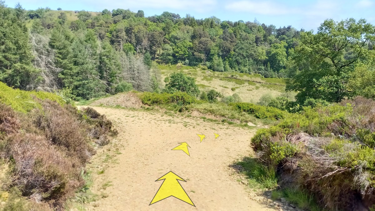
Follow the path for about 200 metres until it meets the stony turning area at the end of a forestry track.
-
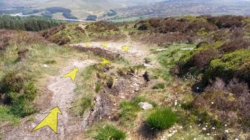
Drop down a small bank onto the turning area, and head downhill along the forestry track.
-
Although the forestry track is quite steep and rocky in places, it's pretty easy going. Above the forest edge, the track has been dug into the hillside, with steep banks either side.
As you enter the forest, the track steepens somewhat, and makes several turns back and forth as it descends.
After about ¾ kilometre (½ mile), you'll reach the bottom edge of the forest and should follow the track as it takes a sharp bend to the left.
-
The track continues to lose height quickly, with good views down into the Goyt Valley to your right.
Continue for about 250 metres before following the track round in a sharp turn to the right.

-
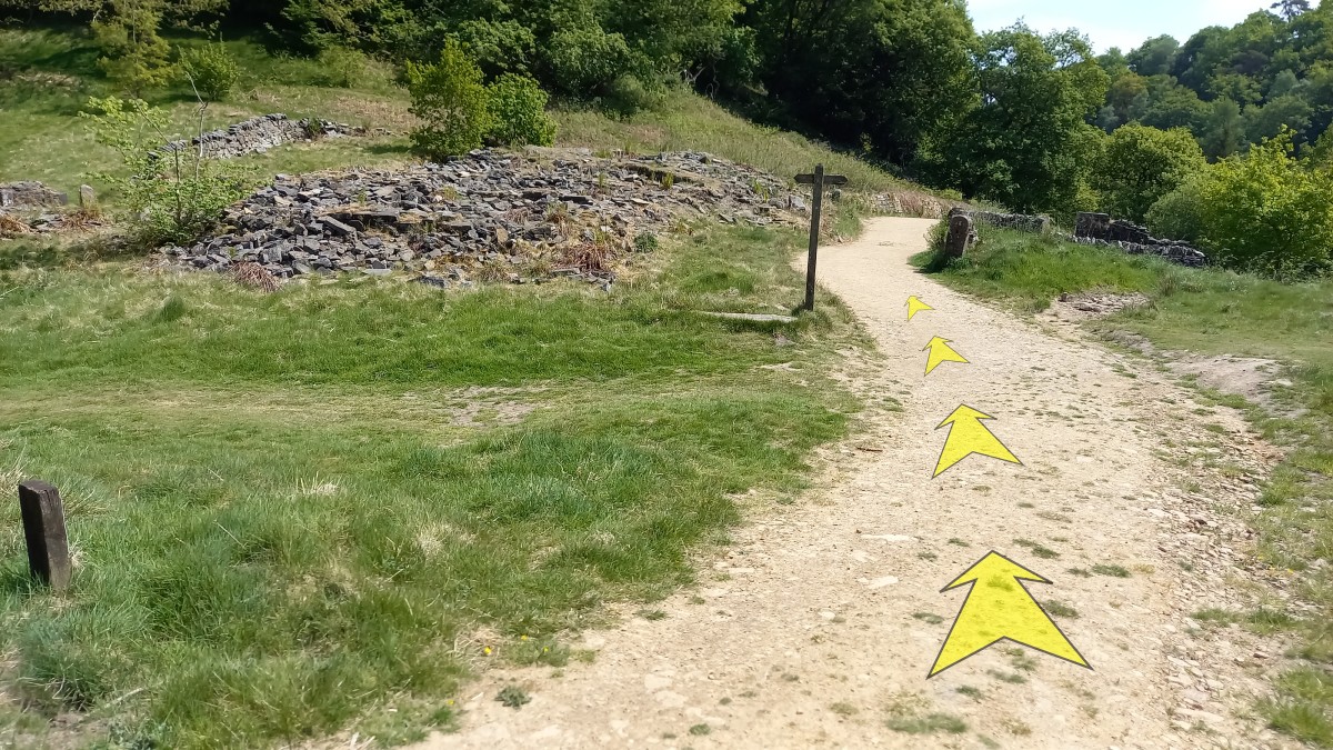
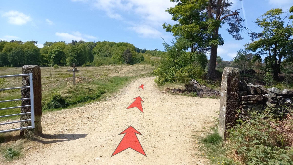
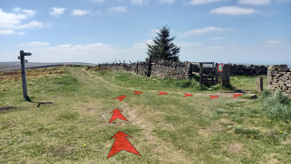
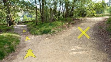
Continue to follow the track as it gradually levels out after about 300 metres, and reaches a path junction with a signpost.
Continue along the main track, signposted to "Errwood Car Park".

-
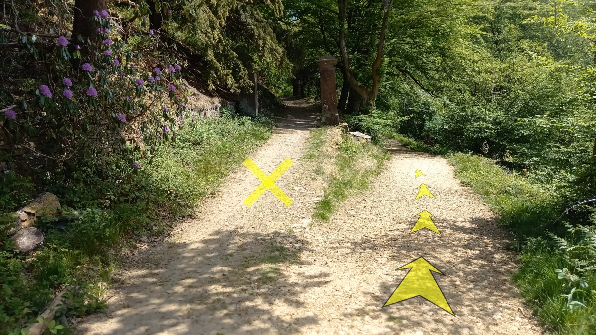
In another 200 metres you'll pass a track forking up to the left past a pair of stone pillars (an old entrance to Errwood Hall).
Keep right and continue to follow the main track.
-
After a further 200 metres you'll reach another path junction, with a signposted track ("Errwood Hall") heading off to the left. If you've time, it's an interesting diversion to take a look at the ruins of the hall, which are only a minute's walk away along the track to the left.
To return to the car park, keep right and continue along the main track.

-
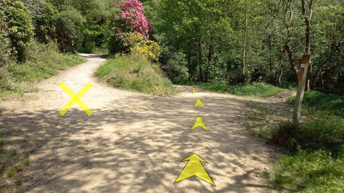
The track continues downhill for another 100 metres from the last path junction, crossing a stream before starting a short easy climb up past swathes of Rhododendron bushes (very attractive when in flower in late May/early June).
-
After another 200 metres of uphill you'll approach the top of the rise.
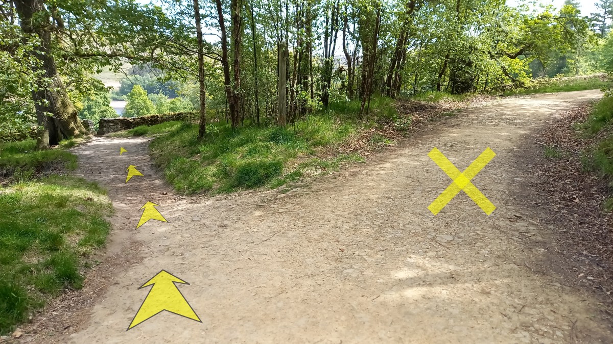
As the main track bends to the right, take the smaller path off to the left.
-
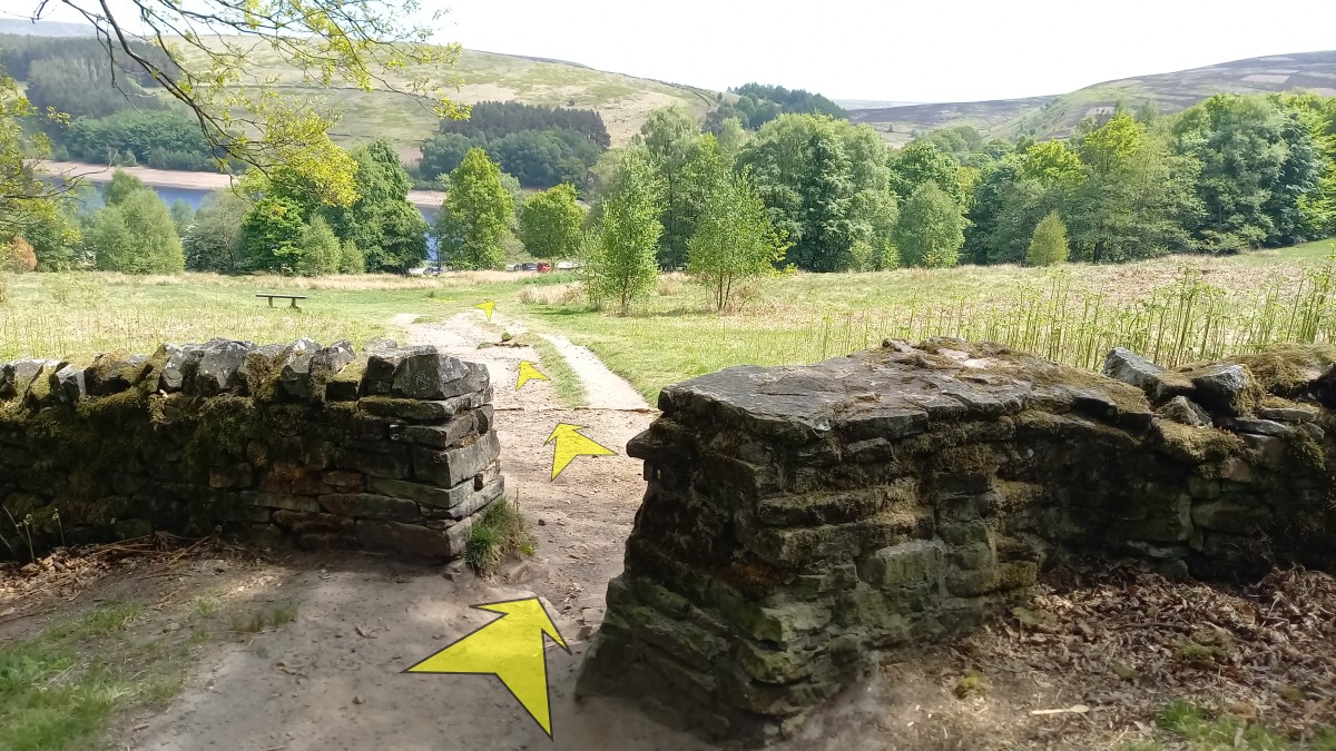
Follow the smaller path for a few metres, and pass through a gap in the stone wall.
At this point, you leave the trees behind, and the Errwood Hall Car Park is clearly visible at the bottom of the grassy slope ahead, just in front of the reservoir.
From the top of the slope, it's just a final 200 metres back to the car park.