Lud's Church Walk
Explore this remote and mysterious chasm, hidden away in the woods near Gradbach
About the walk
This circular walk explores a fascinating corner of the Staffordshire Peak District, the highlight being the mysterious and atmospheric chasm of Lud’s Church. This deep fissure is steeped in local folklore and historical tales, from its use as a secret place of worship for Lollard reformers in the 15th century to its legendary connection to Robin Hood.
The sheer, moss-covered walls of Lud’s Church create a unique microclimate, lending the the site a “lost world” feeling – a magical and timeless place. The chasm is surrounded by attractive woodland, which is particularly beautiful in spring when the bluebells are in bloom.
This walk is suitable for those with a reasonable level of fitness, and includes some short sections of steep and loose paths in the woods, as well as steep rocky steps.
Need-to-know
-
Free parking (no toilet facilities; no height restriction; no overnight parking or camping). Sadly, there’s NO PUBLIC TRANSPORT to this location.
The free car park only has room for about 20 vehicles, so at busy times (which realistically means any time after 10 am during the summer) when the free car park is full, there is often an overflow car park available in a field 100 metres back up the road. All-day parking here costs £5 (as of summer 2025), and payment by cash or card is accepted.
- 3¼ miles / 5¼ kilometres circular walk.
- 2 hours at a leisurely pace.
- 500 ft (150 m) ascent and descent.
- Mixed terrain (including some steep and loose paths, rough ground with tree roots and rocks, rough stone steps and an optional river crossing on rocks at a ford); not suitable for wheelchair users or for pushchairs.
- 1 stile.
- For an optional refreshments stop, the Coffee Cabin at Gradbach Mill is near the start & finish of the walking route (located at number “4” on the map below) and is open from Easter to October. Check facebook.com/gradbachcafe for opening times.
Getting there
Start and finish at Gradbach Car Park (arrowed on the following map).
The following may help if you use a satnav:
- nearest postcode: SK17 0SU (this postcode actually covers a wide area of countryside around Gradbach; you should enter what3words, latitude/longitude or Ordnance Survey grid reference figures into your satnav for a more precise location).
- what3words: flick.rashers.washable
- Latitude, Longitude: 53.193, -2.002
- Ordnance Survey grid reference: SJ 998 662
Map & directions
This simplified map provides guidance for the route described – the numbers refer to the numbered steps in the walk description. This map is not suitable for detailed navigation, for which you should use a copy of the relevant Ordnance Survey map.
The Ordnance Survey map covers a bigger area along with important information such as place names, official rights of way, and areas of Access Land.
For this walk, the ideal map is the Explorer Series Number OL24: The Peak District - White Peak Area (Buxton, Bakewell, Matlock & Dove Dale), which includes the whole area of the walk at 1:25 000 scale (4 centimetres to 1 kilometre).

Contour interval: 10 metres; index contours, 50 metres. North at top (approximate).
Map data from OpenStreetMap (available under the Open Database Licence). Contains Ordnance Survey data © Crown copyright & database right 2010–2023.
Stage 1: Gradbach Car Park to Lud's Church
-
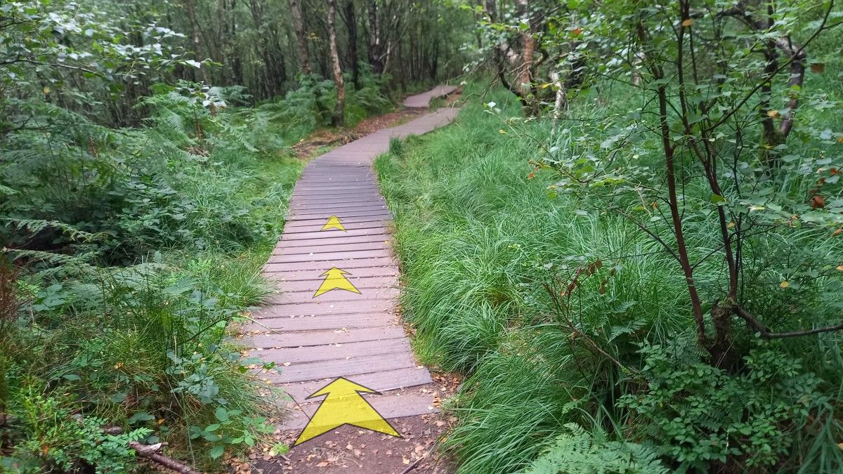
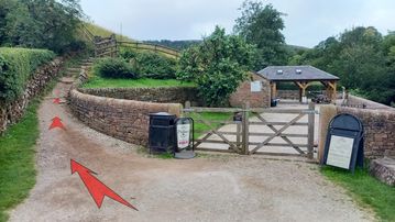
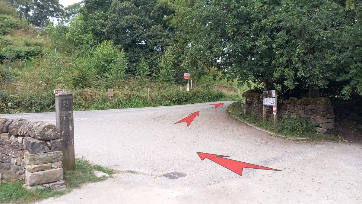
Leave the car park by the main vehicle entrance and turn right onto the road.
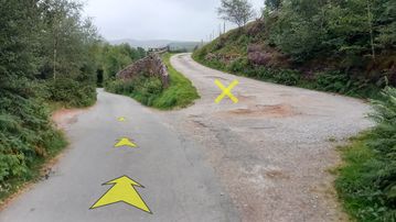
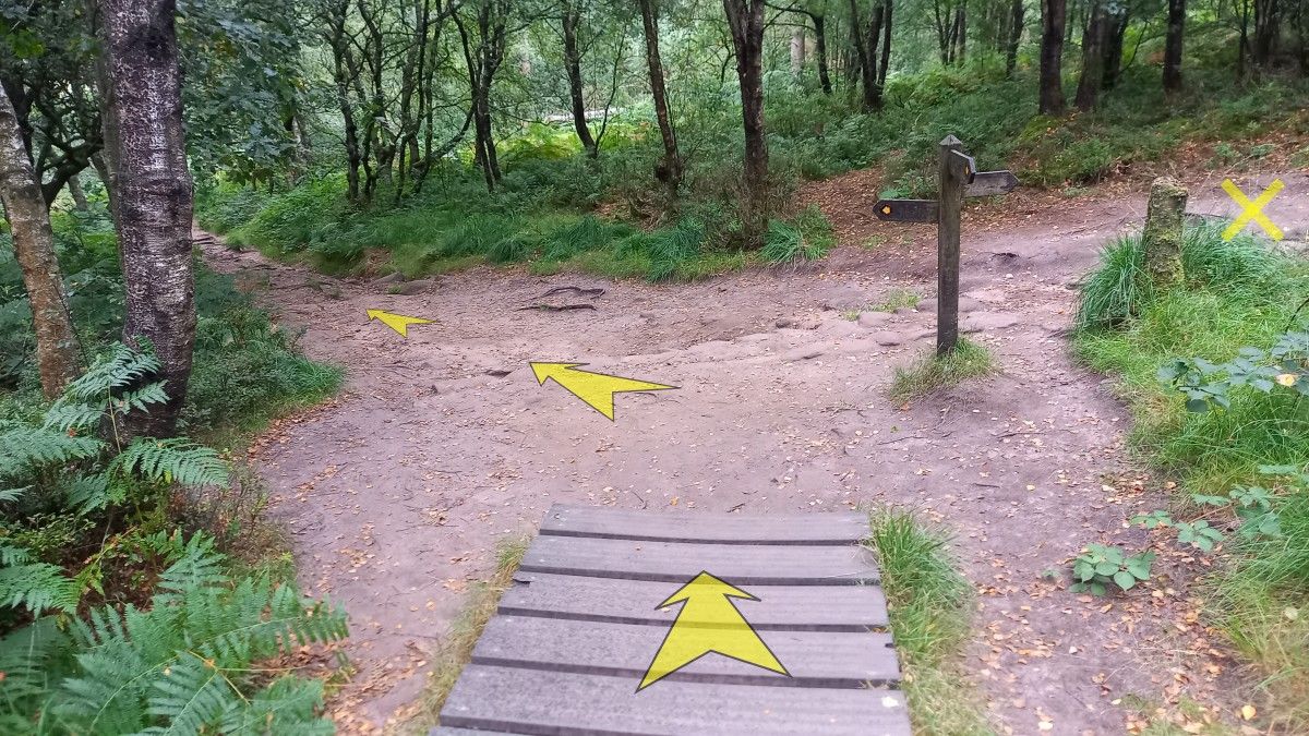
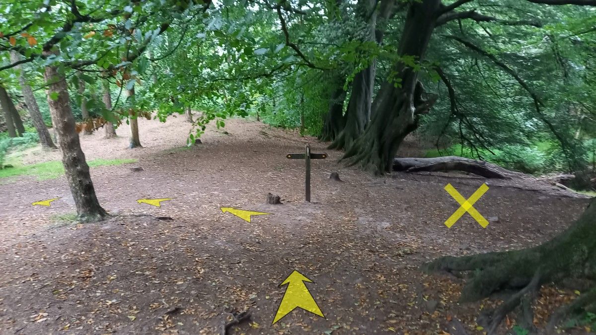
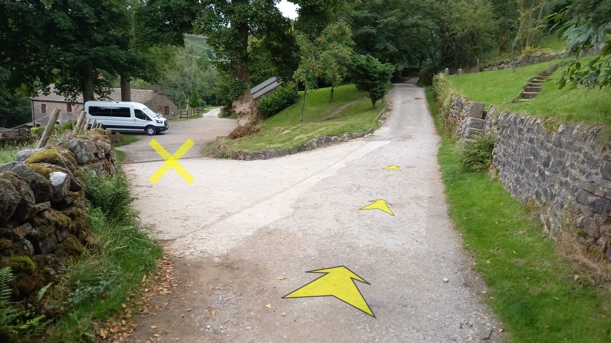
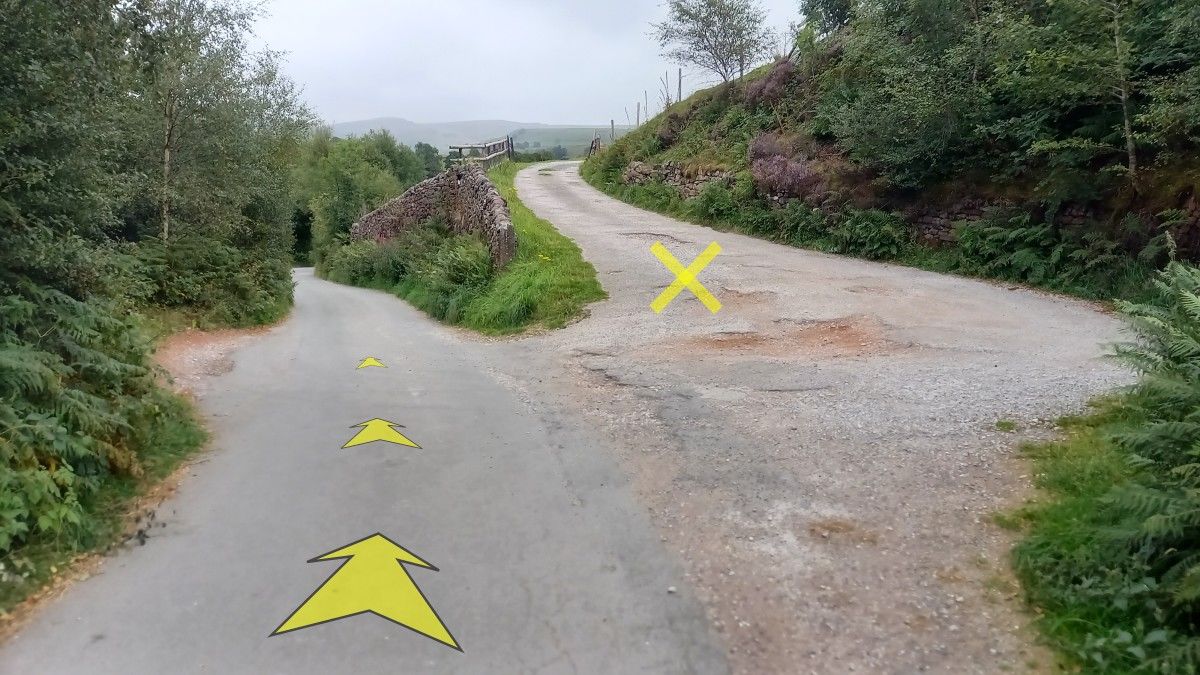
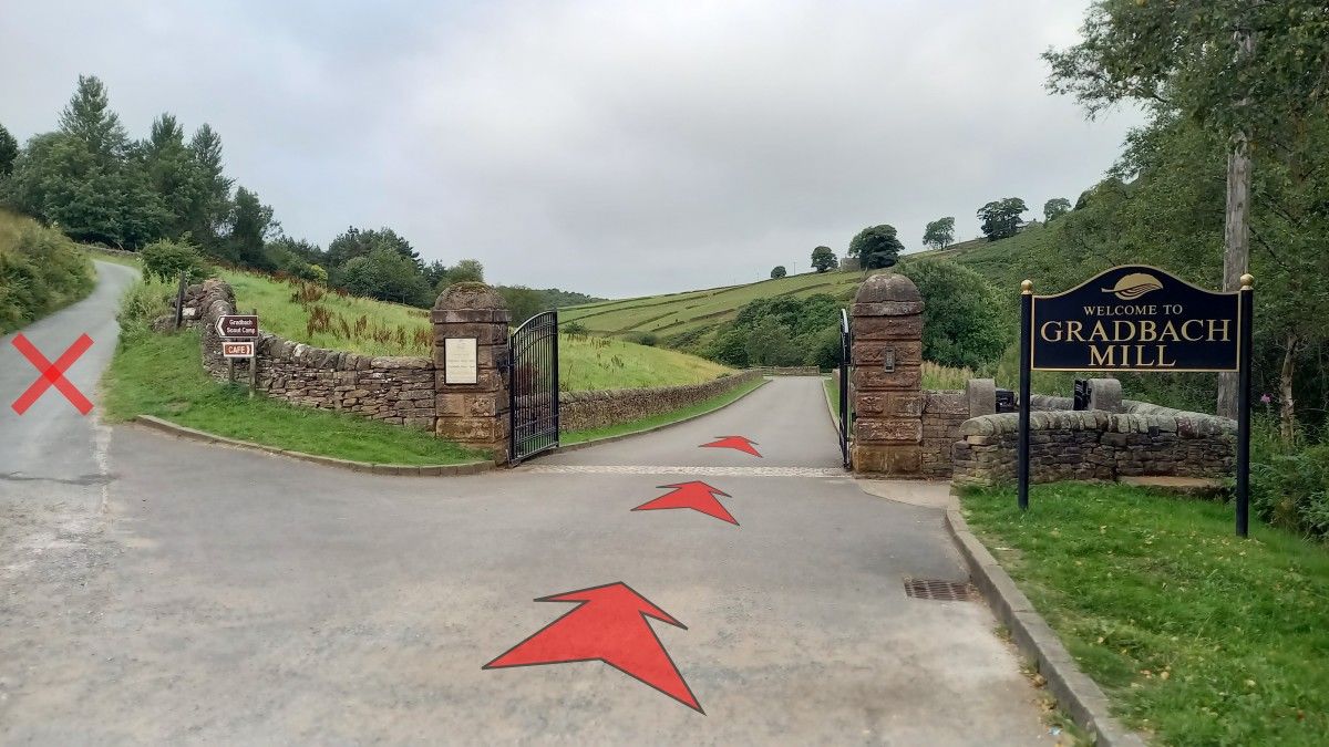
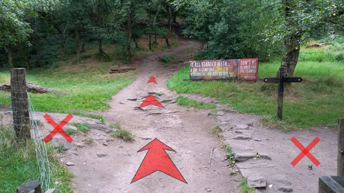
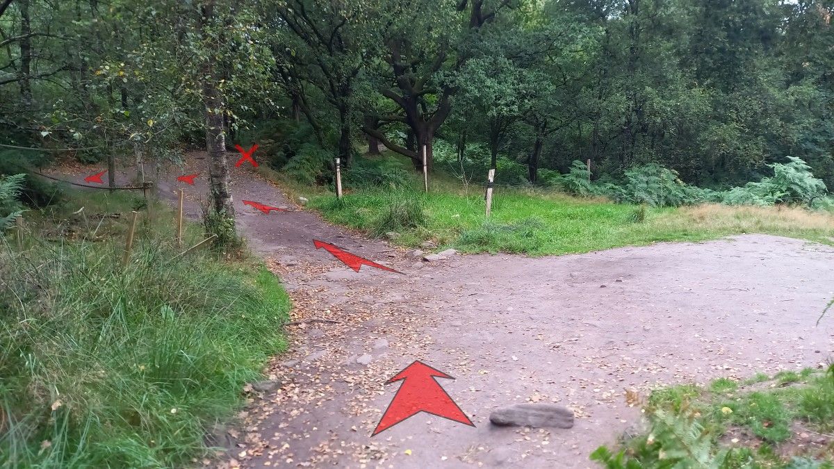
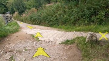
The road climbs gently. After about 300 metres, you’ll reach a fork at the entrance to Gradbach Mill.
-
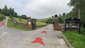
Take the right fork to Gradbach Mill (you’ll be returning down the hill to the left, marked with a red cross in the photo).
Continue down the wide access road to the mill (formerly Gradbach Youth Hostel), which is now a wedding and events venue with accommodation.
Look out for an interesting stone bench-seat with an integral well – on your left as you drop down towards the mill.
-
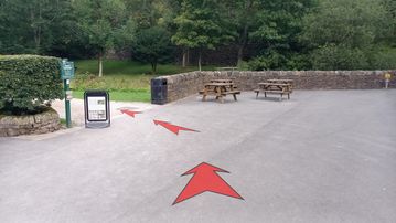
When you reach Gradbach Mill buildings and car park (about 200 metres from the main road entrance), head right and then left to pick up the track towards the Coffee Cabin.
There’s a green Peak & Northern Footpaths Society (PNFS) signpost here (number 251) indicating the way to “Lud’s Church, Danebridge and The Roaches”.
Also keep an eye out for the white cast-iron boundary marker – on the opposite side of the track to the PNFS sign – which marks the border between Staffordshire and Cheshire.
-
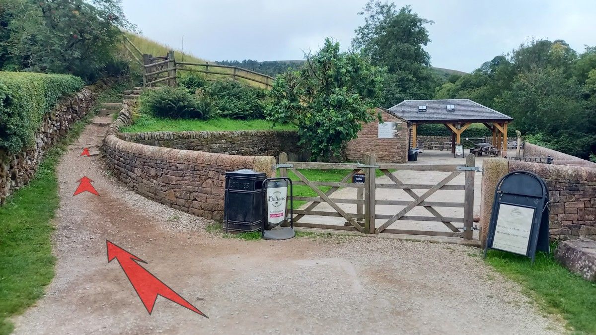
It’s only 50 metres until you reach the entrance to the cafe.
Bear left here up a narrower track and stone steps to a small wooden gate.
Go through the gate and follow the earthy path along the field boundary above the cafe and alongside a wooden fence.
-
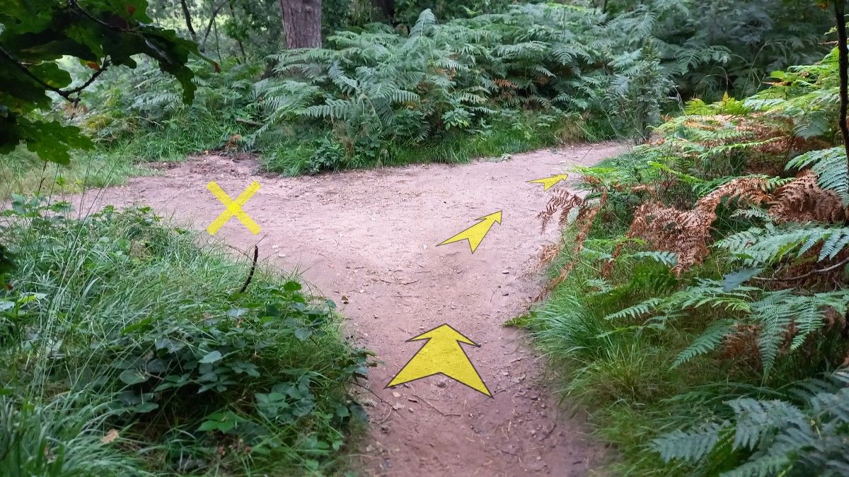
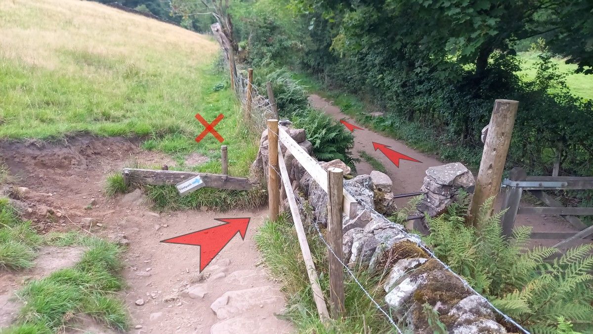
After about 100 metres, turn right through a stone squeeze-stile, then immediately left to continue along the earthy path (now bounded by the field up to your left, and a hedgerow to the right).

-
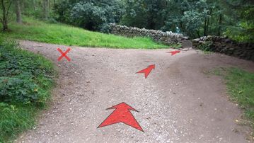
Keep straight on along this path for about 200 metres.
The path broadens into a track as it enters woodland, and bears slightly left to climb gently uphill.
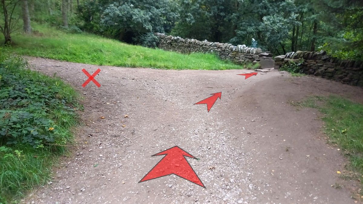
After a further 100 metres, you’ll reach a point where the main track turns back on itself to the left, with a dry-stone wall ahead.
Go through the gap in the wall then bear immediately right down stone steps on the far side.
(There’s also a green PNFS signpost here, number 574 – you’re heading in the direction of “Danebridge”.)
-
Walk 30 metres down hill to reach a footbridge over Black Brook, just above its confluence with the River Dane to your right.
-
Cross the footbridge and continue straight ahead (in the direction marked “Swythamley and Lud’s Church” on the wooden fingerpost).

-
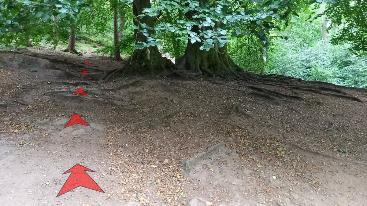
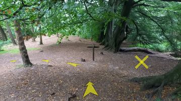
The path enters woodland and immediately climbs, soon reaching a pair of large trees among otherwise open ground.
Bear left uphill past these trees.
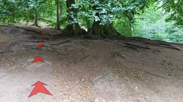
-
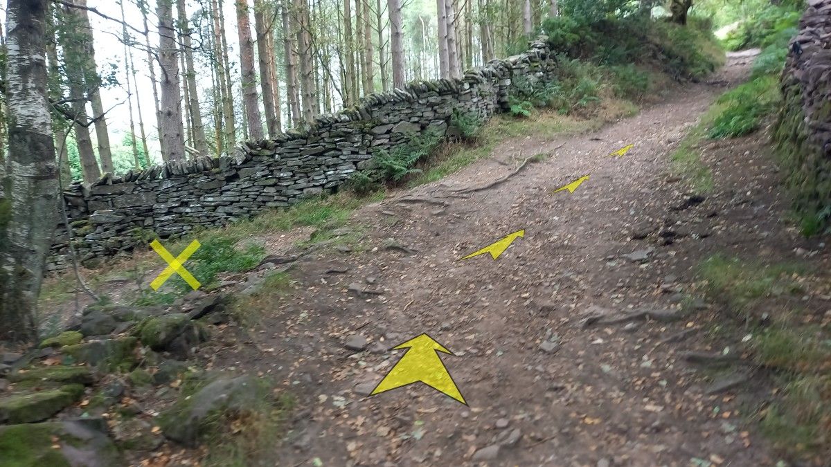
Just past the trees, continue to bear left – now more steeply uphill – to reach a small flight of stone steps that take you up towards a well defined path.
(A wooden signpost lower down, just beyond the the large trees, points towards “Danebridge”. This is NOT the way to go for visting Lud’s Church, so ignore it.)
At the top of the steps, turn right onto the path.
-
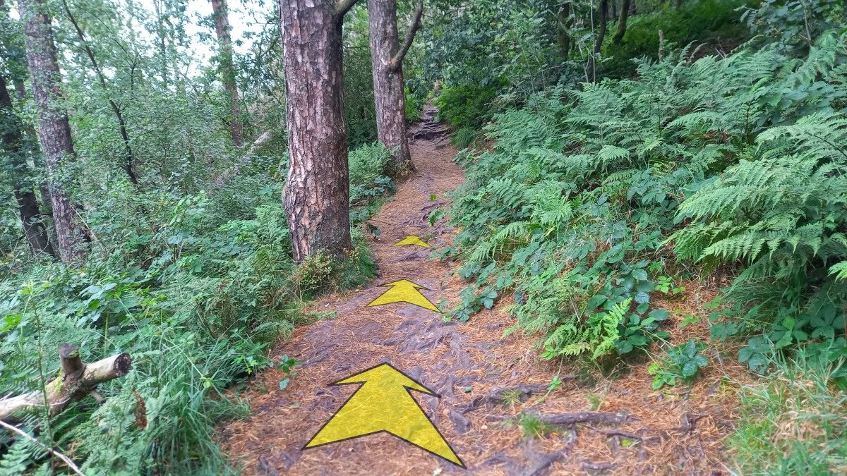
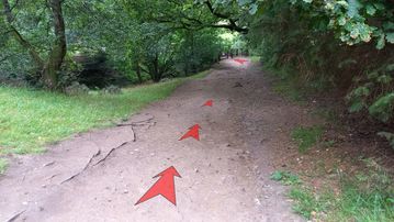
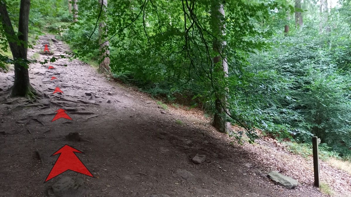
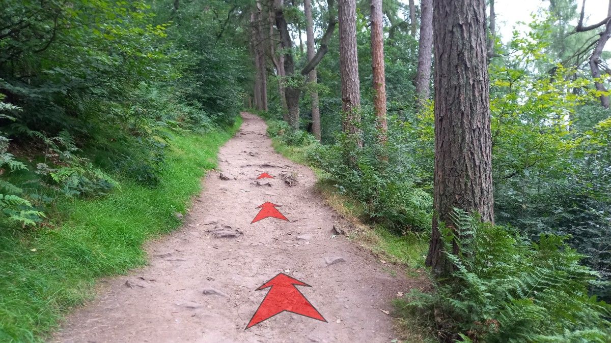
Follow the path as it climbs up through the woodland.
You may notice various much smaller paths leading off both left (uphill) and right (downhill) from the main path, but you should ignore all of these.
-
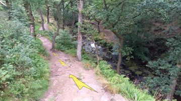
After about half-a-kilometre, the path reaches a small clearing with a large rock outcrop visible to the right.
Bear left here, then left again onto a narrower, rooty path.
A wooden fingerpost points you towards “Lud’s Church”.

-
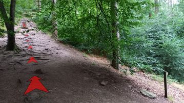
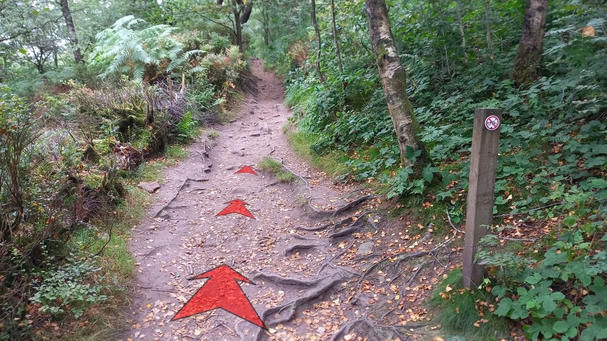
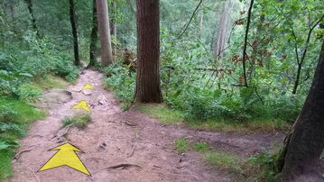
Follow this narrower path as it climbs gently through the woodland, meandering here and there as you approach the well-hidden entrance to Lud’s Church.

-
About 200 metres from the last wooden fingerpost, look out for the narrow rocky passage on your right – this leads you into Lud’s Church. At the time of writing (August, 2025) there wasn’t a signpost here.
The narrow rocky passage is just after a short wooden fence on the right, and just beyond a distinctive tree with a sloping trunk and a branch overhanging the path. There are also some large rocks on the path at this point.


Stage 2: Lud's Church to Gradbach Car Park
-
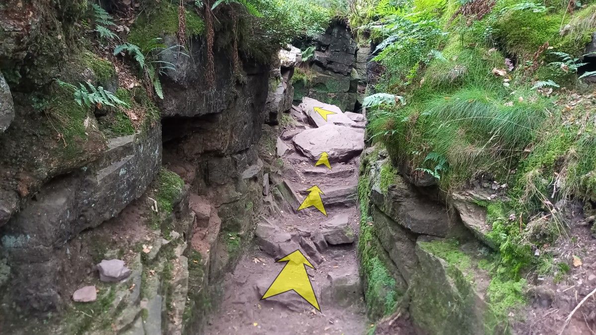
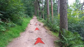
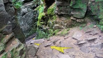
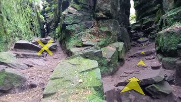
Turn right off the main path, and into the narrow rocky passage. This is the western entrance to the chasm of Lud’s Church – the main chasm being hidden from view at this point.
Proceed through the gap, and turn left at the end where it abuts a rock wall.

-
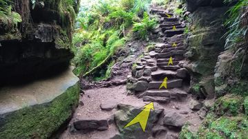
A steep descent on rocky steps now brings you into the main chasm below. There’s some boardwalk at this end to help negotiate the heavy mud that can build up over the winter months.
Spend some time taking in the atmosphere of this remarkable place, and exploring the various nooks and crannies. Even on a hot day, it’ll be cool and damp down here.
-
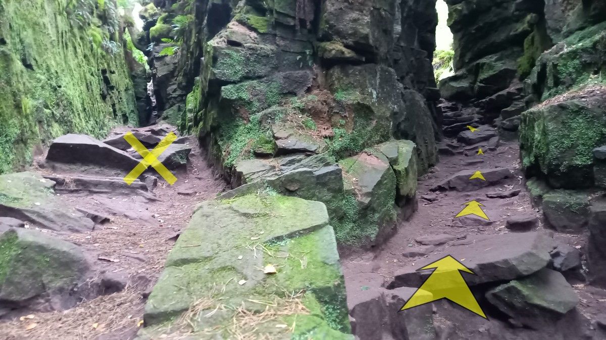
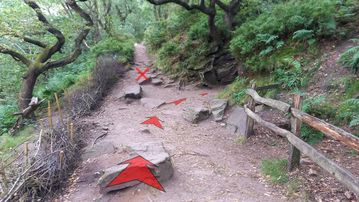
Proceeding east along the base of the chasm, you’ll soon reach a rocky slope that climbs towards a split.
Our way ahead lies through the right-hand split, which is the main exit from the chasm. However, it’s worth spending some time exploring the various other paths that lead off to the left.
Just be sure to return to this point and head right when you’re ready to leave Lud’s Church and continue the walk.
-
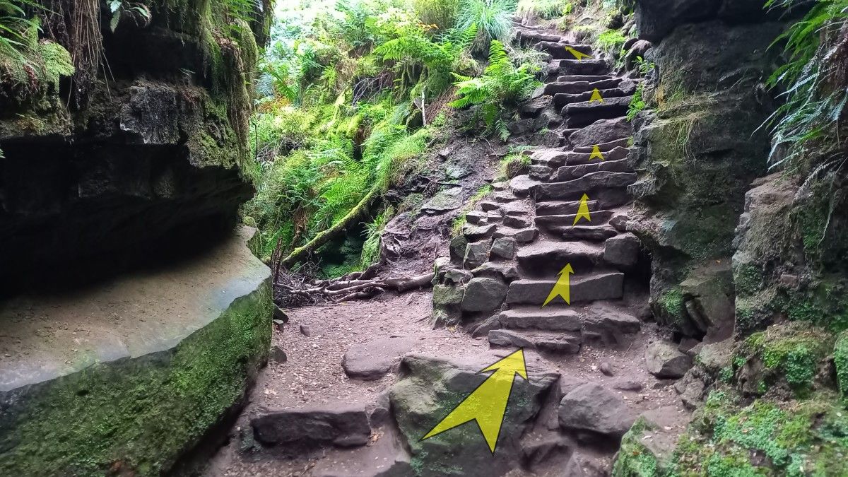
A series of stone steps climb out of the right-hand split, leaving Lud’s Church and re-entering the woodland.
-
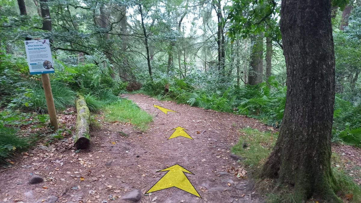
The next section through the woods is very pleasant walking on an obvious path, though the tree cover precludes any distant views.
Several sections of boardwalk help with erosion and soft ground.

-
About 250 metres after leaving Lud’s Church, you’ll reach a junction with another path.
A wooden fingerpost here points left towards “Gradbach/Roaches”, and right to “Ridge”.
Turn left here (towards Gradbach/Roaches), and follow the earthy path slightly downhill.

-
In about 30 metres, you’ll reach another path junction.
There’s no signpost here, but you should turn right.

-
The next section of path meanders through the woodland (Forest Wood), with a few ups and downs as it makes its way east up the valley of Black Brook.
The path is generally easy to follow, with occasional parallel paths that rejoin further along.
Where the tree cover thins out there are excellent views left, out over the Dane Valley.

-
After about ¾-of-a-kilometre, you’ll descend slightly to reach a path junction in a clearing. A wooden fingerpost points left towards “Gradbach/Danebridge”, and right to “Roaches”.
Turn left here, towards Gradbach.
-
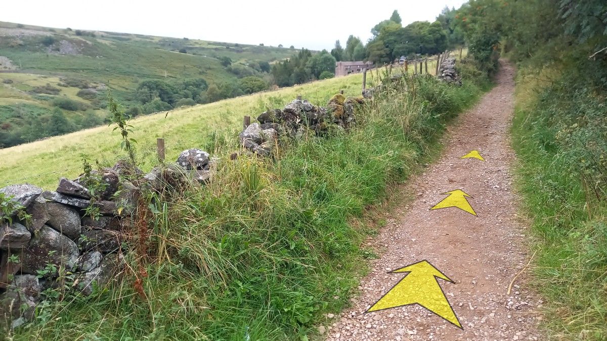
Pick up the obvious earthy path here, and proceed to follow it northwest, now heading down the valley of Black Brook.
Again, there are some excellent views (out to the right now) from this section of path.

-
Take care, as the path descends quite steeply in places, on loose earthy ground.
The path generally trends downhill, but there are a few short level sections too, and some slight ascents.
-
About a kilometre from the last fingerpost, the path descends more steeply down to Black Brook.
The river is clearly visible down to your right at this point.
-
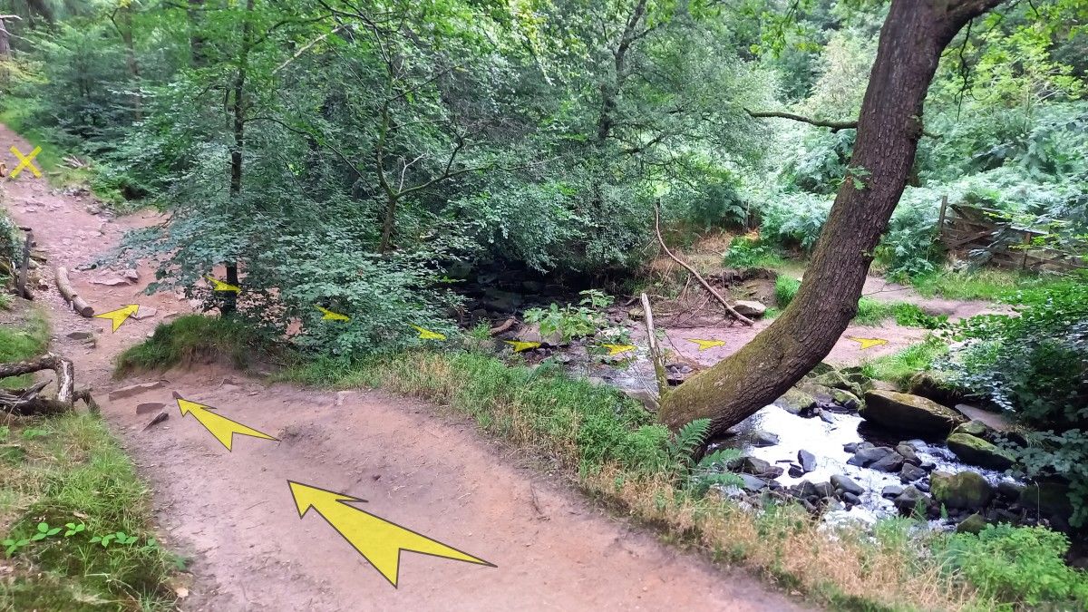
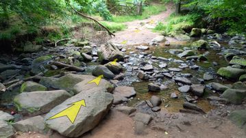
As you approach the level of the river, a ford comes into view (with a wooden gate visible on the far side).
Provided the river is low, you should be able to cross here without any problems.
(If the river is high, or you don’t fancy the ford, you can continue ahead and take the right-hand fork in the track. This will return you to the wooden fingerpost and footbridge described in Step 8 after about 100 metres. From here, you can reverse your outward route to take you back to Gradbach Car Park.)

-
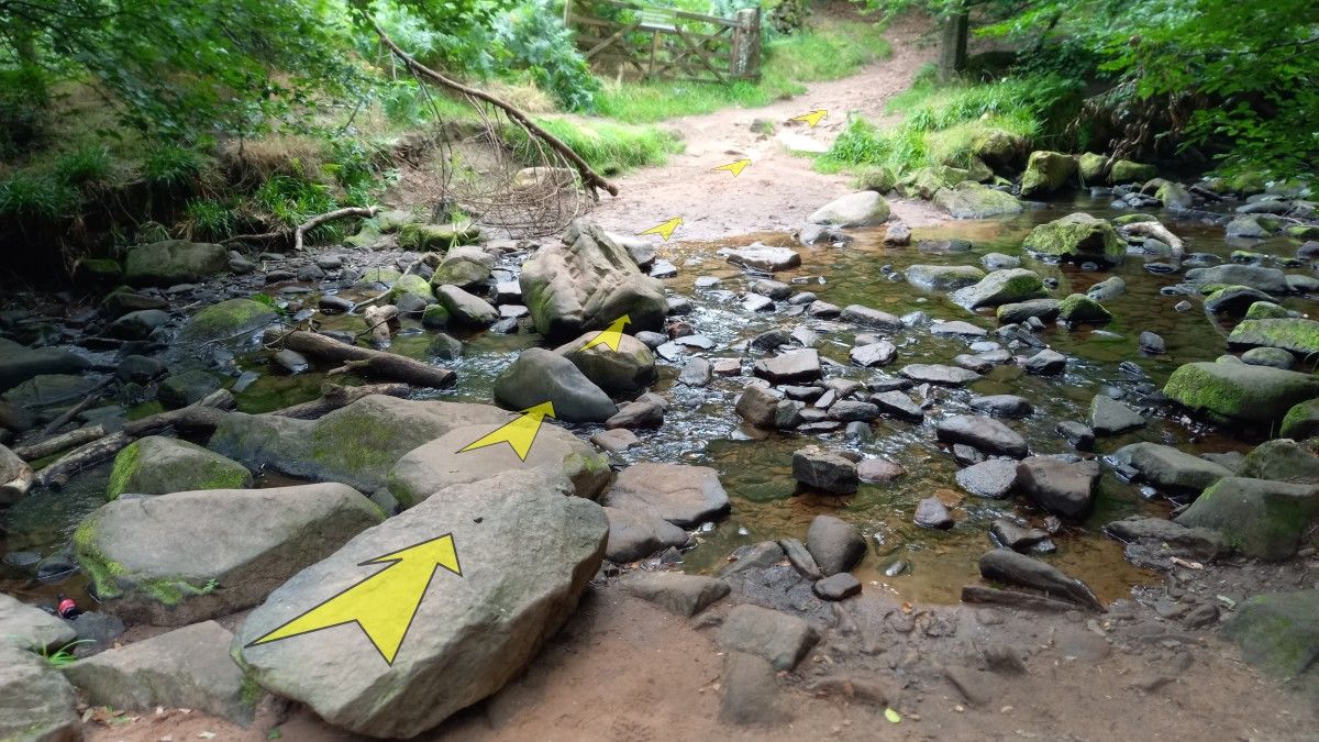
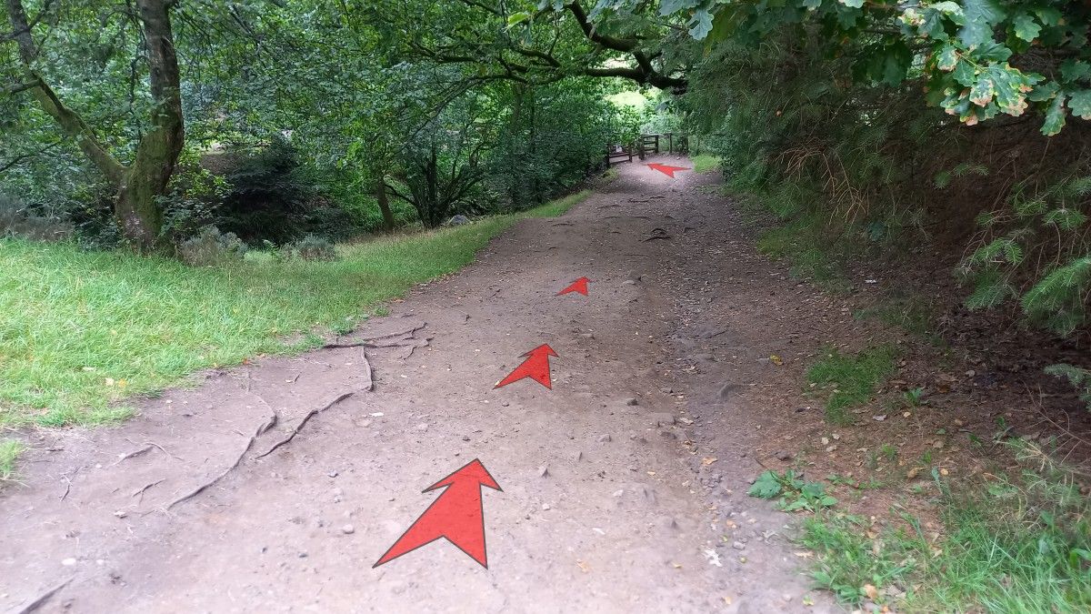
Cross the ford on rocks to reach the wooden gate on the far side, then head up the obvious broad track.
-
Follow the broad track as it bends to the left and climbs uphill through woodland.
-
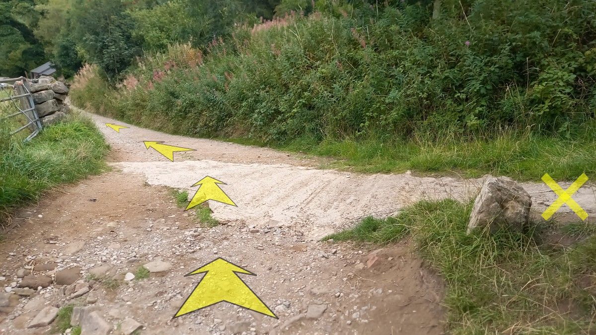
After about 100 metres, the track reaches a dry stone wall ahead, and swings right.
Continue uphill on the track.

-
The track soon levels off and narrows, and a great view opens up over the Dane Valley to your left.

-
200 metres from where the path levelled off, reach a junction with another path, just below a farmhouse.
Bear left here.
-
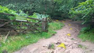
After a further 30 metres, reach another junction.
There’s a wooden gate and stile to the right here, but you should head left, heading slightly downhill on a broad track.
-
You’ll soon reach an entrance to the Gradbach Scout Camp on the left.
Ignore this, and continue straight on along the broad track.

-
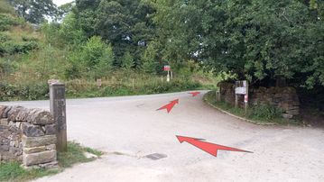
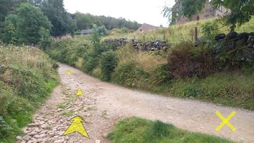
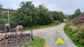
As you proceed, the track climbs slightly, then descends towards the entrance to Gradbach Mill that you went through near the start of the walk.
Bear right here and follow the minor road back to Gradbach Car Park.
-
It’s easy to retrace your steps back to the Car Park. Just be sure to bear left (downhill) at the fork just beyond the entrance to Gradbach Mill – if you bear right (uphill) you’ll end up at Greensytch Farm!