Kinder Reservoir Walk
Escape the crowds on this beautiful circular walk around peaceful Kinder Reservoir
About the walk
Kinder Reservoir lies only two kilometres northeast of Hayfield village, at the foot of Kinder Scout. Although the reservoir doesn’t have a low-level path all the way around its shore, it’s still possible to circumnavigate the lake relatively easily, on good tracks. In fact, the lack of a single obvious track around the reservoir makes for a quiet walk in beautiful hilly countryside, much of which is usually far quieter than the better known tracks heading up Kinder Scout proper. And you get excellent views onto the west side of Kinder Scout itself.
Kinder Reservoir was created in 1911, taming the river Sett which had previously caused serious flooding in Hayfield. The earth dam holds back half-a-billion gallons, and supplies Stockport with drinking water.
Need-to-know
-
Pay & Display parking (picnic tables close by; public toilets; no height restriction; no overnight parking or camping).
Parking prices, per car (last checked July 2025):
- Up to 1 hour, £2.10
- Up to 2 hours, £3.40
- Up to 4 hours, £5.50
- All day, £6.60
Payment by coins (no change given; no cards) or by phone using RingGo location 51705 (but note that mobile reception from the car park is quite poor); charges apply every day 9am–6pm.
- There’s no public transport available to Bowden Bridge car park. However, there are regular buses to Hayfield, stopping about 1½ kilometres (1 mile) from the starting point described. See “Getting there” for more information.
- 4½ miles / 7½ kilometres circular walk.
- 2 to 2½ hours at a leisurely pace.
- 550 ft (160 m) ascent and descent.
- Mixed terrain (including some steep slopes, rough tracks and some boggy ground after rain); not suitable for wheelchair users or for pushchairs.
- 3 stiles.
- Refreshments are available from:
- The Hayfield Camping and Caravanning Club Site, has a small shop that sells ice creams and other refreshments. Cross the stone bridge almost opposite the car park entrance, and walk a couple of hundred yards down the site access road to the entrance.
- The Sportsman Inn is 350 metres from the car park, down the road towards Hayfield village. See their website for opening times.
- There’s sometimes a coffee van available in Bowden Bridge car park (times vary).
- For Public toilets, cross the stone bridge almost opposite the car park entrance, where you’ll find toilets on the right. (Open 24 hours; facilities for people with disabilities – RADAR key required for access.)
Getting there
By bus: Bus numbers 60, 61, and 358 stop at Hayfield bus station. You will then need to walk 1 mile, initially across the bypass into Hayfield village, then up Kinder Road to reach the start point described. Remember that you’ll need to reverse this initial walk to return for the bus, which will add extra distance to the route.
You can download timetables for Derbyshire public transport from www.derbysbus.info/times.
By car: Start and finish at Bowden Bridge Car Park (arrowed on the following map).
Note that there is NO PARKING on Kinder Road beyond the entrance to Bowden Bridge car park.
The following may help if you use a satnav:
- nearest postcode: SK22 2LE (this postcode is for the Hayfield Caravanning and Camping Club Site which is close by. For a more precise location, you should enter the name – *Bowden Bridge Car Park*, what3words, latitude/longitude, or Ordnance Survey grid reference figures into your satnav).
- what3words: croak.threading.wiggly
- Latitude, Longitude: 53.380, -1.928
- Ordnance Survey grid reference: SK 048 869
Map & directions
This simplified map provides guidance for the route described – the numbers refer to the numbered steps in the walk description. This map is not suitable for detailed navigation, for which you should use a copy of the relevant Ordnance Survey map.
The Ordnance Survey map covers a bigger area along with important information such as place names, official rights of way, and areas of Access Land.
For this walk, the ideal map is the Explorer Series Number OL1: The Peak District - Dark Peak Area (Kinder Scout, Bleaklow, Black Hill & Ladybower Reservoir), which includes the whole area of the walk at 1:25 000 scale (4 centimetres to 1 kilometre).

Contour interval: 10 metres; index contours, 50 metres. North at top (approximate).
Map data from OpenStreetMap (available under the Open Database Licence). Contains Ordnance Survey data © Crown copyright & database right 2010–2023.
Stage 1: Bowden Bridge Car Park to Dam
-
Before starting your walk, remember to seek out the plaque that commemorates the Kinder Trespass (which started from this location, then a quarry, 24th April 1932). You can find the plaque attached to the crag behind the car park.
Leaving the main car park access road, bear right, then immediately left to cross the River Sett on a stone bridge.
It’s worth looking down to the river here, as you may get lucky and spot a Dipper, charismatic aquatic birds that breed on this stretch of the river.

-
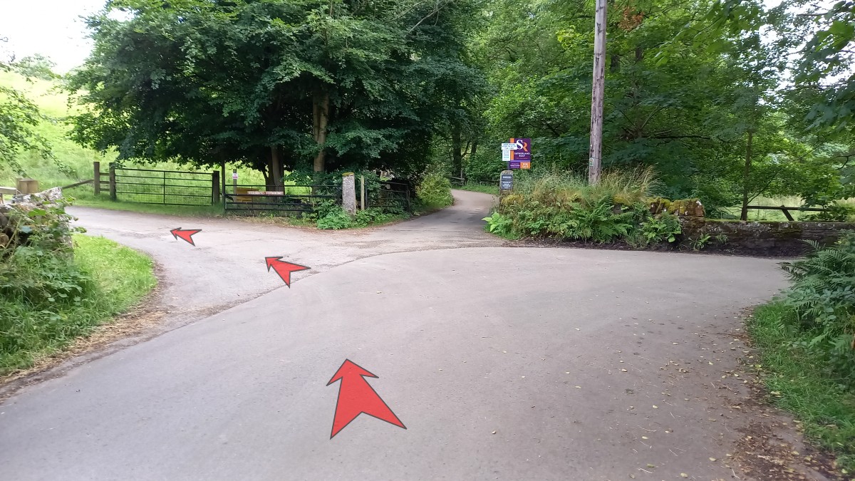
On the far side of the bridge, follow the road round to the left (signposted Kinder Scout via Tunstead or Coldwell Clough).
For public toilets, head right for a few yards at the bend.

-
Follow the road as it gently curves round to the right. You should be able to make out the old packhorse bridge to the left, shortly after you’ve passed the entrance to Kinder Lodge on your right (an old reservoir now used for angling). There are a couple of benches here, overlooking the confluence of the River Sett (which joins from the right), and the river Kinder.
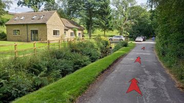
Continue to follow the road as it passes a house, and then straightens out as it rejoins the river which is down to your left.
-
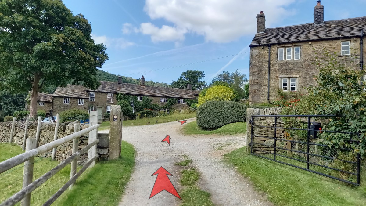
You soon reach a junction of roads. Bear left here, taking the track that’s signposted Public Footpath, Hill House Booth and Farlands.

-
The track winds gently uphill to Hill Houses. Follow the track between the buildings as indicated, bearing slightly right as you leave this small settlement. There are good views back to Mount Famine and South Head from here.
Look out for the well, built-in to the stone wall on your right. This used to be dressed along with the other Hayfield wells during the Well Dressing festival, but has not been included for the last few years.

-
Pass through the gate just beyond Hill Houses (there’s a nice patch of bright blue Alkanet on the left here, in flower from spring till mid-summer) and continue along the well defined farm track.
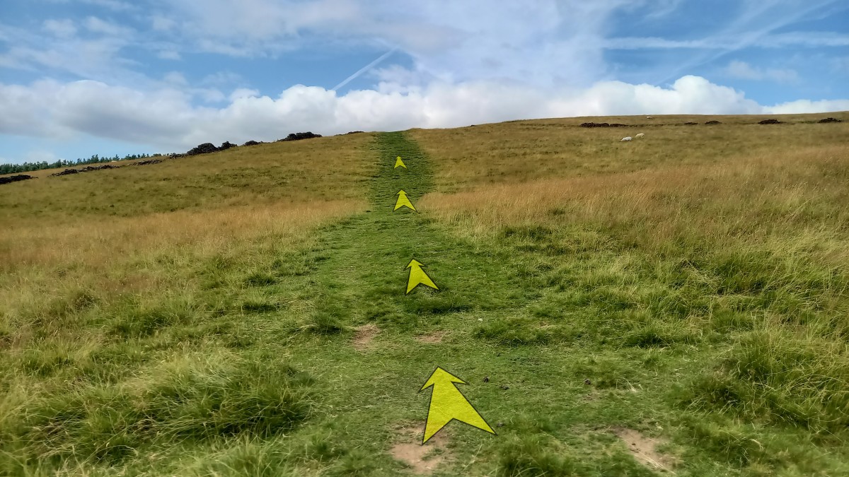
This bends around to the right then back to the left, but always keep to the main track, heading towards the bulk of Kinder Scout in the distance.

-
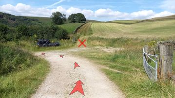
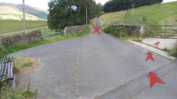
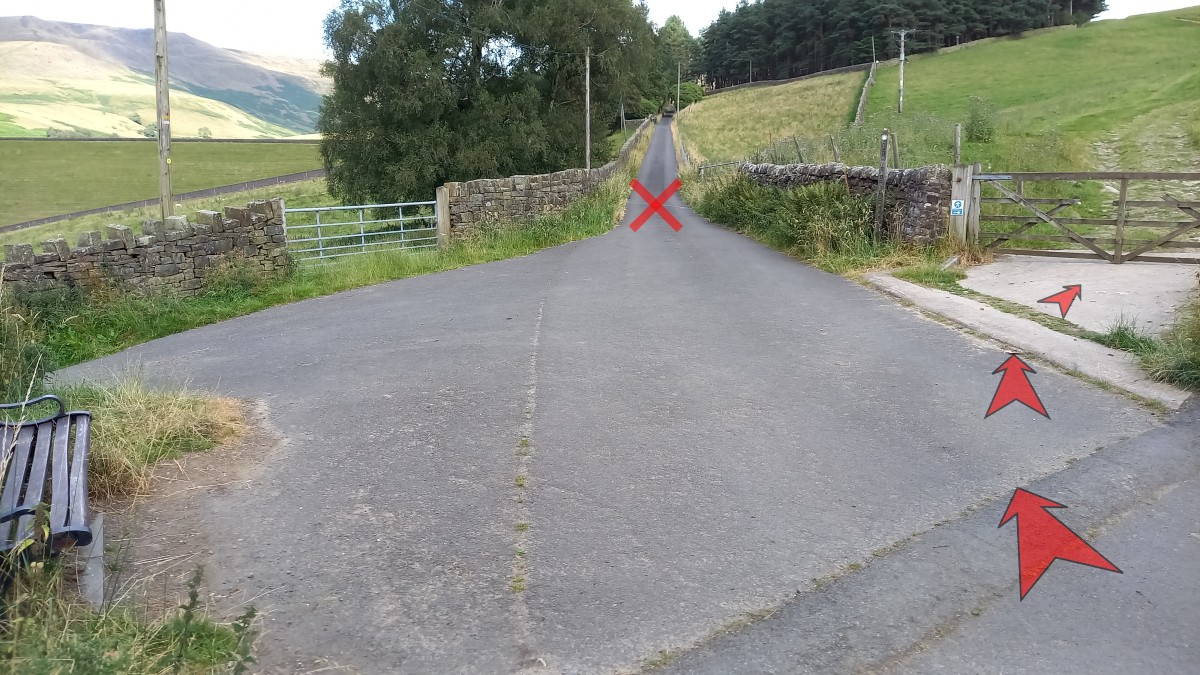
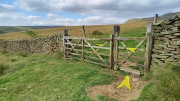
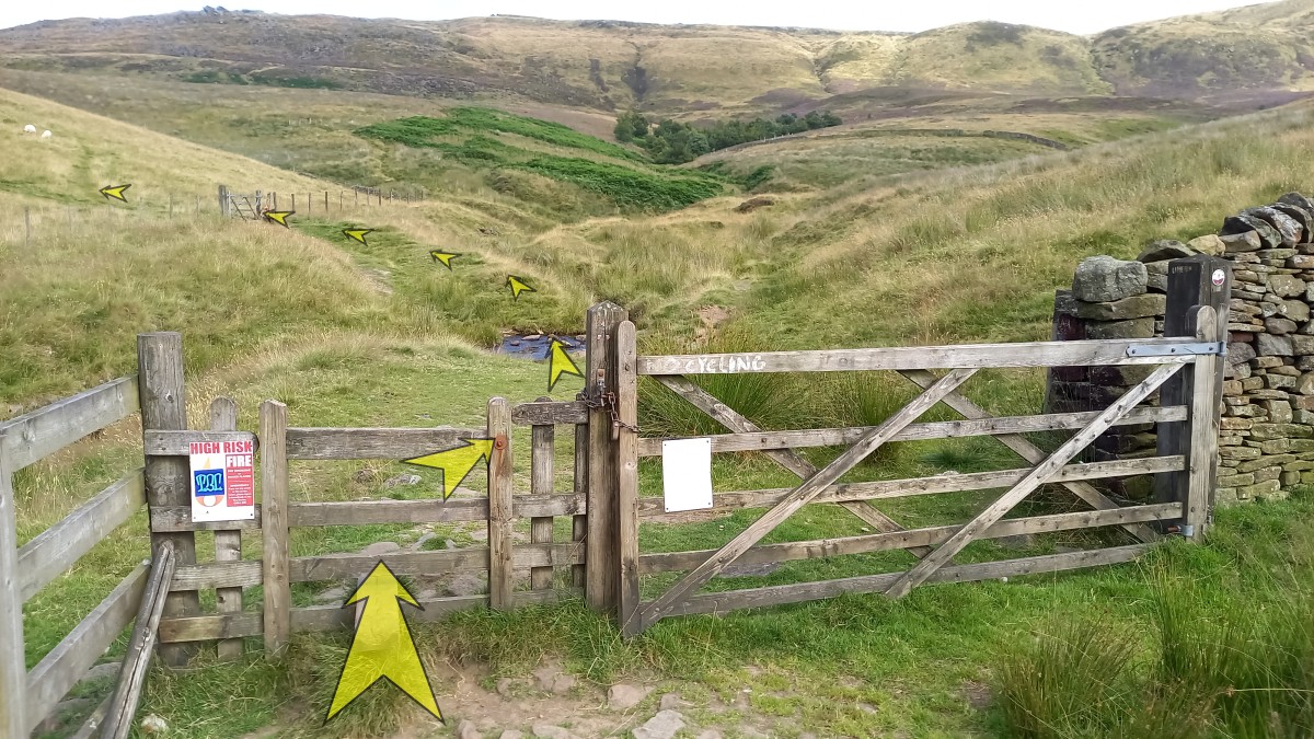
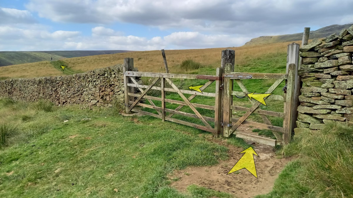
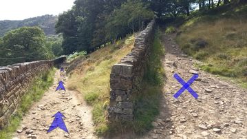
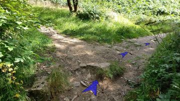
A sharp bend to the left, then immediately right, takes you on towards Booth Farm (make sure you don’t continue ahead here – marked with an ‘X’ in the photo – as this is private land).
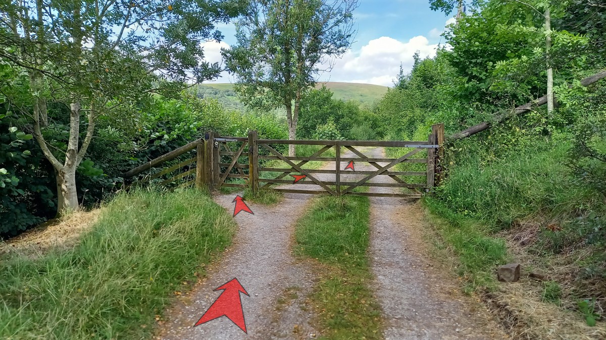
Pass through the gate further along the track (usually open).
-
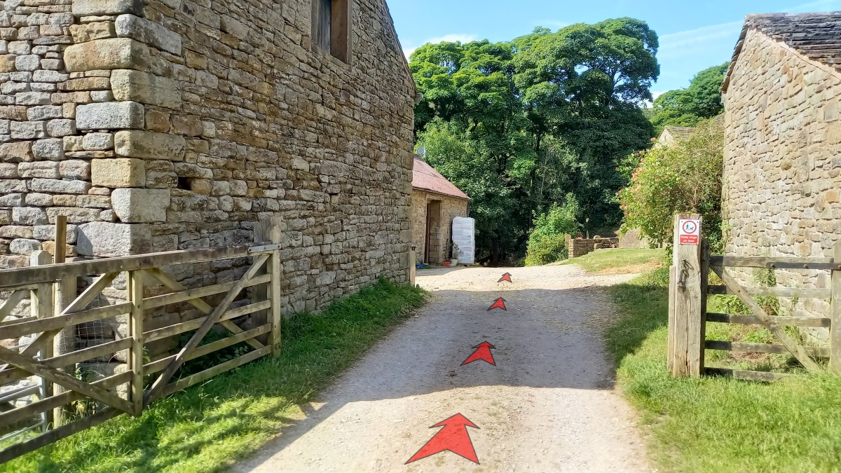
Pass through the gate at Booth Farm (usually open), through the farmyard, and down towards the lane on the far side.

-
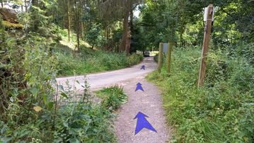
Turn right onto the lane signposted Public Bridleway to Farlands, and head steeply uphill.
-
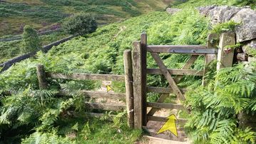
Continue up the lane for about 300 metres, then turn off to the right, through a gate and onto the open hillside (signposted Stony Ford).
From this point you can clearly see the dam that holds back Kinder Reservoir (but are not quite high enough to see the reservoir itself).


Stage 2: Dam to William Clough
-
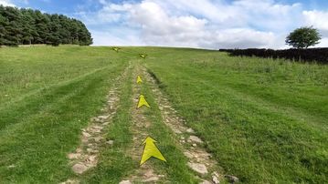
The track up the hill ahead is fairly well defined. You’re heading for the corner of Upper House plantation, as shown.
-
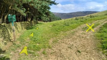
Once you reach the corner of the plantation, the track starts to level off. Stick to the track alongside the stone wall for another 200 metres, until you reach a signpost (Public Bridleway to Oaken Clough, sign no. 285). This points you off to the right and up the hill.
Do NOT follow the track up the hill, but instead continue on the track which follows the stone wall adjacent to the plantation. This is a permissive path, and will lead you round to the back of Kinder Reservoir.
Continue to follow the track, rough and wet in places, for the best part of a kilometre (half a mile).
A new wire fence (to your right) parallels the track from about half-way along the woodland. A gate across the track is provided with a stile you’ll need to use to continue along the track.
-
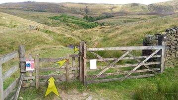
After about 1 km from the signpost, you’ll reach a second gate (there’s a National Trust signpost and information board here for Broad Clough).
This second gate is normally locked, so cross using the stile (the top bar lifts up to make this slightly easier), and then ford the stream a few yards further on. There are a few stones in the river at the crossing point, so unless the water’s particularly high, you should keep your feet dry.
If the stream’s high, it’s possible to jump across from bank to bank just a few yards further upstream where the watercourse narrows.
-
Immediately after crossing the stream, there’s another locked gate with a stile (which is now falling into disrepair).
Head straight uphill from here on steep grass. There’s a visible track, which then bears left towards twin gates on the horizon as you reach the top of the steepest section.
You finally start to get some views of the reservoir as you climb this hill :-)

-
Go through the gate, and turn immediately left to follow a clear grassy track.
-
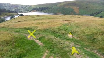
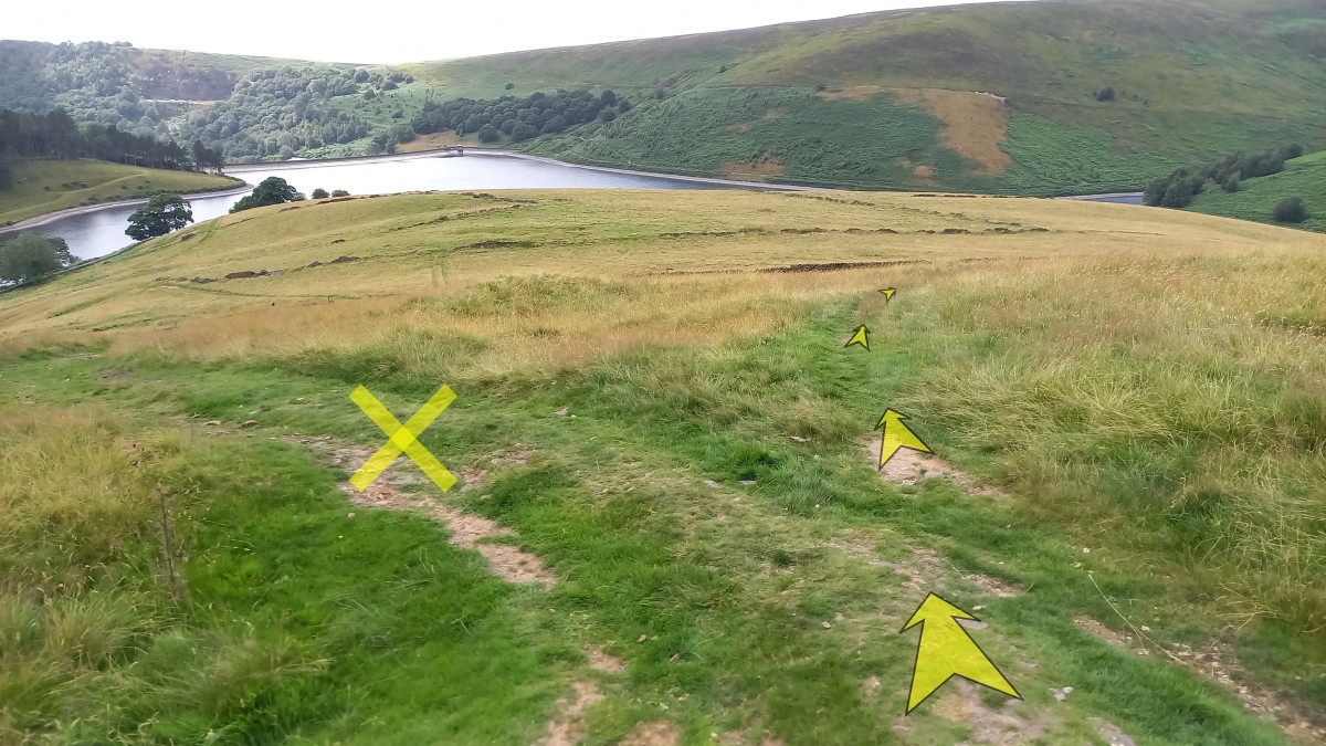
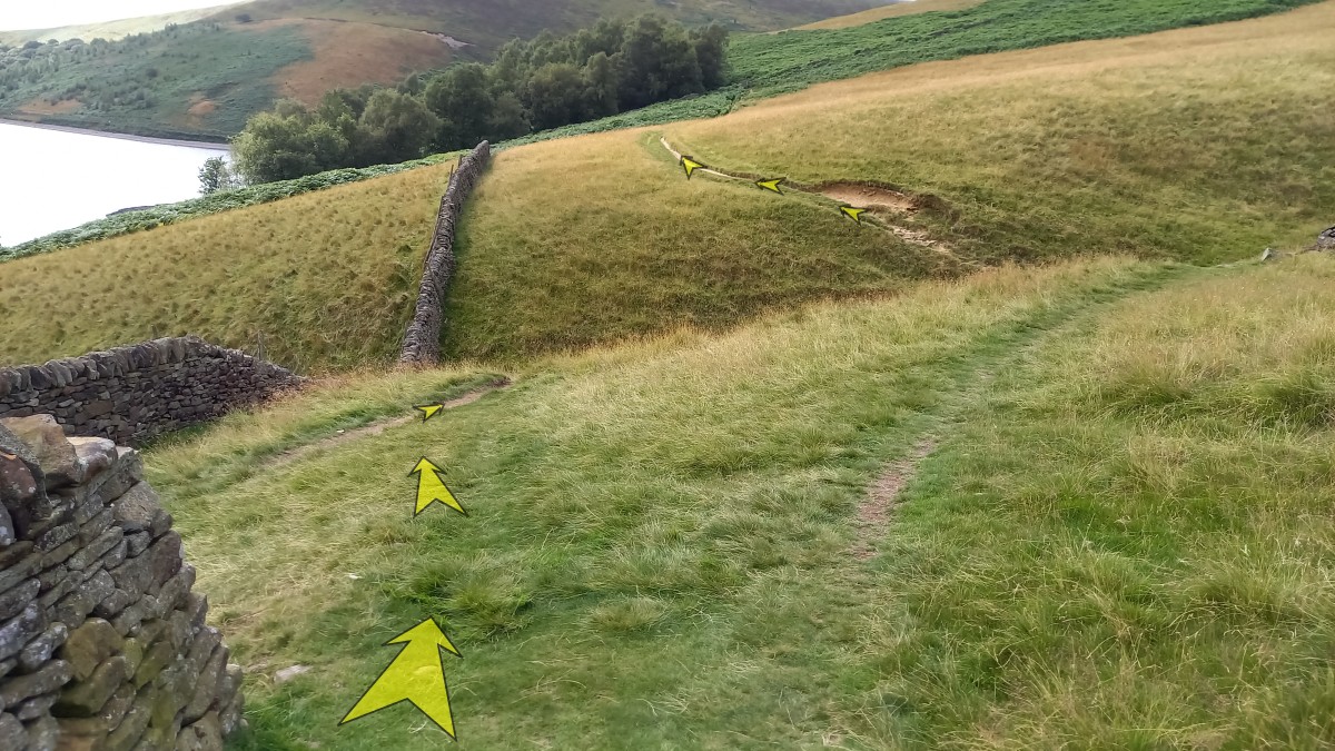
The grassy track climbs slightly above a plantation to the left, then descends. Descend until you’re adjacent to the corner in the stone wall around the plantation, at a point where the main track bends to the left, with expansive views of the reservoir directly ahead.
Leave the main track here, and continue straight ahead onto a narrow grassy track. This cuts off a corner of the main track.
-
Follow the narrow grassy track downhill for 100 metres to where it rejoins the main track – turn right onto the main track.
-
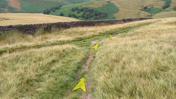
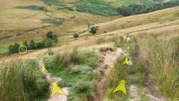
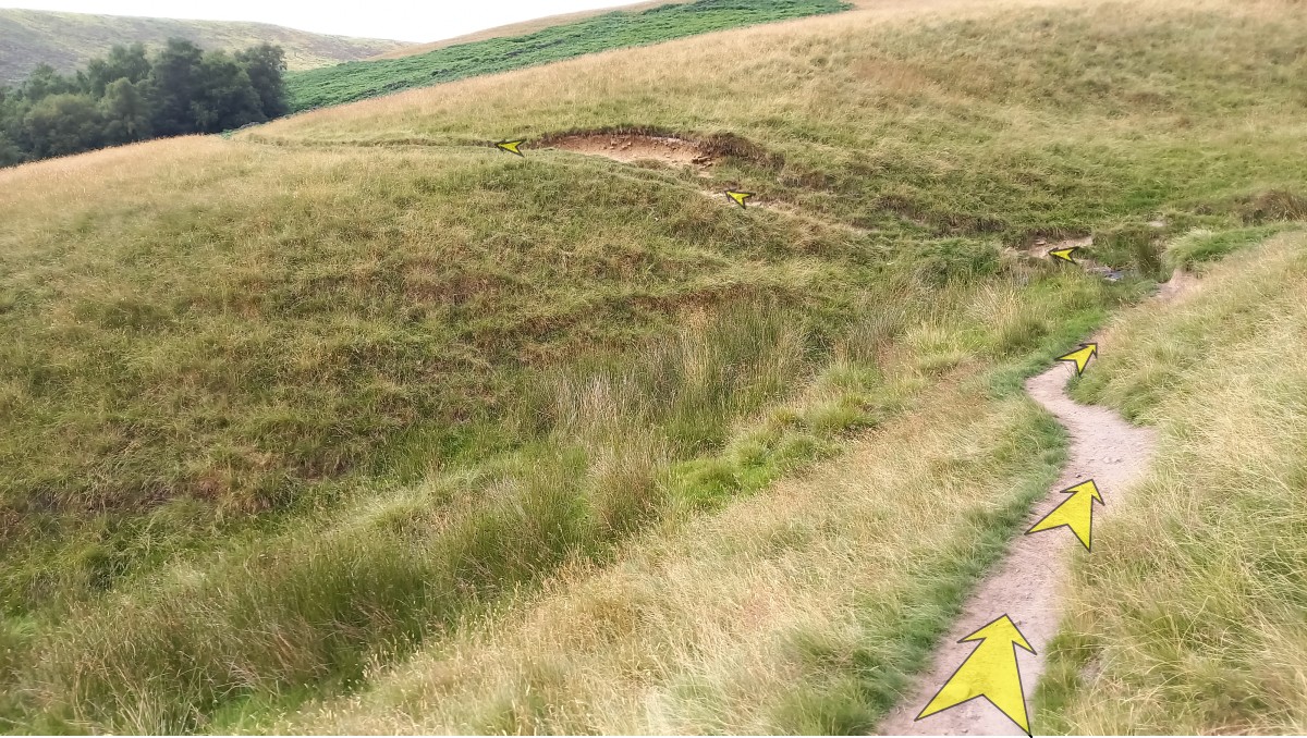
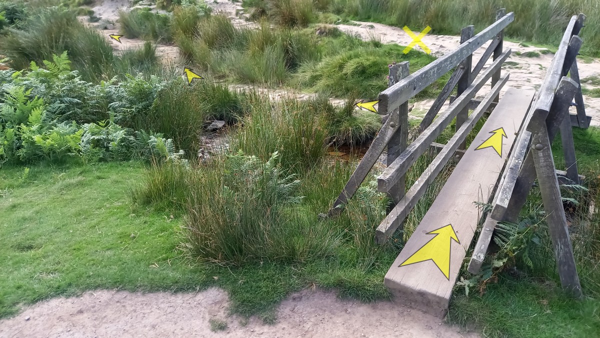
Continue along the track, now wider and more stony as it heads downhill and curves gradually to the left. There are good views up to the amphitheatre of Kinder Downfall from here.
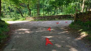
Shortly before the track starts to turn back on itself, there’s an optional short-cut path on the left. Whichever way you go, both the track and path meet next to a wooden footbridge (circled in the photo), which is where you’re aiming for.
-
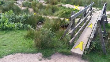
Cross the wooden footbridge over the River Kinder (which has descended via Kinder Downfall, high above to your right).
-
Once over the footbridge, continue to follow the track as it curves up the hill ahead, aiming for the top edge of a small plantation.
-
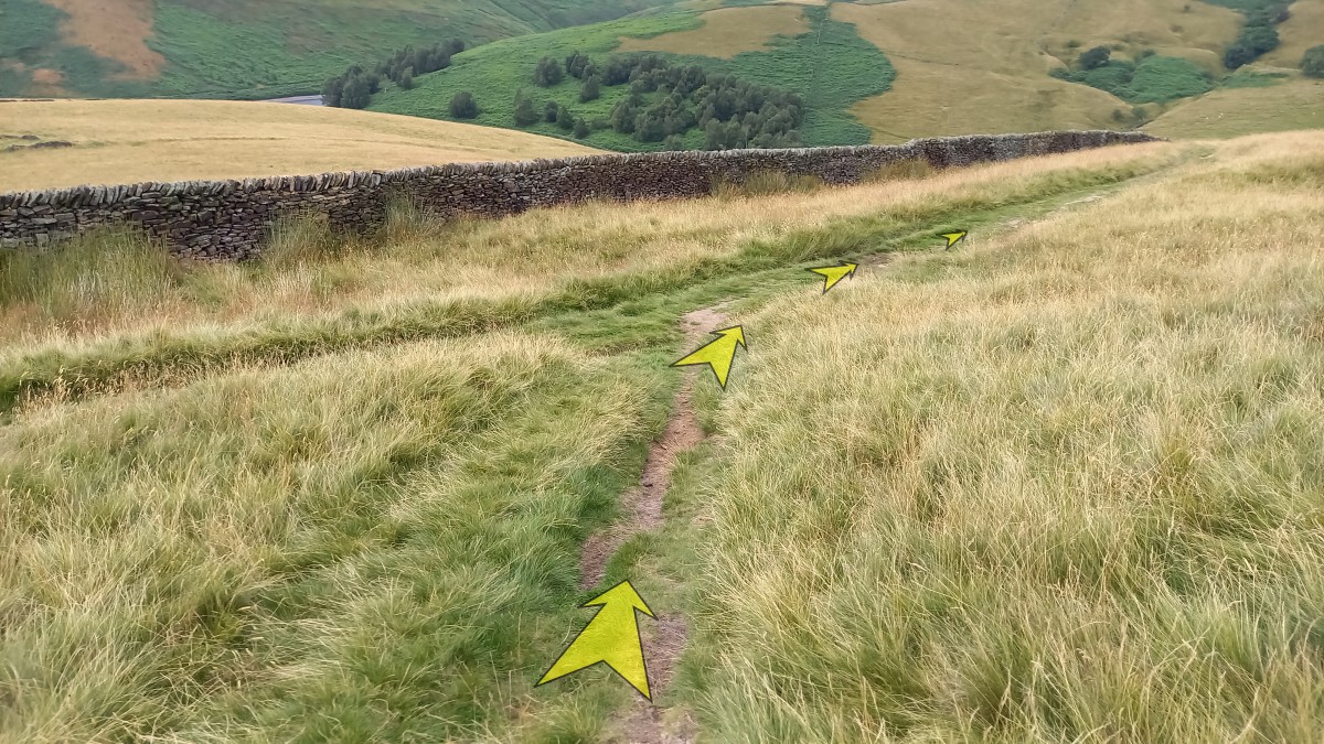
The track continues alongside a stone wall to your left. When you reach the end of this wall, bear left as indicated to pick up another track slightly lower down.

-
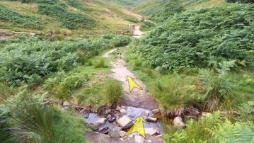
Continue along the lower track for a few metres, then cross the small stream (no bridge) and pick up the track on the other side. Unless there’s been recent heavy rain, you should be able to keep your feet dry!
-
Follow the track slightly uphill until it reaches the top edge of a plantation at a gate. Pass through the gate, and continue along the track.
-
Continue to follow the track, initially alongside the plantation, then across more open ground with good views down to the reservoir.
The track now curves round to the right, and starts to descend. Pass through a wooden gate, and continue towards the bottom of William Clough ahead.
-
Shortly before you reach the wooden footbridge at the bottom of William Clough, cross a small stream.
-
This footbridge at the foot of William Clough is known locally to some as “Benny’s Bridge”, after Benny Rothman, the access campaigner who led the Mass Trespass on Kinder Scout in 1932. This is a nice spot for a break, with some grassy areas and places to sit and take in the view.
Cross the footbridge and turn immediately left, onto the lower path that heads south along the west side of the reservoir.


Stage 3: William Clough to Bowden Bridge Car Park
-
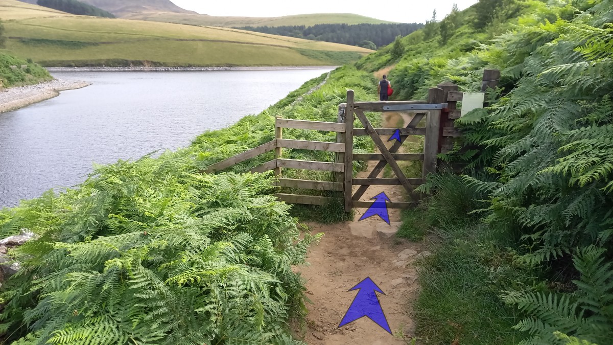
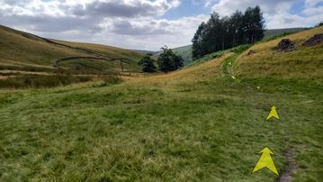
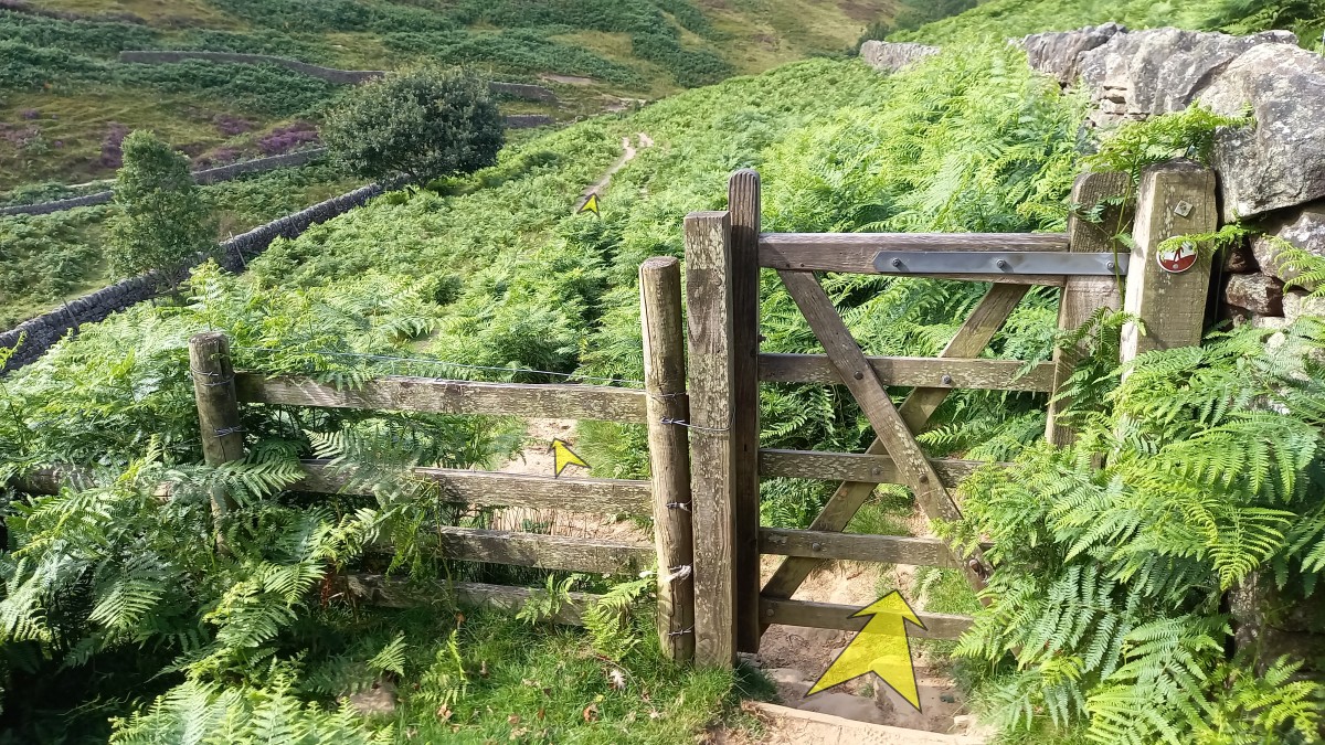
Continue along the level path alongside the reservoir, passing through a wooden gate after a couple of hundred metres.

-
Continue along the path until you reach a fork (the dam is visible not far ahead). Take the right-hand fork uphill on the broader path.
-
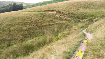
At the top of the hill, pass through a wooden gate, and follow the path around to the left.
This next section includes a few ups and downs, and a stream crossing where a large tree grows in the middle of the path. Following wet weather, and in winter, this section can be extremely muddy.
-
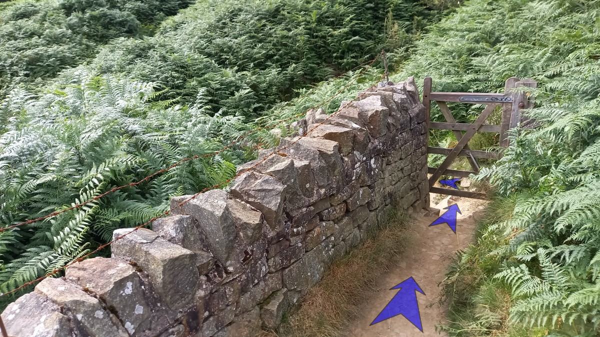
Having crossed the stream and left the (potentially) muddiest sections behind, you’ll reach an information board that overlooks the dam.
Just after the information board, a bridleway forks right uphill. Ignore this, and keep to the left, initially on the level.
-
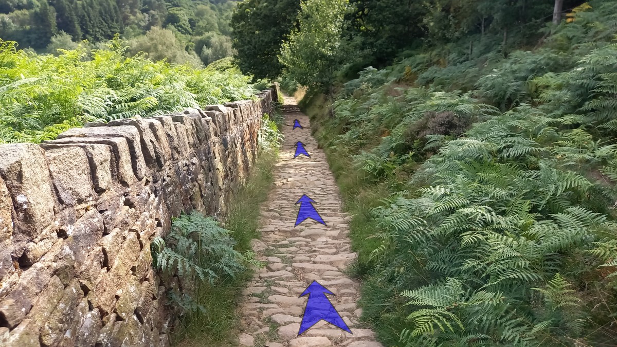
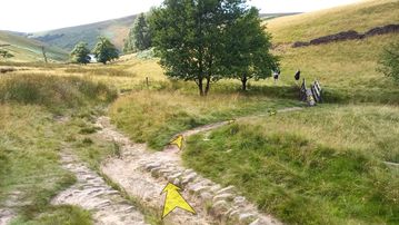
The path soon starts to descend quite steeply alongside a stone wall. This cobbled section of path follows the line of the old incline that was built to allow the hauling of materials up the hillside when constructing the dam.
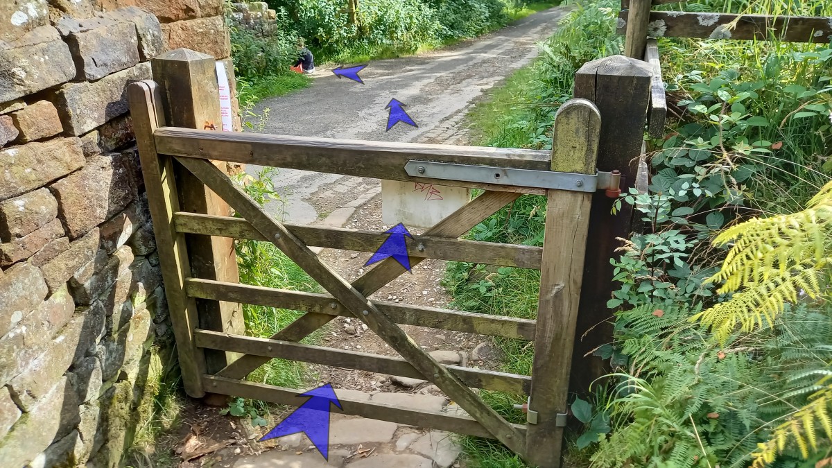
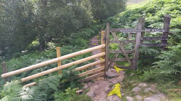
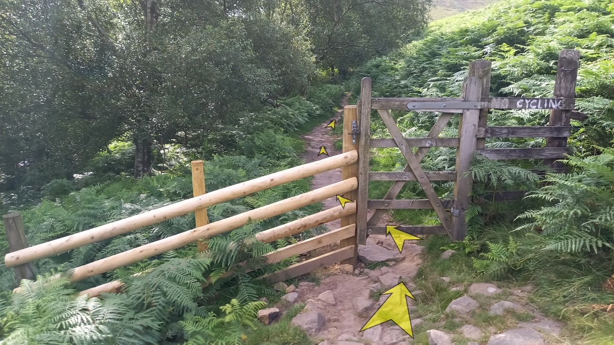
Continue down the cobbled path, reaching a wooden gate at the bottom (the steepest section is just before the gate).

-
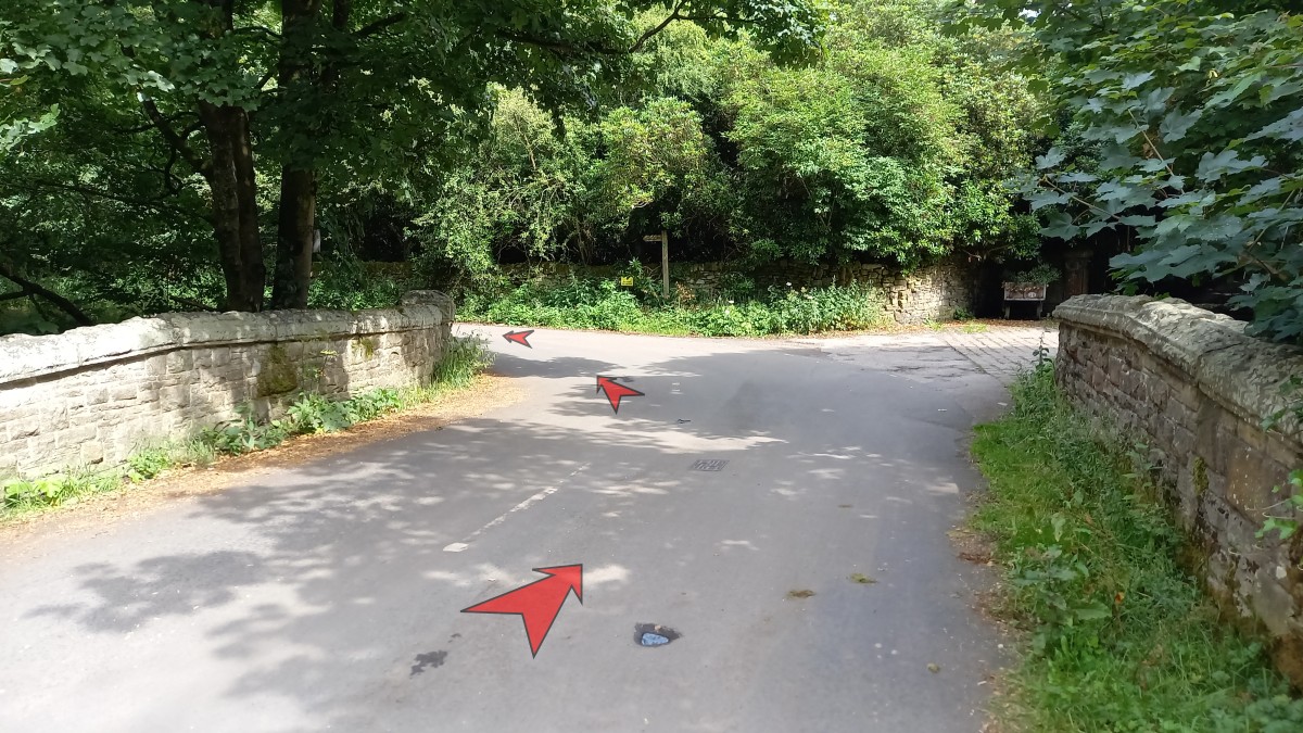
Pass through the gate, and then head left off the tarmacced road (as shown). A Public Bridleway signpost points the way.

-
Follow the earthy track through a tunnel of rhododendrons, then cross a footbridge over the River Kinder. This section can get quite muddy after wet weather.
Shortly after crossing the footbridge, where the path forks, bear right.
-
Continue to follow the path as it follows close by the left bank of the River Kinder. This is another spot where you may get lucky and spot a Dipper. Herons also frequent this stretch of river.
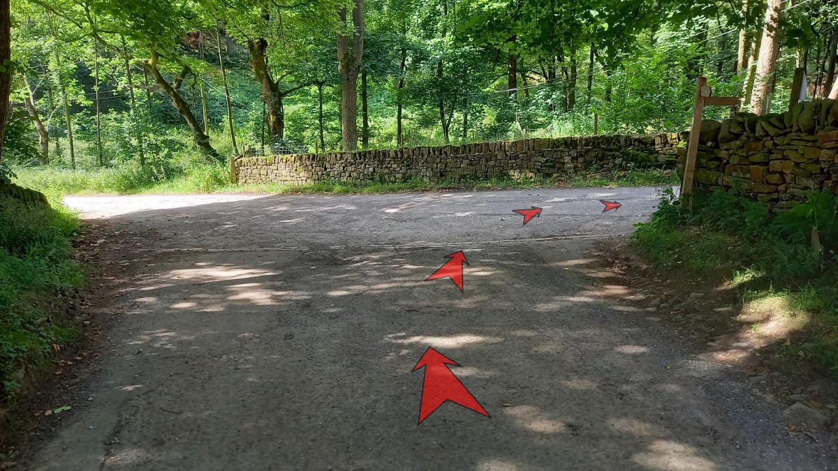
Pass through a wooden gate, shortly before the path joins a tarmacced road. Bear right onto the road.
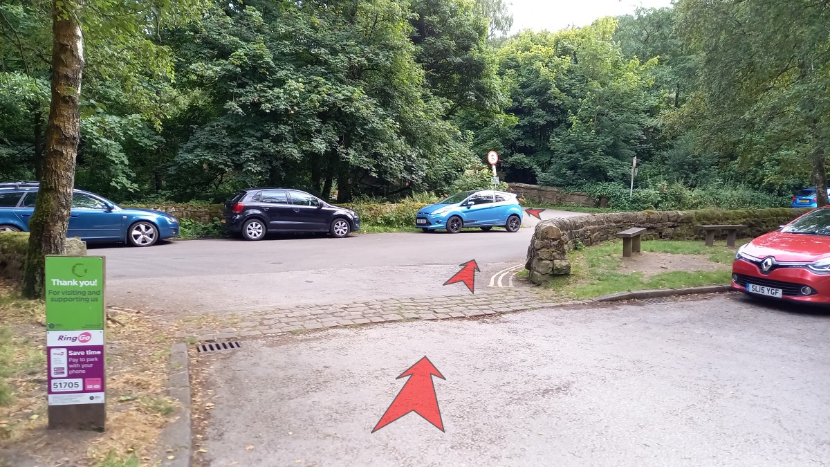
-
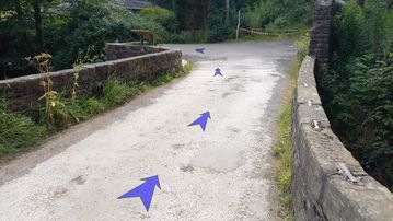
Pass a duck pond on your left, then bear right as the road crosses the river on a stone bridge.
An information board on the far side of the bridge describes Booth Sheepwash which you can see just downstream of the bridge.
Bear left and continue along the road.
-
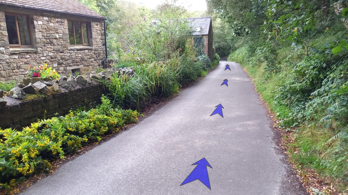
It now just remains to follow the road back to Bowden Bridge car park (approx half-a-mile). The road heads uphill initially, but then is flat or gently downhill all the way back to the car park.