Corbar Hill Walk
Visit the cross on Corbar hill, and take in extensive views of Buxton while you're there
About the walk
Corbar Hill lies just to the north of Buxton town centre and is a popular destination for walkers. The hill is topped by Corbar Cross (a gift from the Duke of Devonshire to Buxton Catholics), which was erected in 1950 to mark the Holy Year declared by Pope Pius XII. The walk to the cross offers extensive views over Buxton and the surrounding countryside.
Starting from Pavilion Gardens Car Park (which is a short walk from Buxton town centre and train station) this circular route takes you through Corbar Woods and on up to the cross, before returning via residential streets.
The walk is approximately 2½ miles long and should take an hour-and-a-half to complete, depending on your pace and how long you spend at the cross enjoying the views.
Need-to-know
-
Pay & Display parking at Pavilion Gardens Car Park.
Parking prices, per car (last checked July 2025):
- Up to 1 hour, £1.80
- 1 to 2 hours, £2.50
- 2 to 4 hours, £4.10
- Over 4 hours, £6.10
Payment by coins (no change given), by card, or with a smartphone using the PayByPhone app; charges apply every day 8am–6pm.
- Buxton has good connections to public transport. See “Getting there” for more information.
- 2½ miles / 4 kilometres circular walk.
- 1½ hours at a leisurely pace.
- 450 ft (140 m) ascent and descent.
- Mixed terrain in and above Corbar Woods (including some steep slopes and a rough rocky gully just below Corbar Cross); not suitable for wheelchair users or for pushchairs.
- 1 stile (which you’ll need to cross twice).
- Pavilion Gardens (the car park sits at the northwest corner of the gardens) is a beautiful Grade II-listed venue that is well worth taking the time to explore before or after your walk up Corbar Hill. Perfect for a picnic, and with a café, restaurant and ice cream kiosk, it’s a great place to relax. See the Pavilion Gardens website for more information.
- Accessible Public toilets are available at Pavilion Gardens Car Park (open 8am–5pm).
Getting there
By bus: Buxton is well served by frequent buses from many surrounding towns and cites. Buses run along St. John’s Road (which passes the Pavilion close to the start/finish of the walk described) and also pass through the middle of town (The Quadrant/Colonnade) near the northeast corner of Pavilion Gardens.
You can download timetables for Derbyshire public transport from www.derbysbus.info/times.
By train: Buxton railway station (arrowed on the following map) is about ½-a-mile from Pavilion Gardens Car Park (the start/finish point for the walk described) and is served by trains from Manchester Piccadilly and Stockport. You can start from step 2 of the walk description below (on St. John’s Road).
Use the National Rail Journey Planner at https://www.nationalrail.co.uk/ to check train times.
By car: Start and finish at Pavilion Gardens Car Park (arrowed on the following map).
See Need-to-know for detailed parking information.
The following may help if you use a satnav:
- nearest postcode: SK17 9AR (For a more precise location, you should enter the name – *Pavilion Gardens Car Park*, what3words, latitude/longitude, or Ordnance Survey grid reference figures into your satnav).
- what3words: bandstand.cyclones.gossip
- Latitude, Longitude: 53.257, -1.920
- Ordnance Survey grid reference: SK 053 733
Map & directions
This simplified map provides guidance for the route described – the numbers refer to the numbered steps in the walk description. This map is not suitable for detailed navigation, for which you should use a copy of the relevant Ordnance Survey map.
The Ordnance Survey map covers a bigger area along with important information such as place names, official rights of way, and areas of Access Land.
For this walk, the ideal map is the Explorer Series Number OL24: The Peak District - White Peak Area (Buxton, Bakewell, Matlock & Dove Dale), which includes the whole area of the walk at 1:25 000 scale (4 centimetres to 1 kilometre).

Contour interval: 10 metres; index contours, 50 metres. North at top (approximate).
Map data from OpenStreetMap (available under the Open Database Licence). Contains Ordnance Survey data © Crown copyright & database right 2010–2023.
Stage 1: Pavilion Gardens Car Park to Corbar Cross
-
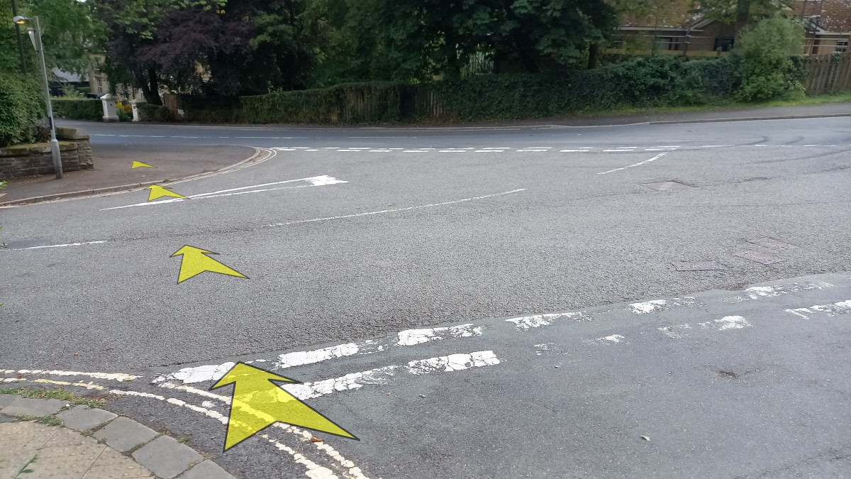
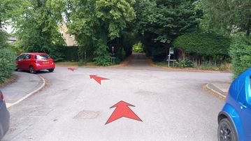
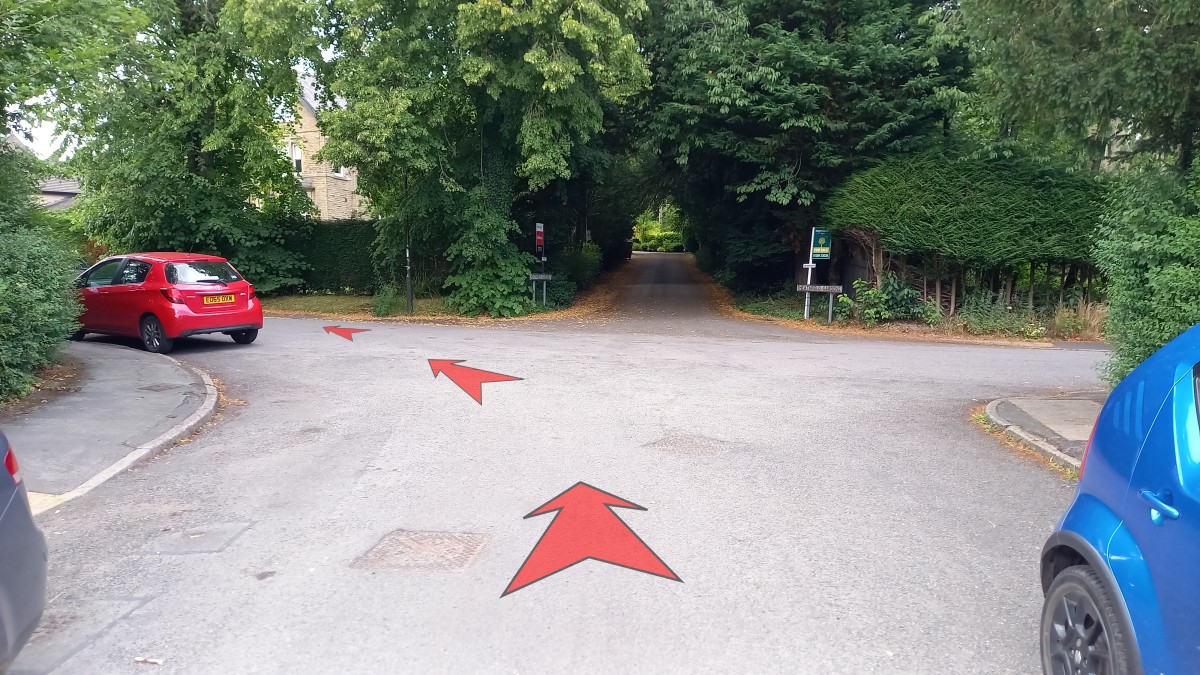
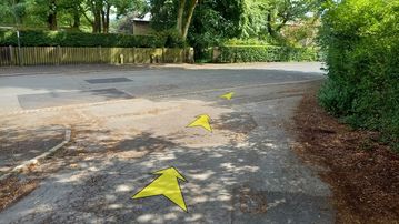
Leave the Pavilion Gardens car park by the main vehicle entrance, turning right onto Burlington Road.
-
After 60 metres, reach the T-junction with Saint John’s Road and use the pedestrian crossing a few metres to the right to cross.
On the far side, turn left and then right after 10 metres to head into a short alleyway that takes you onto Park Road.
-
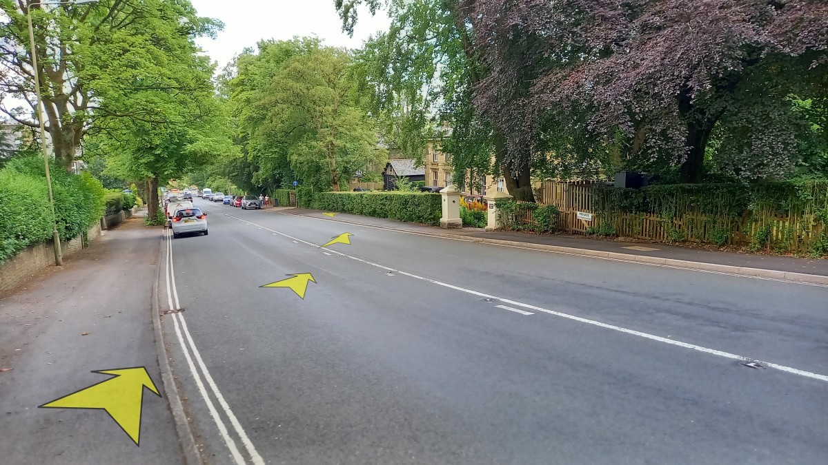
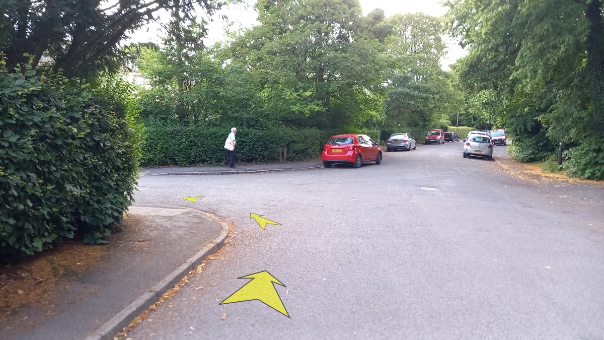
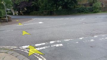
Walk up Park Road for 30 metres to the T-junction (Heathfield Gardens opposite) and turn left to follow the road (still named Park Road) as it gradually bends round to the right, gradually climbing up away from Buxton centre.
-
After approximately ½-a-kilometre, turn left onto a side road (the third side-road on the left since you turned left onto Park Road).
This road isn’t signed (though it’s still named Park Road) but you’ll know you’re in the right place because it’s directly opposite a sign to number 62, “Parkholme”. There’s also a red pillar box just around the corner.
-
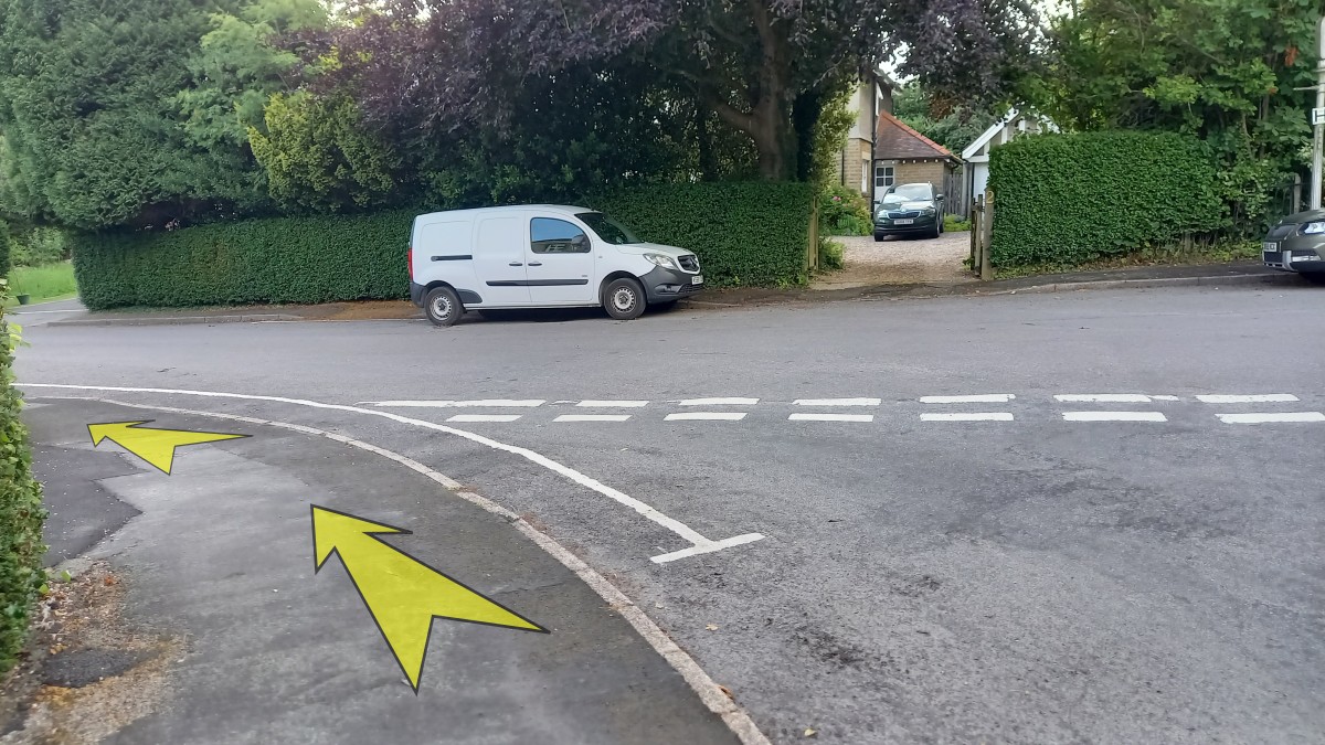
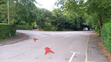
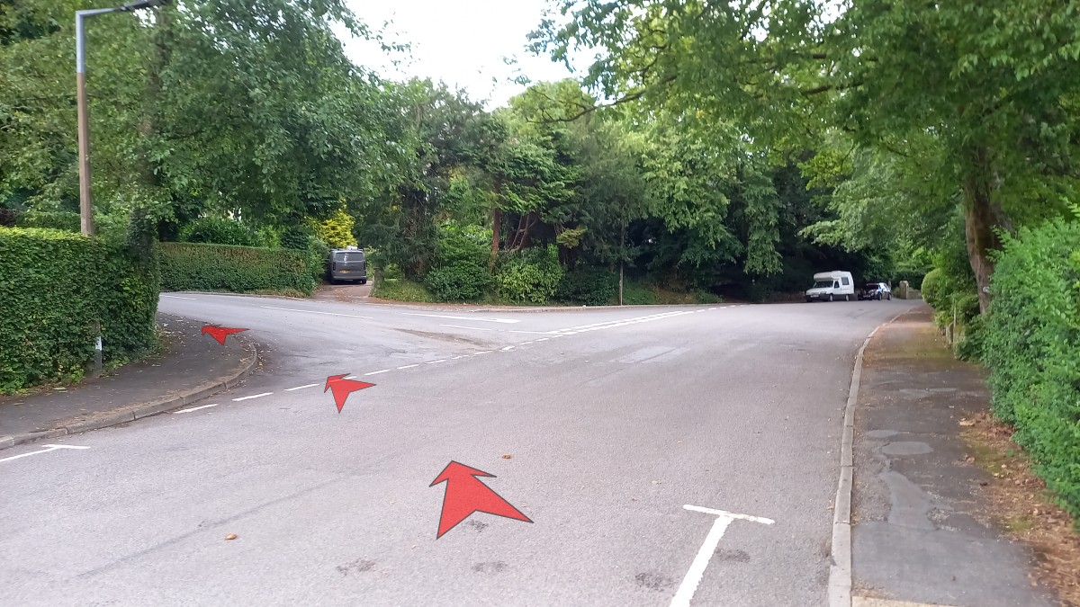
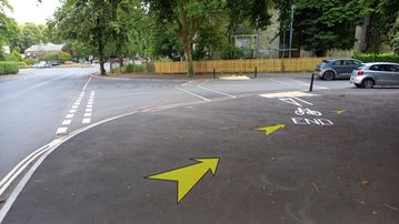
Continue up Park Road, more steeply now, for about 300 metres.
You’re best off crossing over to the right-hand side of the road, ready to cross Manchester Road when you reach the T-junction (opposite “Punch Bowl Park”).

-
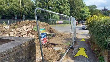
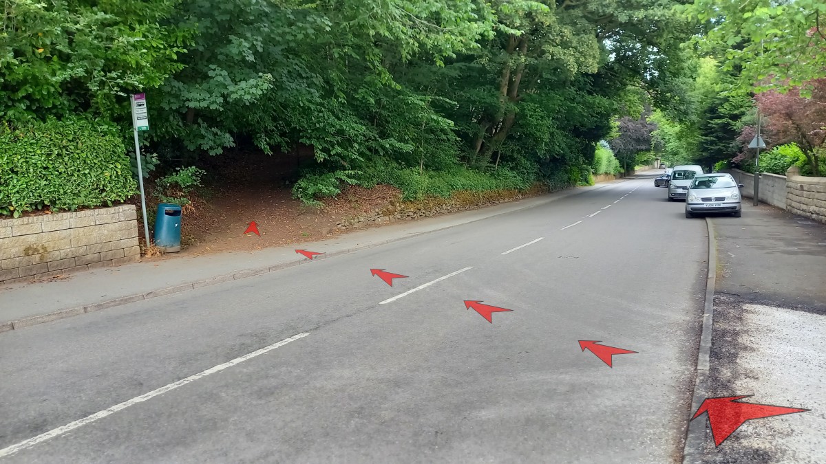
Once at the T-junction with Manchester Road, head right for a few metres then cross over to the bus stop sign and litter bin.
Take the earthy path that heads up the hill into Corbar Woods from here.
-
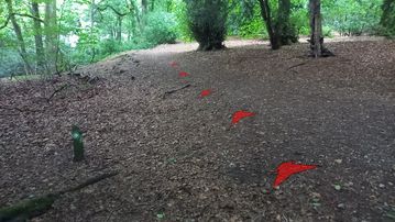
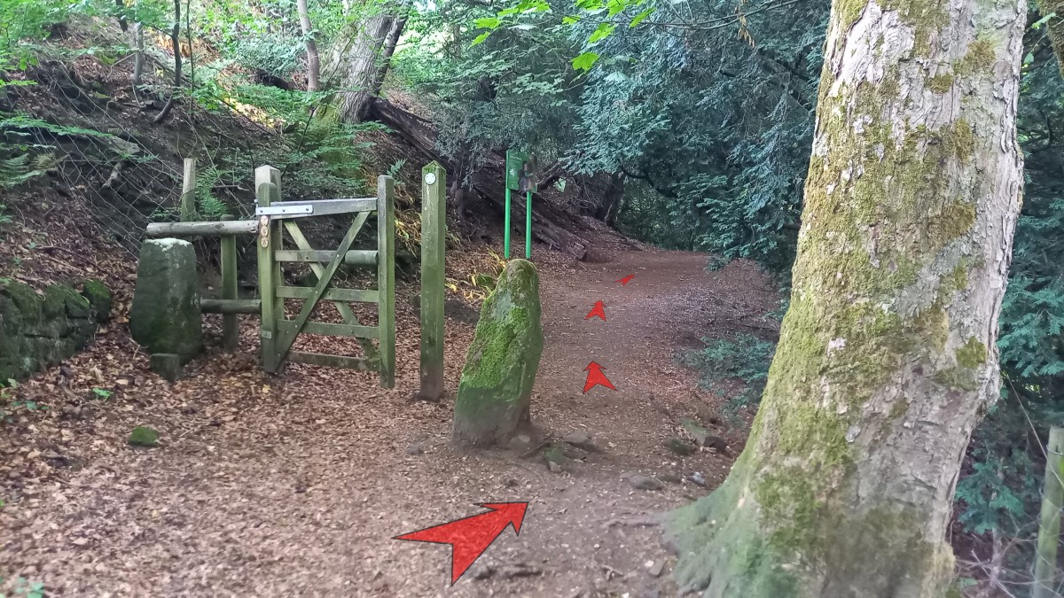
Follow the earthy path uphill through the woods.
Another path soon joins from the right, but continue straight on – soon reaching a gate that you can simply walk around.
Just after the gate, an information board welcomes you to Corbar Wood, which is owned and cared for by Buxton Civic Association
-
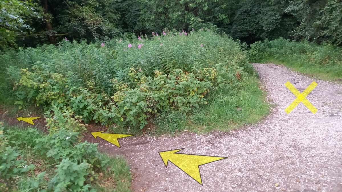
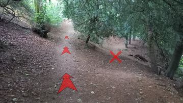
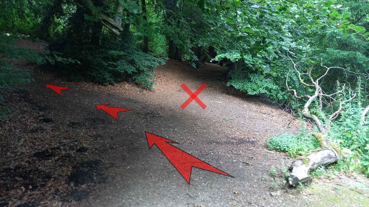
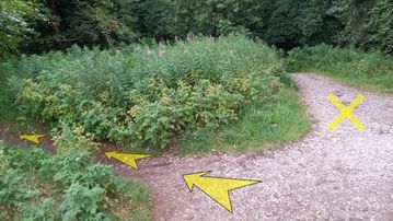
Continue along the earthy path, soon reaching an indistinct fork where you should bear left (uphill).
-
The path bends around to the left and then crosses a short stone causeway.
At the far end of the causeway, turn right and ascend a short flight of steps cut into the track.
-
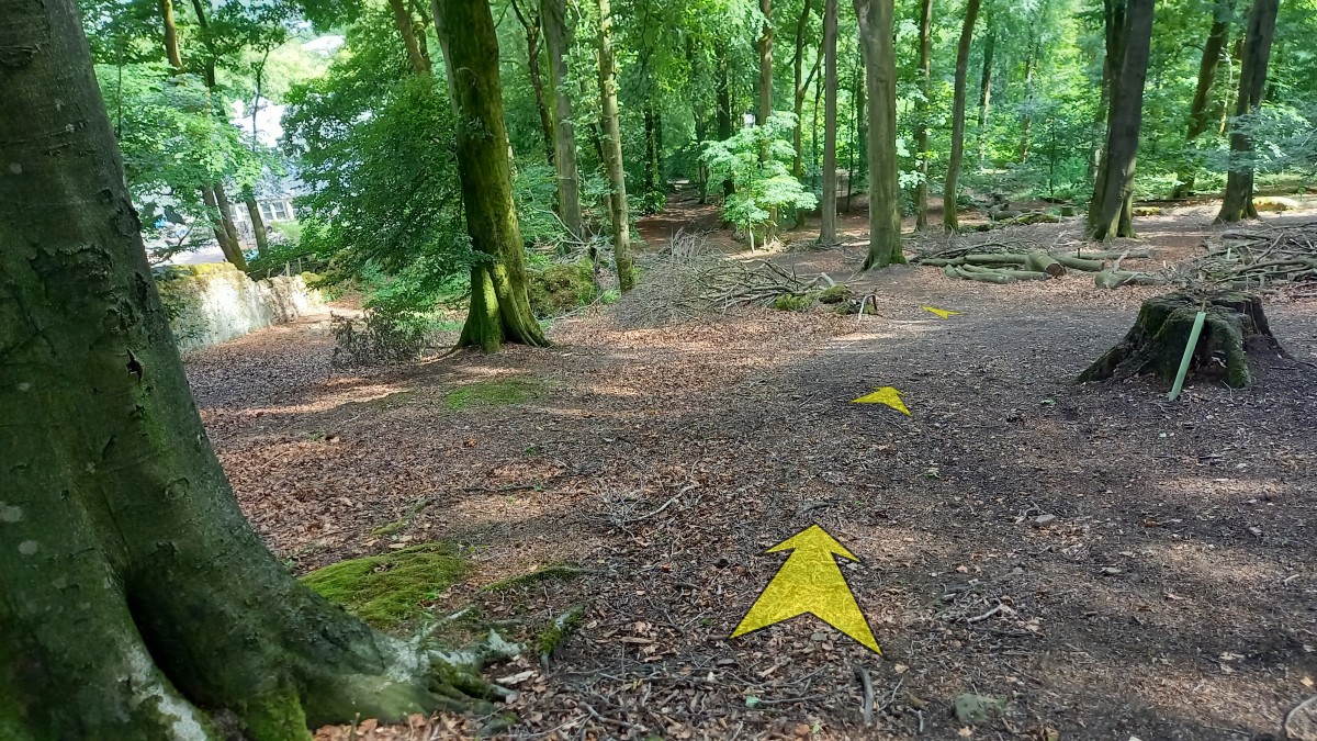
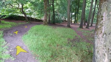
Continue on the earthy path beyond the steps, trending uphill, and passing an information board.
A little further on, reach another indistinct junction, and bear left again (uphill)
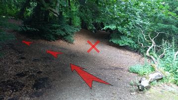
-
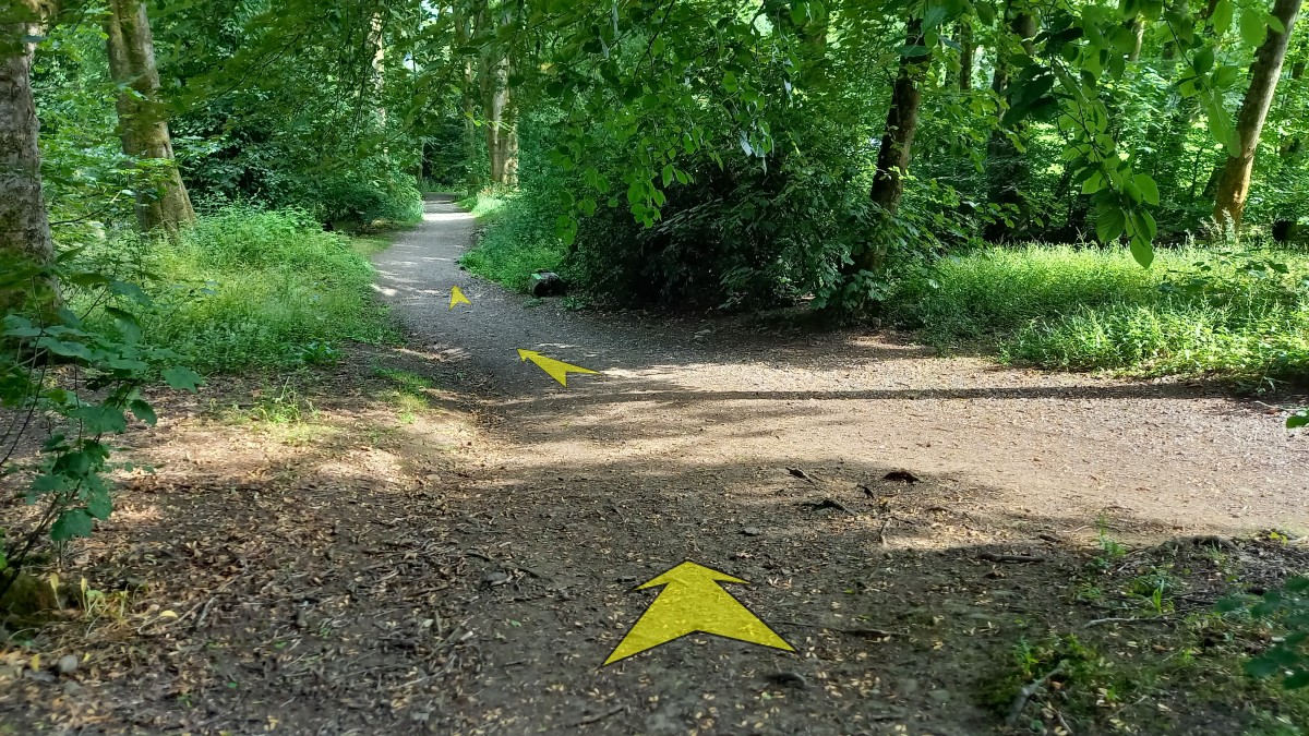
The broad earthy path (somewhat indistinct here) turns back to the left and continues to trend uphill.
Ignore the short signpost on the left with an arrow pointing off to the right, and instead continue straight on, still heading gently uphill.
-
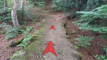
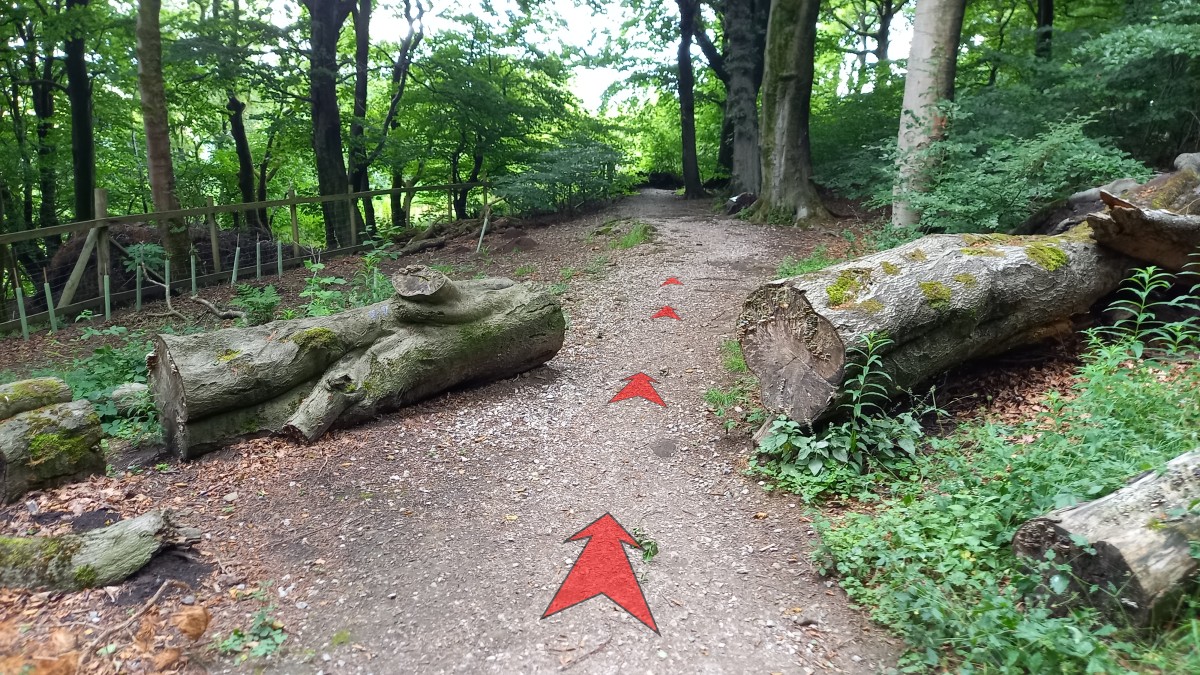
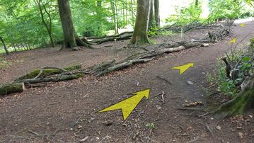
The broad earthy path continues to trend uphill – still a little indistinct – as the ground drops away more steeply to your left.
Pass another information board and some mature trees, before reaching a felled tree that has been cut to make a way for the path.

-
Just beyond the felled tree, pass another information board on your right (this section of woodland is carpeted with bluebells in spring) and continue along the path, which is now stonier and much clearer.
A fence and wall also joins the path on the left at this point.
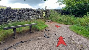
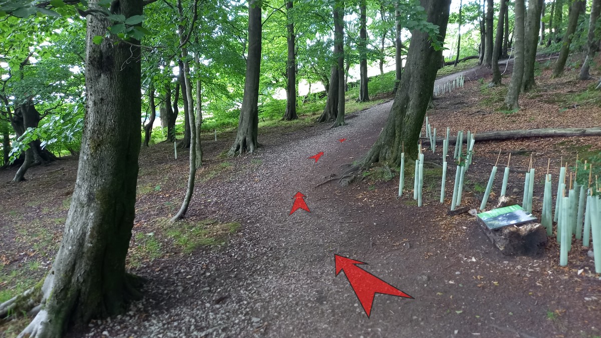
As you continue, the stony path starts to bend round to the right (passing a bench, and an additional information board), and climbs more steeply up through the woodland.

-
After about 250 metres – during which the stony path climbs steeply to the top edge of the woodland (still bearing right), and then follows alongside a stone wall to your left – you’ll pass another information board on your right, and then reach a path junction with a bench seat and a gate.
Bear left here and go through the gate.
-
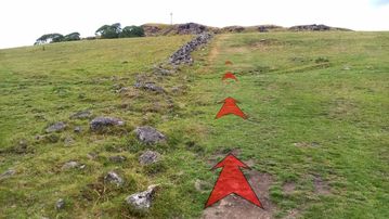
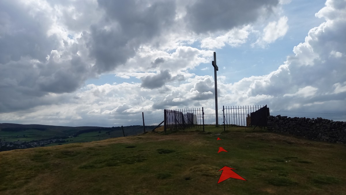
Corbar cross should now be obvious atop the hill ahead of you.
Continue straight up the hill on a grassy path alongside a broken-down stone wall to your left.
Note that these fields may contain cattle, so take care if you’re walking with a dog.
-
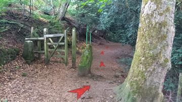
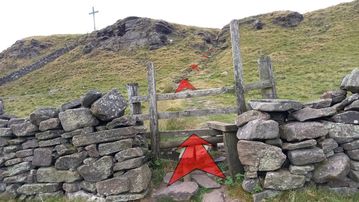
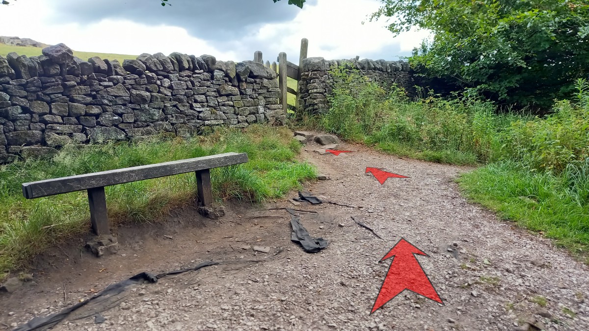
After about fifty metres, cross a wooden stile, and then make your way straight ahead and up through a rocky gully with natural stone steps.
You may need to use your hands briefly here, but it’s not too difficult.
An alternative path goes around to the left just before the rocky gully (beneath the small rock outcrop), but this is considerably looser than the gully.
-
At the top of the rocky gully, turn left and head over to the open iron-railing enclosure (no gate) that surrounds Corbar Cross.
The views south over Buxton from here are magnificent. To the west and north, Combs Moss moorland dominates.
If you wish to visit the triangulation pillar (the white painted concrete pillar with a metal plate on top), which sits outside the enclosure, you’ll need to cross another stile just north of the cross and then go through a wooden gate for access to the pillar.


Stage 2: Corbar Cross to Pavilion Gardens Car Park
-
To start the return journey down to Buxton, retrace your steps from the cross back through the rocky gully and down the grassy slope to the gate you came through earlier.
Turn left here onto an earthy path (rather than continuing straight on down the hill on the broader stony path).
-
The earthy path (quite narrow initially) follows along the top edge of the woodland, then bears right and starts to descend quite steeply.
Take care on this slope, as it can be quite loose.
-
The earthy path, much broader now and a little indistinct, continues to descend quite steeply – never very far from the boundary wall to your left.

-
As the gradient begins to ease (about 300 metres from the gate at the top edge of the woodland), bear right and then left where some branches have been laid on the ground to guide you.
-
Join a much clearer stony path, and bear left (soon passing another information board on your right).
This stony path soon joins a minor tarmacced road (where there’s another “Welcome to Corbar Wood” information board), onto which you should turn left.

-
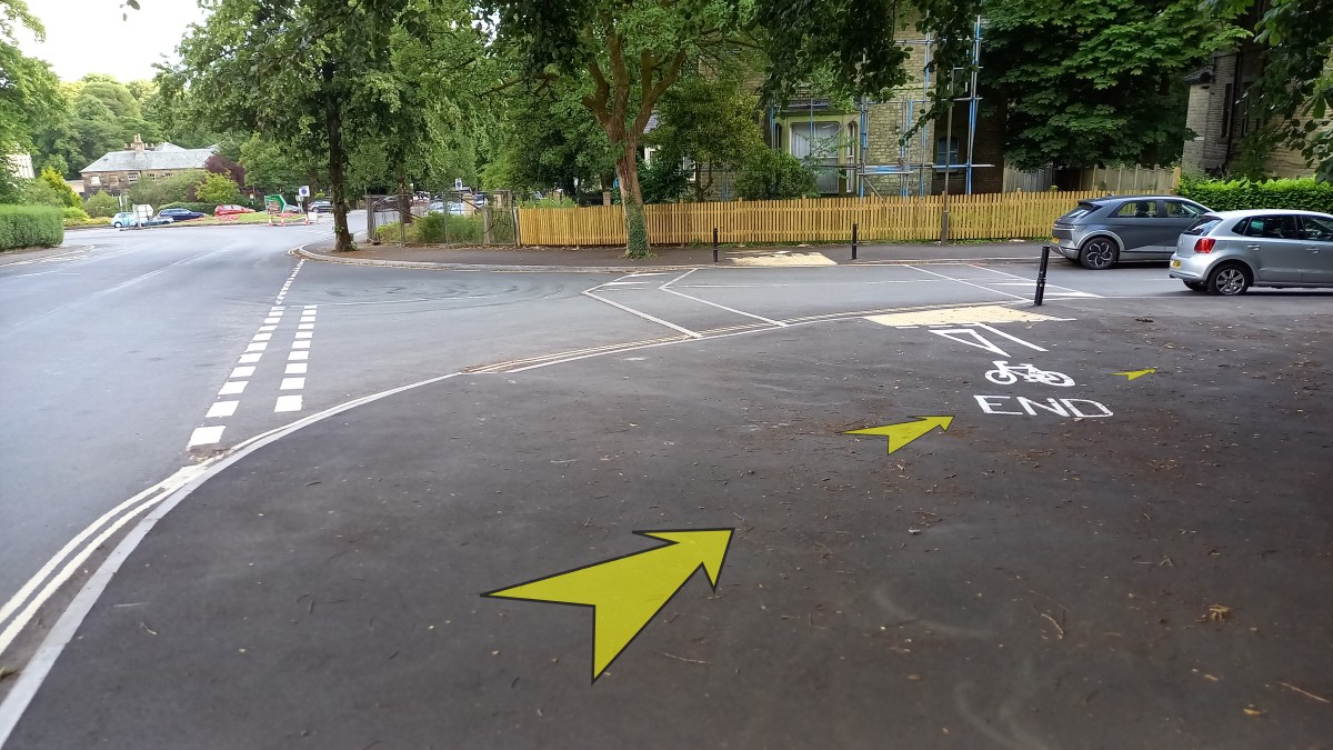
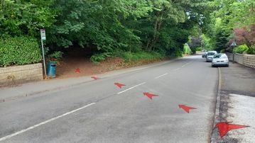
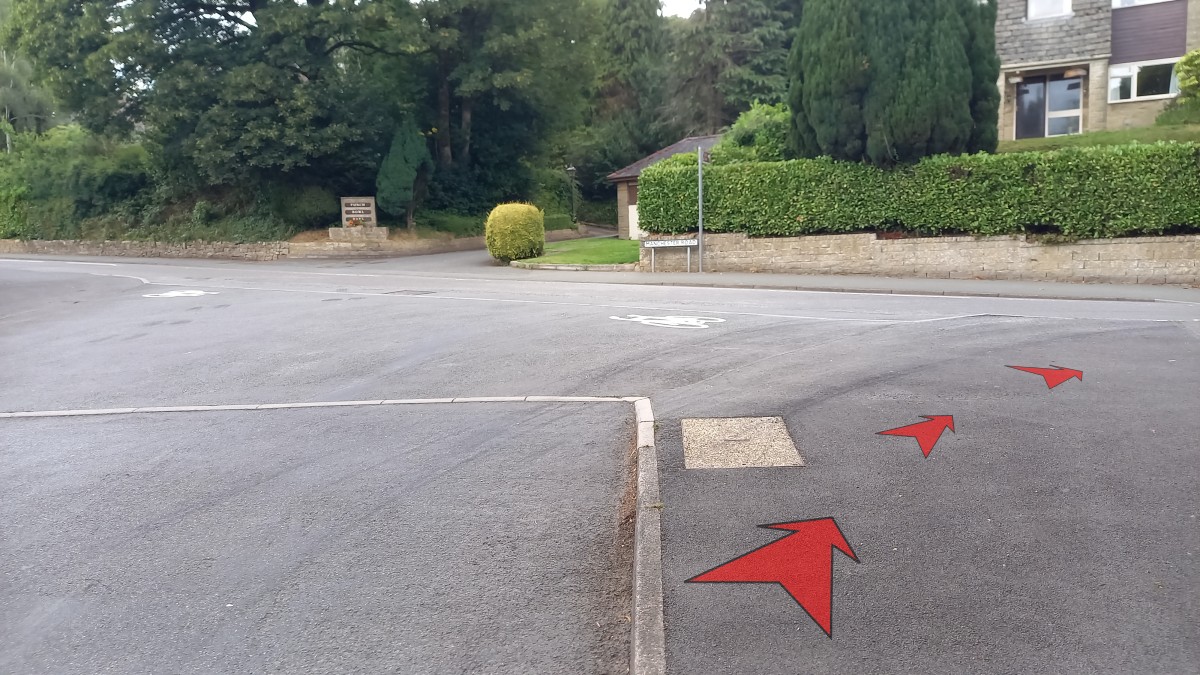
Follow the minor road for approximately 50 metres to reach a T-junction with Corbar Road.
Turn right onto Corbar Road. You’re now back onto residential streets that are likely to have more traffic.
-
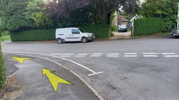
Continue along Corbar Road for about 200 metres to reach a corner-junction with Devonshire Road (to your left) and Manchester Road (straight ahead).
Cross over Devonshire Road and continue down Manchester Road towards the town centre.
-
Continue down Manchester Road.
You’ll need to cross over to the right-hand side of the road at some point.

-
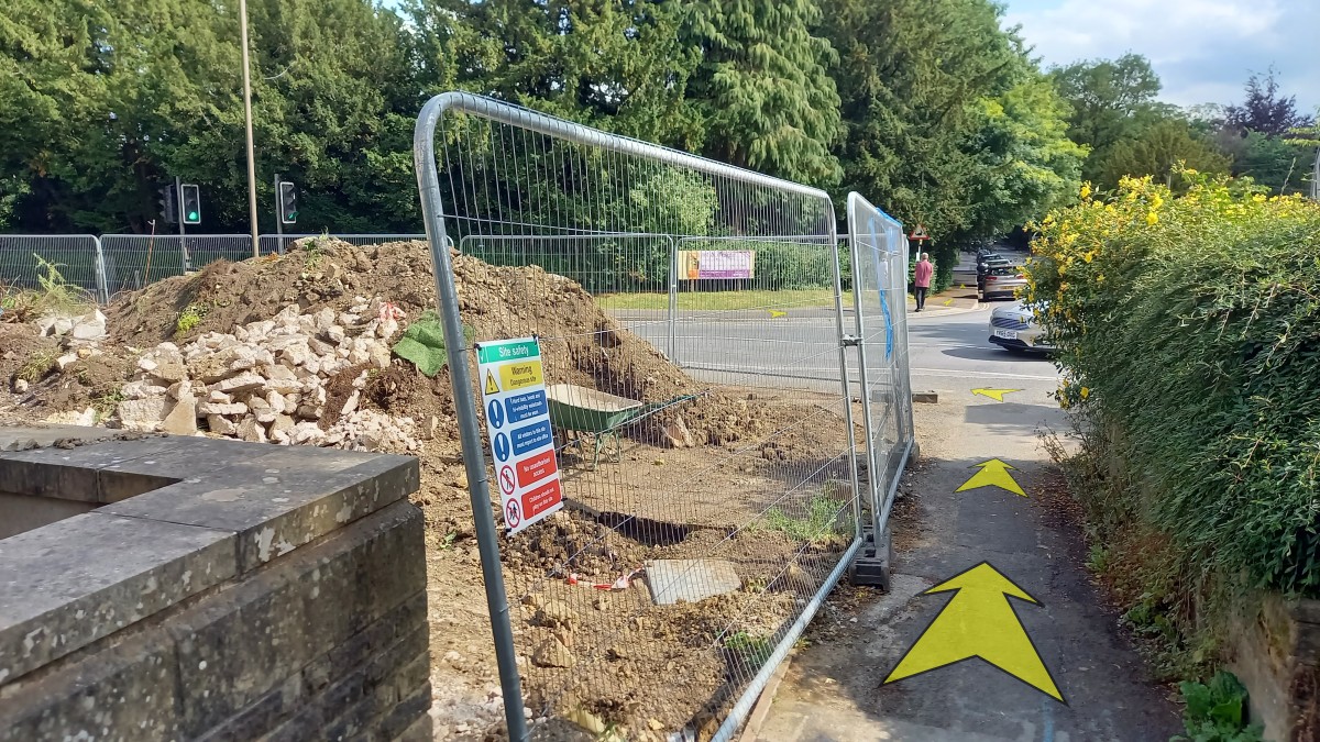
After about 250 metres, turn right off Manchester Road onto Park Road (the first side-road on the right after the junction with Devonshire Road and Corbar Road).
Before heading down Park Road, take some time to admire the Devonshire Dome, opposite. This is a magnificent building – the largest unsupported dome in the UK. When it was constructed in 1881, it was the world’s largest unsupported dome.
-
Continue down Park Road for about 100 metres to reach a T-junction, where you should turn left.
-
Follow the road (still named Park Road) as it bends round to the right.
After about 200 metres, you’ll reach the point at which you joined this main section of Park Road earlier (opposite Heathfield Gardens). Turn left here and proceed to the short alleyway that leads onto Saint John’s Road.

-
At the end of the alleyway, turn left onto Saint John’s Road, cross using the lights, then turn right and then left to join Burlington Road and return to the Pavilion Gardens car park.
If it’s a nice day, you might like to explore Pavilion Gardens and possibly the buildings and shops in this part of Buxton before you leave.