Bamford Edge Walk
Experience stunning views from the gritstone escarpment of Bamford Edge
About the walk
This circular walk explores the gritstone escarpment of Bamford Edge, with stunning outlooks over the surrounding moorland, valleys and reservoir. Before the Countryside and Rights of Way act (CRoW) 2000 came into force, much of this area was inaccessible to walkers, making it a hidden gem for those in the know.
It’s much more popular nowadays, and rightly so. The views from the edge are truly breathtaking, and the varied terrain offers an interesting half-day out on this circular route from Heatherdene.
The walk is suitable for those with a reasonable level of fitness, but care should be taken on the rougher sections and near sheer cliffs.
Need-to-know
-
Pay & Display parking at Heatherdene Car Park.
Parking prices, per car (last checked August 2025):
- Up to 2 hours, £3.50
- 2 to 4 hours, £6.00
- Over 4 hours, £7.00
Payment by coins (no change given) or card; charges apply all day, every day.
There’s public transport (bus service) to Heatherdene, with a stop just north of Heatherdene car park (which is where the walk description starts). See “Getting there” for more details.
- 3½ miles / 5½ kilometres circular walk.
- 2½ hours at a leisurely pace.
- 750 ft (225 m) ascent and descent.
- Mixed terrain (including some steep slopes, rough bouldery ground, and paths near the top of sheer unfenced cliffs); not suitable for wheelchair users or for pushchairs.
- 2 stiles.
-
Dogs are NOT PERMITTED on any of the moorland/edge sections of this route, as it crosses open access land (away from designated rights of way) on which dogs are prohibited.
- For an optional refreshments stop, the Yorkshire Bridge Inn (marked on the map below) is on the route, just under a kilometre south of Heatherdene Car Park.
Getting there
By bus: Bus number 257 (Sheffield – Bamford – Hathersage – Baslow – Bakewell) serves the Heatherdene stop, which is just north of the Heatherdene Car Park where this walk description starts.
You can download timetables for Derbyshire public transport from www.derbysbus.info/times
By car: Start and finish at Heatherdene Car Park (arrowed on the following map).
See Need-to-know for detailed parking information.
The following may help if you use a satnav:
-
nearby postcode: S33 0BY (this postcode is for an area about one kilometre south of Heatherdene Car Park).
For a more precise location, you should enter the name – Heatherdene Car Park, what3words, latitude/longitude, or Ordnance Survey grid reference figures into your satnav.
- what3words: ///factually.slings.belonged
- Latitude, Longitude: 53.370, –1.697
- Ordnance Survey grid reference: SK 202 859
Map & directions
This simplified map provides guidance for the route described – the numbers refer to the numbered steps in the walk description. This map is not suitable for detailed navigation, for which you should use a copy of the relevant Ordnance Survey map.
The Ordnance Survey map covers a bigger area along with important information such as place names, official rights of way, and areas of Access Land.
For this walk, the ideal map is the Explorer Series Number OL1: The Peak District - Dark Peak Area (Kinder Scout, Bleaklow, Black Hill & Ladybower Reservoir), which includes the whole area of the walk at 1:25 000 scale (4 centimetres to 1 kilometre).

Contour interval: 10 metres; index contours, 50 metres. North at top (approximate).
Map data from OpenStreetMap (available under the Open Database Licence). Contains Ordnance Survey data © Crown copyright & database right 2010–2023.
Stage 1: Heatherdene Car Park to New Road
-
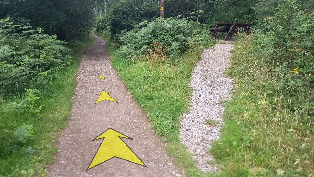
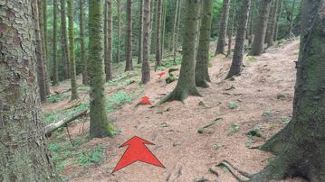
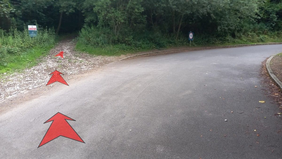
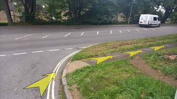
From the car park, walk north towards the main vehicular access road, and take the clear gravel track that heads up into the woods from the road corner.
Pass a wooden barrier and continue fairly steeply uphill through the trees on a broad earthy track. This steepens a little and narrows further up before reaching a junction in a clearing under some power lines, about 200 metres from the car park.
-
Follow the arrow on a wooden post and turn left here to follow the track (now level), bordered by bracken, beneath the power lines.

-
After about 50 metres, reach a second wooden post with an arrow (“Path to Access Land”), and bear right.
-
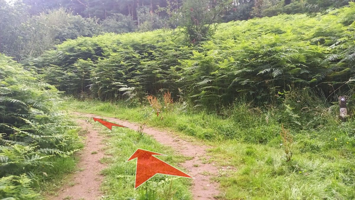
Continue to follow the earthy path through bracken, which soon enters more open woodland.
Additional posts guide you along the obvious path as it climbs up through the woodland, soon bearing left and becoming less steep.
-
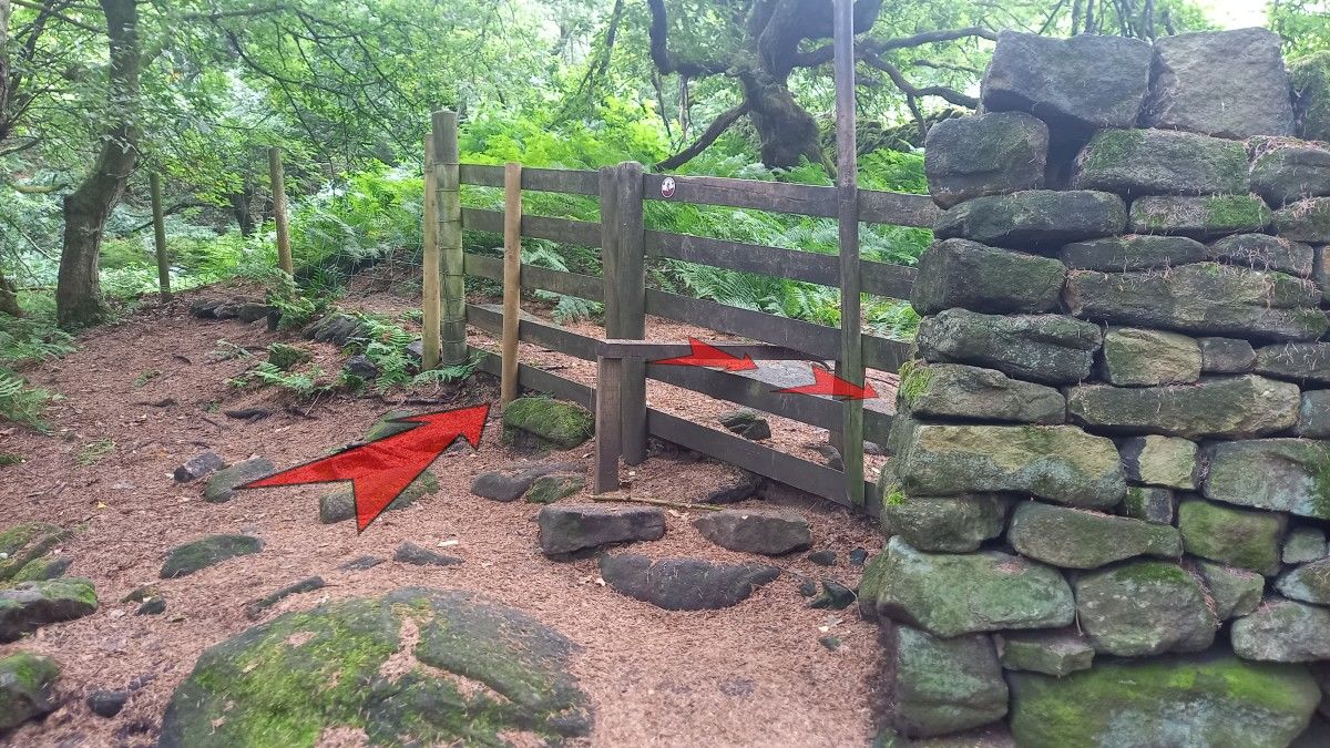
Keep your eye out for wooden posts as the path drops slightly, and then reaches a wooden stile and fence at the end of a dry-stone wall.
Cross the stile, and turn immediately right, heading alongside the wall.

-
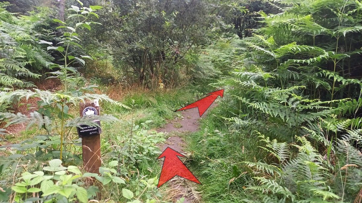
After only 10 metres, bear left away from the wall and follow the path as it climbs more steeply uphill.

-
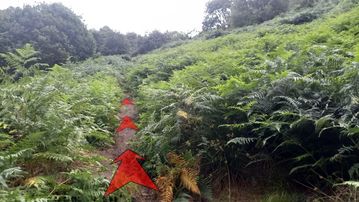
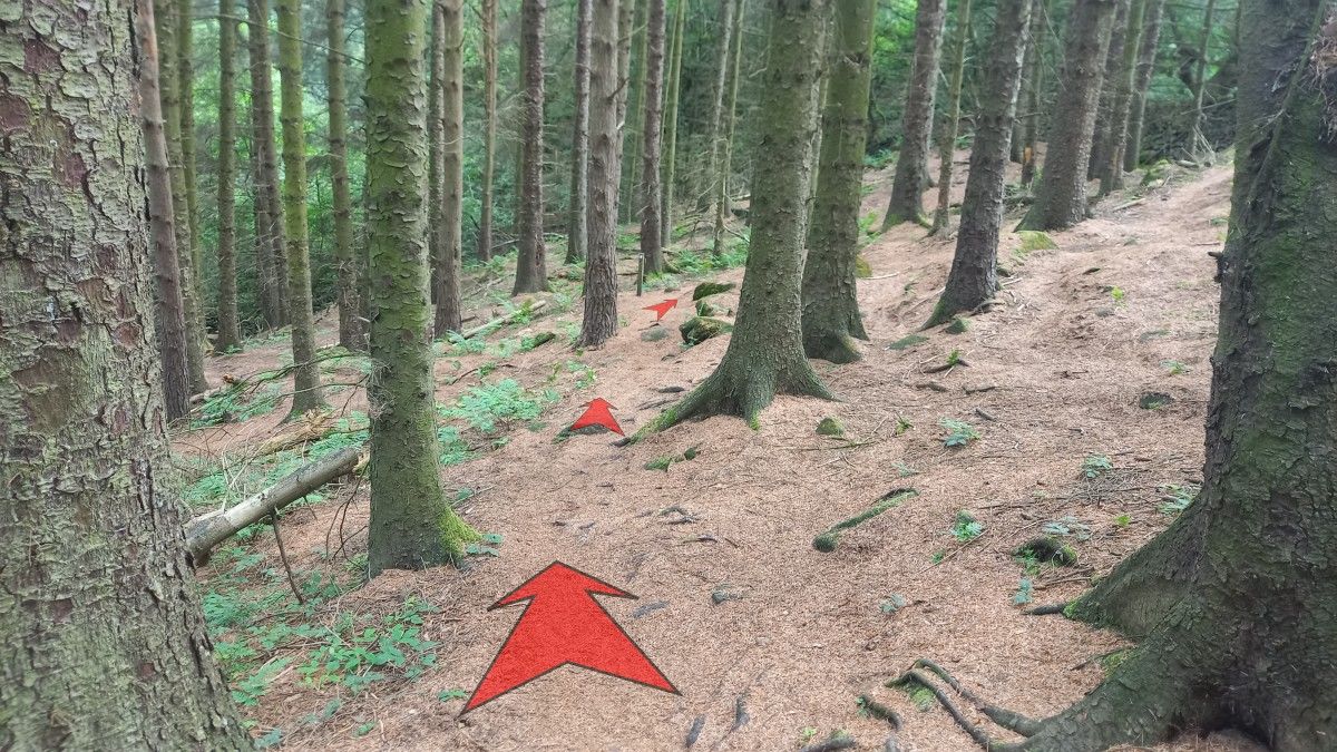
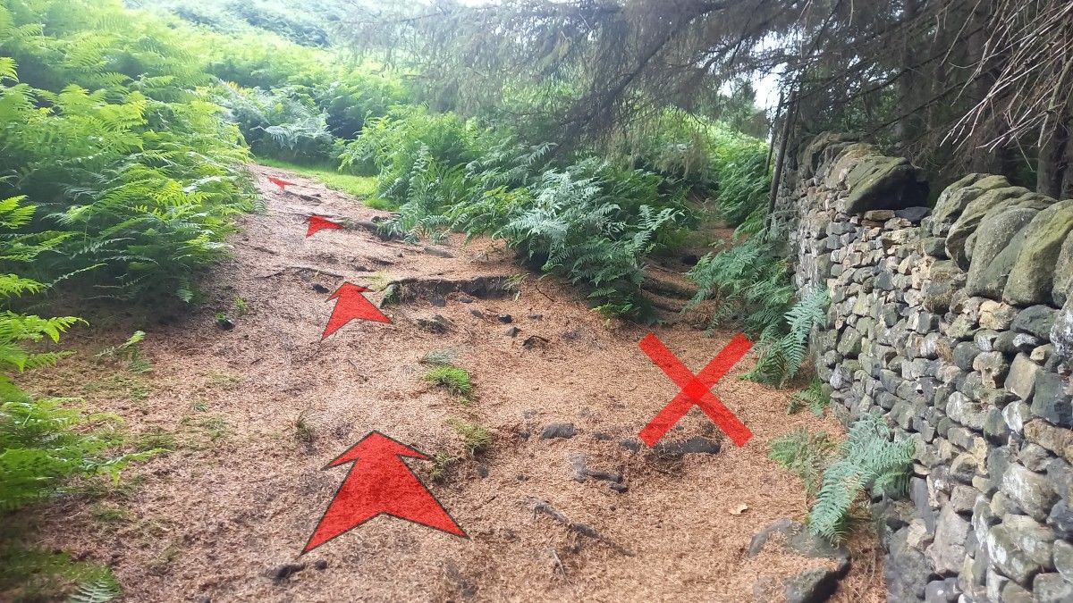
The earthy path continues up the hillside, and may be slightly obscured by tall bracken in the late summer.
At one point the path passes close by some small trees, and you should be able to hear the stream trickling down to your left.
The path continues uphill, rocky in places and gradually becoming grassier and more open. There are great views back down to Ladybower Reservoir behind you as you climb.
-
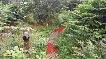
About 250 metres from the wooden stile, you’ll reach a path crossroads. At the time of writing (August 2025) there was also a wooden post at this junction with a sign warning of fire hazard.
Turn right at the junction and continue to follow the earthy path uphill, passing a small rock outcrop on your left not far from the crossroads.

-
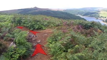
As the path climbs, Win Hill (the obvious pointy hill) becomes prominent directly ahead and on the far side of the valley.
As it starts to level off, bear left to stay on the main path (about 100 metres from the crossroads).
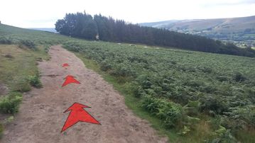
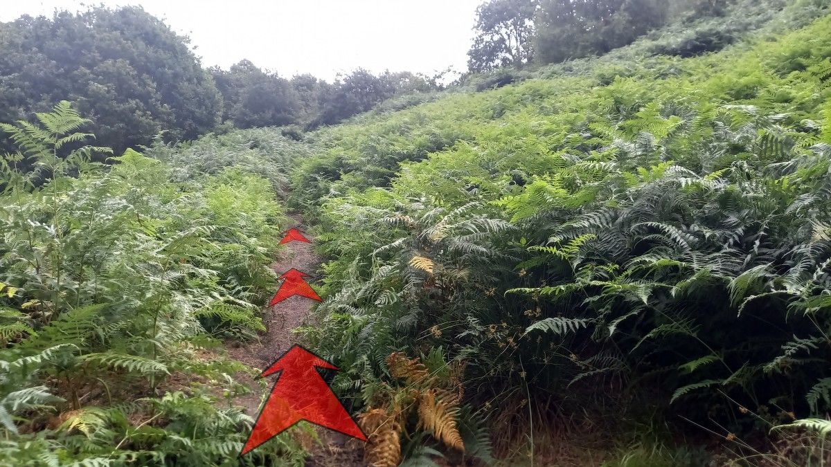
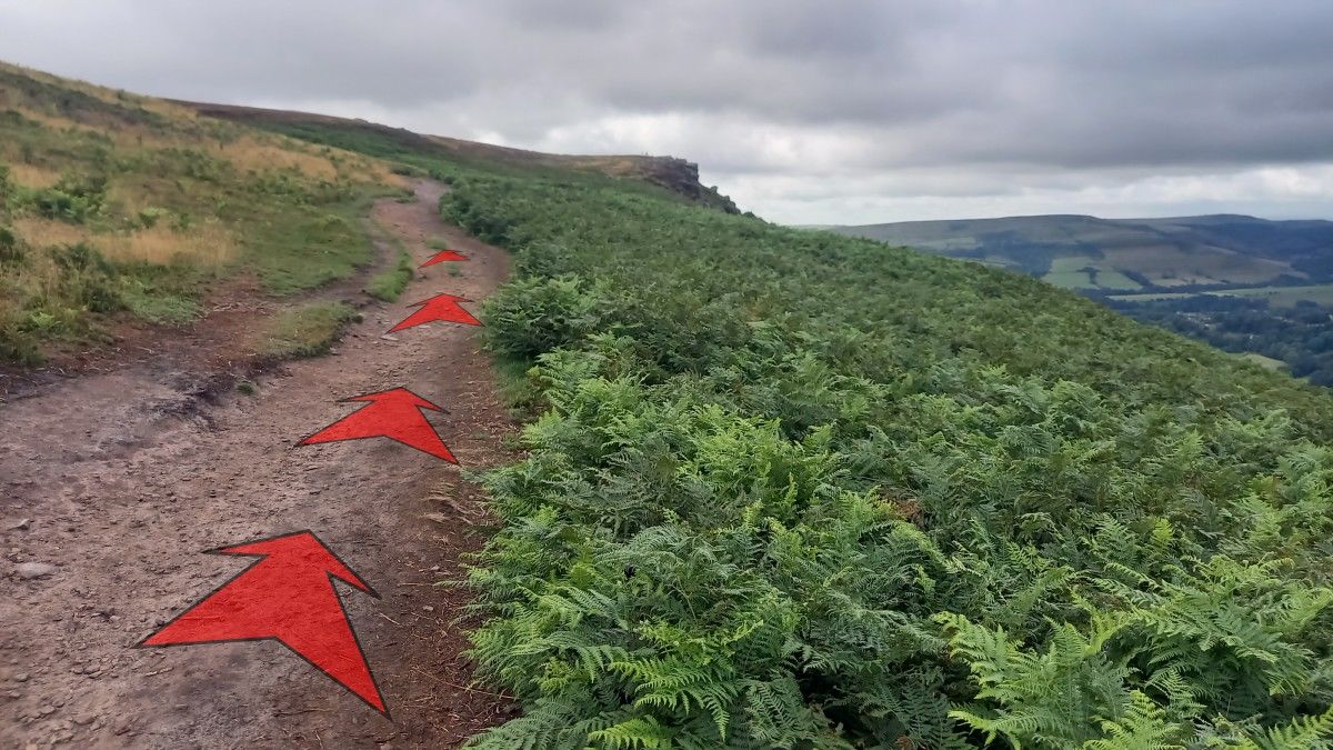
All of the steepest climbing is now over, and you can enjoy a more gentle climb up along Bamford Edge, heading for the obvious outcrops in the distance.
-
The best route along the main edge path is clear. Be sure to ignore any paths coming in from the left (down hill) and if in any doubt, choose the path closest to the edge for the best views.

-
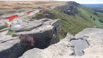
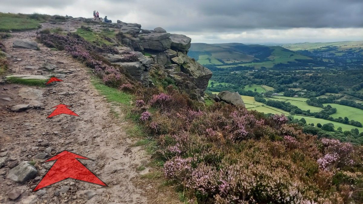
After about ½–a–kilometre, you’ll reach the first gritstone rock outcrops on the edge proper.
Take you time to enjoy the next section as the path levels off (though it remains quite rocky in places) and the views really open up.

-
There are many rock outcrops to explore here. Just be careful not to stray too close to the edge, as there are sheer (unfenced) drops off the crags down to the bracken-covered slopes below.
-
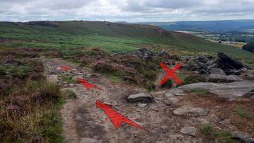
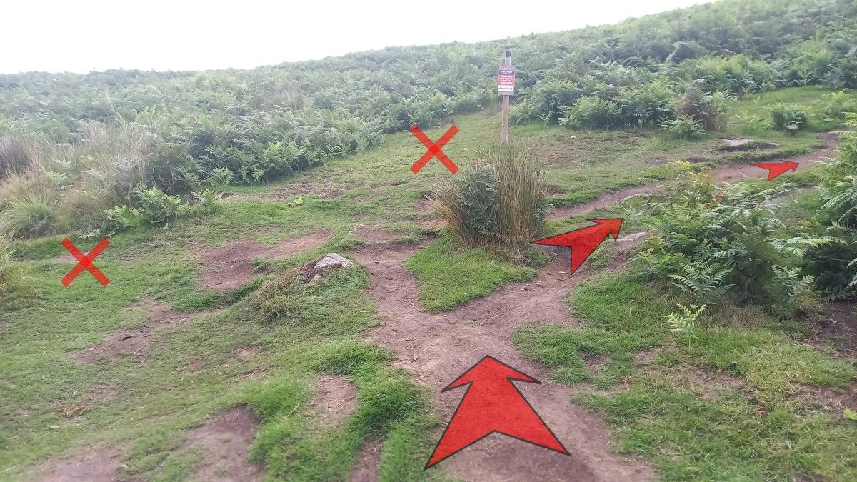
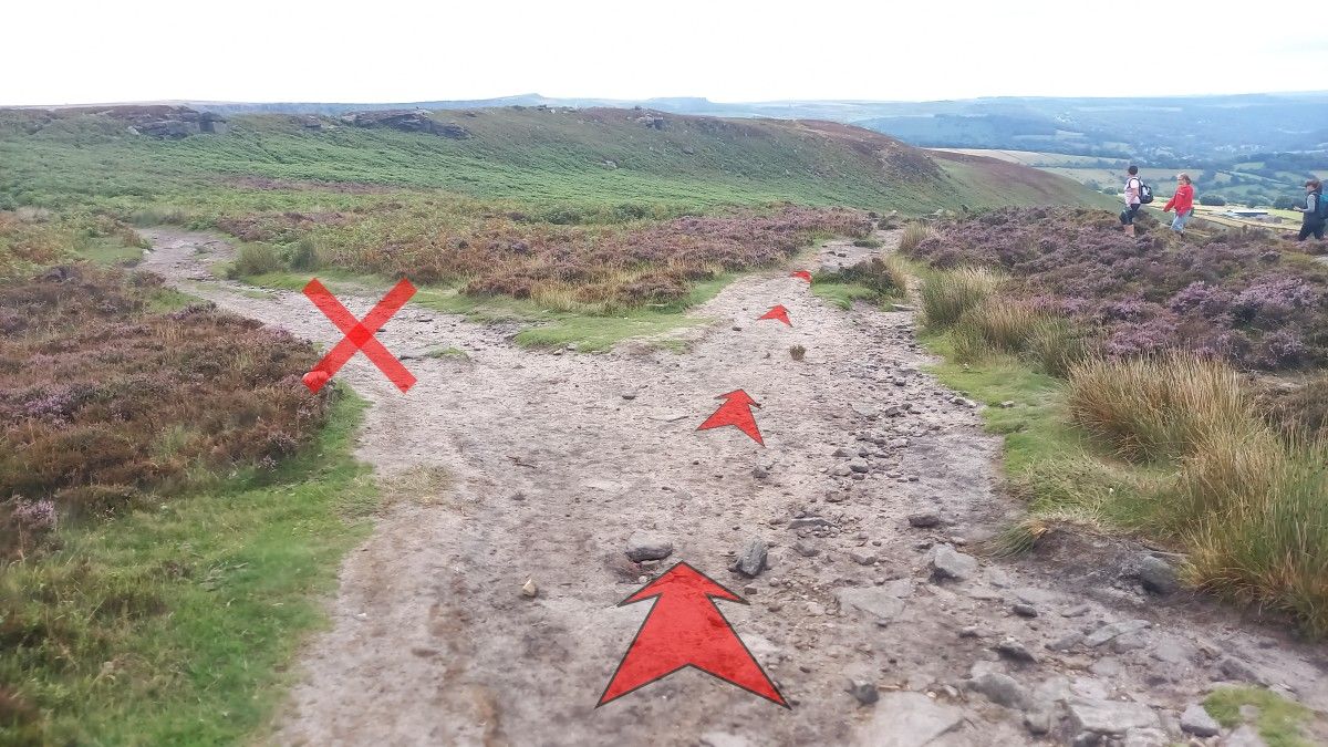
There’s about ½–a–kilometre of rocky outcrops along the edge, before you reach an obvious path junction just before starting your descent down to New Road.
Bear right at this junction.

-
Only a little further on, at another path junction, bear left.
These two paths rejoin further down the hillside, but the left-hand branch is easier to negotiate (fewer boulders).
-
There are a few path choices for this next section, but the best way along the main path is usually pretty obvious.
Just make sure you’re continuing to lose height, and heading roughly in the direction of an obvious plantation in the middle distance

-
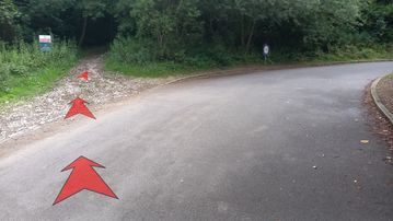
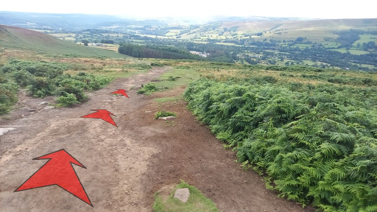
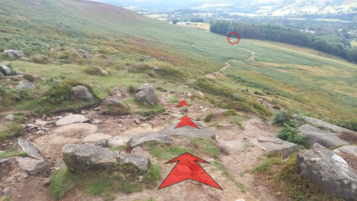
Continue on down the hillside on the main path, which starts to become less rocky as it loses height towards the plantation.
The route onwards across the hillside is obvious in clear weather. You’re heading for the top edge of the plantation – shown with a red circle in the photo.
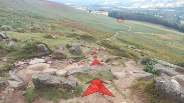
-
As the path gets lower, it broadens and starts to level out. Not far to New Road now…
-
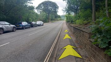
About ½–a–kilometre from where you started to drop down off the edge, you’ll reach a wooden stile heading onto New Road.
Cross the stile, and turn right onto the road.


Stage 2: New Road to Heatherdene Car Park
-
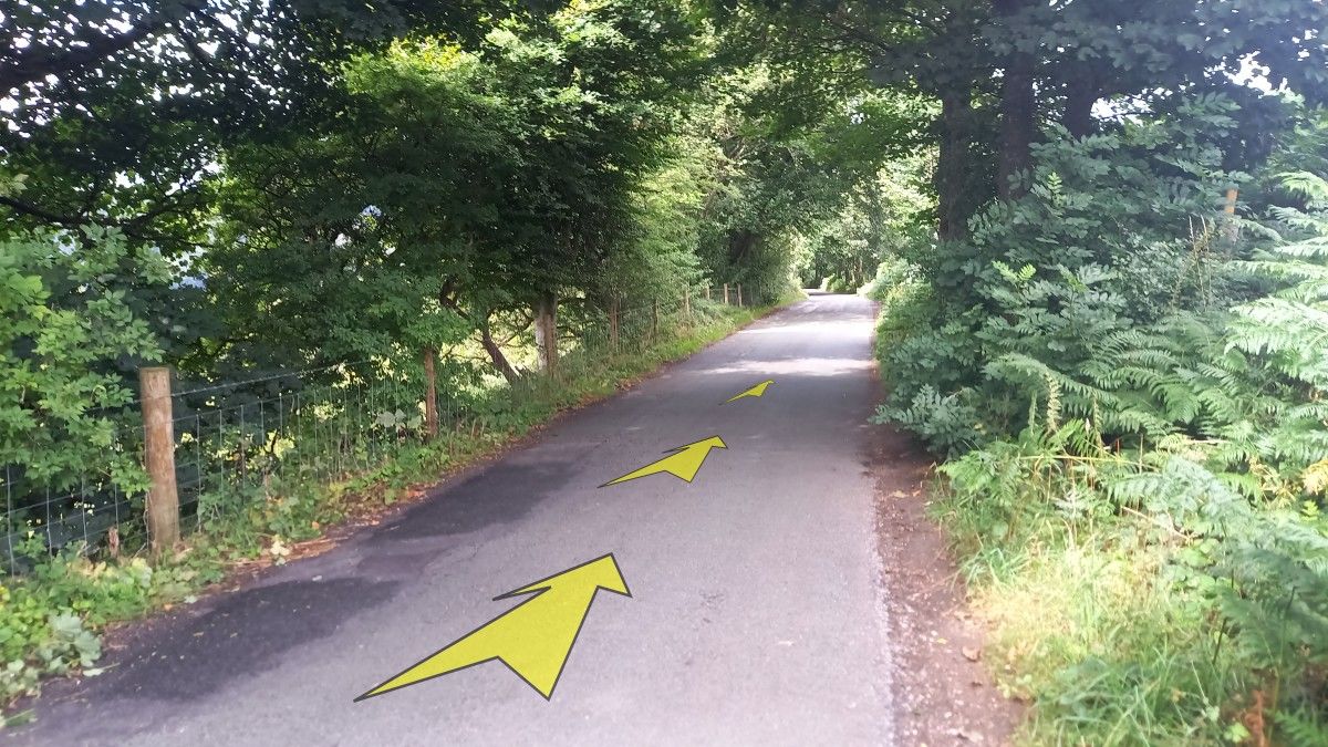
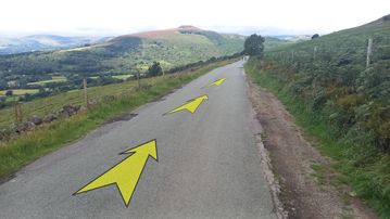
Head off down New Road (Win Hill is once again prominent ahead), taking in the expansive views both down into the valley, and back up towards Bamford Edge.
Although New Road is quite narrow, there isn’t too much traffic, and it provides pleasant walking back down into the valley. Do keep your eyes open for traffic though (including push bikes).
-
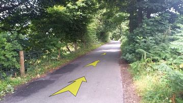
You’ll continue to follow New Road downhill for about 1½ kilometres in total.
As you descend, the surroundings become more wooded.
-
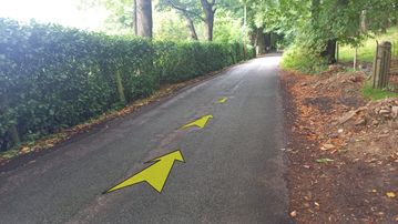
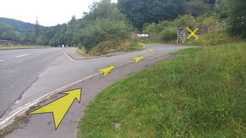
Further on down New Road, you’ll start to pass some farm buildings and residences as the road approaches the valley bottom.
-
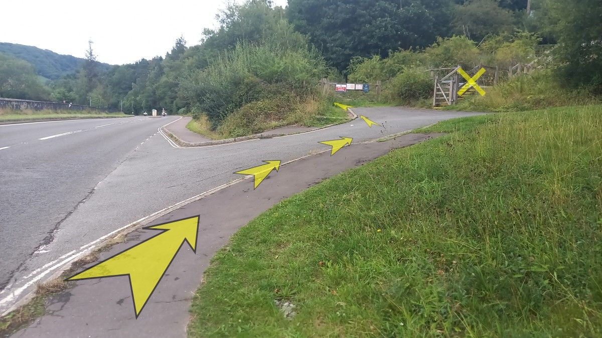
Upon reaching the main Ashopton Road (about 1½ kilometres from where you started down New Road), turn right and follow the pavement.
About 200 metres along Ashopton Road, the Yorkshire Bridge Inn appears on your left – a pleasant spot to stop for refreshments.
-
Continue past the Yorkshire Bridge Inn, following the pavement along Ashopton Road.
-
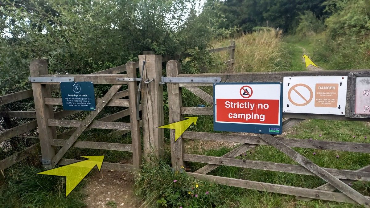
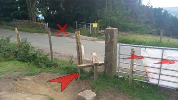
About 200 metres from the Yorkshire Bridge Inn turn right onto a minor road, and then immediately left to reach a pair of wooden gates.
Don’t go through the gate to the right (which leads up yellow-edged steps).
-
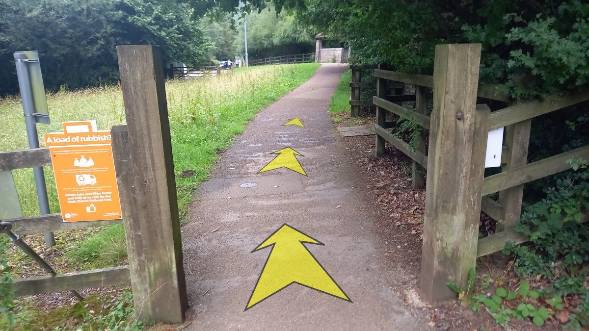
Go through the small wooden gate, and continue up the narrow path beyond.

-
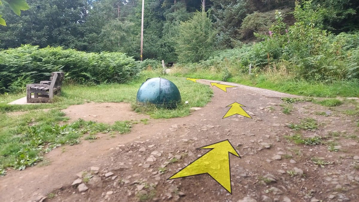
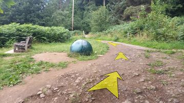
You’ll soon reach a junction with another path (having passed some steps coming up from your left), with a bench and a large green-metal hemisphere (probably something to do with the reservoir).
Bear left onto this clear path.
-
There are a number of picnic tables along this section of path, which takes you directly towards Heatherdene Car Park.

-
About 300 metres from the wooden gate, the public toilets at Heatherdene Car Park come into view.