Axe Edge Walk
Take in the far-reaching views from Axe Edge and Axe Edge Moor, south-west of Buxton
About the walk
This circular walk takes you up onto Axe Edge Moor, 551 metres (1,808 feet) above sea level. You’ll then head south along the moor until you reach Axe Edge, before returning to the Dane Head parking area.
On a clear day the views are extensive, and you’ll likely have the place pretty much to yourself. If you’re looking to get away from the crowds for a while, this is a great walk to try.
Although many of the short walks on this website are doable in trail shoes, the boggy ground on this route makes walking boots more appropriate – unless you don’t mind getting wet feet!
Need-to-know
- Free parking (informal parking area off a minor road at Dane Head; no facilities; room for about four cars). Sadly, there’s NO PUBLIC TRANSPORT to this location.
- 3½ miles (5½ kilometres) circular walk.
- 350 feet (100 metres) of ascent and descent.
- 1½ to 2 hours at a leisurely pace.
- Mixed terrain (including a lot of open moorland paths with some boggy ground after rain); the complete route as described is not suitable for wheelchair users or for pushchairs.
- No stiles.
-
Dogs are NOT PERMITTED on much of this route, as it crosses open access land on which dogs are prohibited (away from rights of way).
Getting there
Start and finish at the informal Dane Head parking area (arrowed on the following map) with room for about four cars. The following may help if you use a satnav:
- nearest postcode: SK17 0TG (this postcode actually covers a wide area southwest of the parking area. You should enter what3words, latitude/longitude or Ordnance Survey grid reference figures into your satnav for a more precise location).
- what3words: rice.stages.enveloped
- Latitude, Longitude: 53.230, -1.959
- Ordnance Survey grid reference: SK 027 703
Map & directions
This simplified map provides guidance for the route described – the numbers refer to the numbered steps in the walk description. This map is not suitable for detailed navigation, for which you should use a copy of the relevant Ordnance Survey map.
The Ordnance Survey map covers a bigger area along with important information such as place names, official rights of way, and areas of Access Land.
For this walk, the ideal map is the Explorer Series Number OL24: The Peak District - White Peak Area (Buxton, Bakewell, Matlock & Dove Dale), which includes the whole area of the walk at 1:25 000 scale (4 centimetres to 1 kilometre).

Contour interval: 10 metres; index contours, 50 metres. North at top (approximate).
Map data from OpenStreetMap (available under the Open Database Licence). Contains Ordnance Survey data © Crown copyright & database right 2010–2023.
Stage 1: Dane Head to Axe Edge End
-
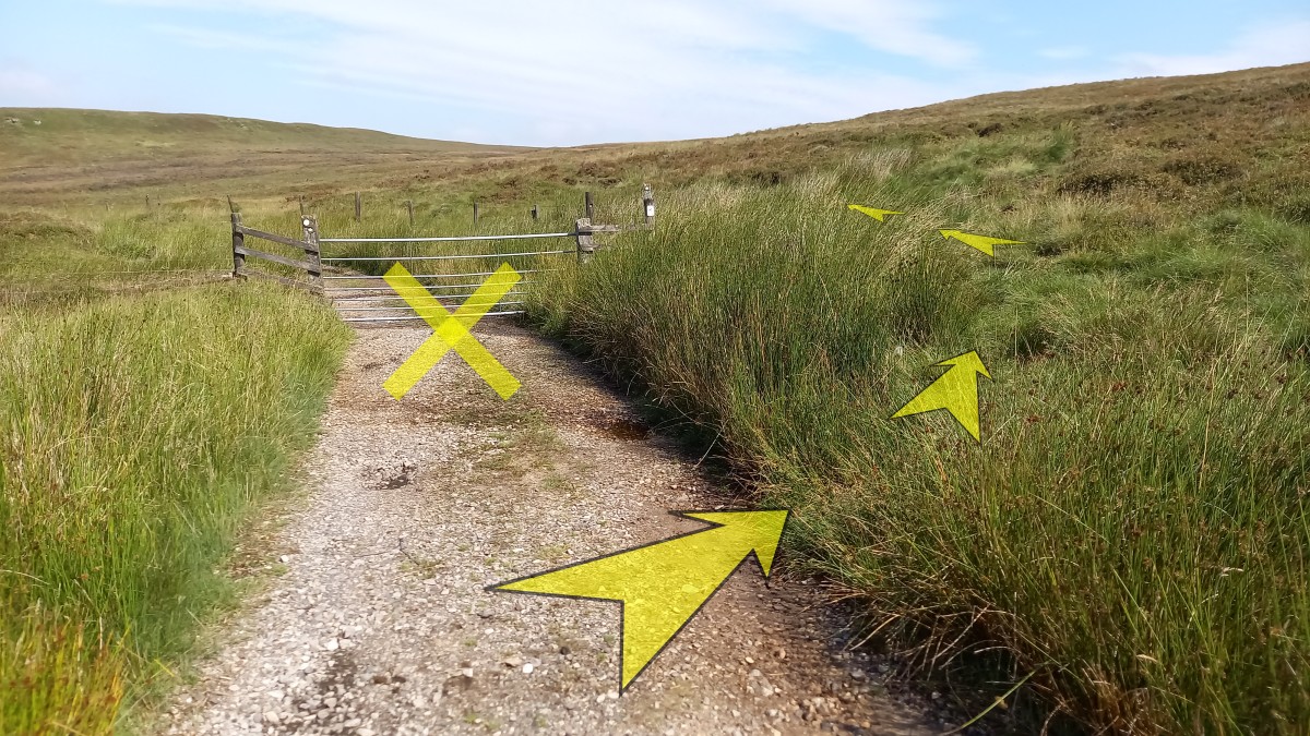
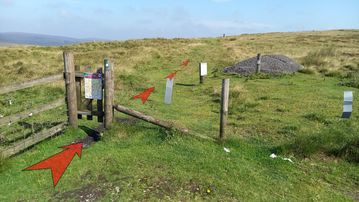
Starting from the small informal parking area at Dane Head, go through the narrow wooden gate in the corner and head north onto Axe Edge Moor along a broad grassy path.
The sign on the gate shows that most of the moorland crossed on this walk is prohibited to dogs (as much of the route described crosses access land away from officially designated rights of way). These restrictions, which are primarily for the protection of ground-nesting moorland birds, apply year-round.
-
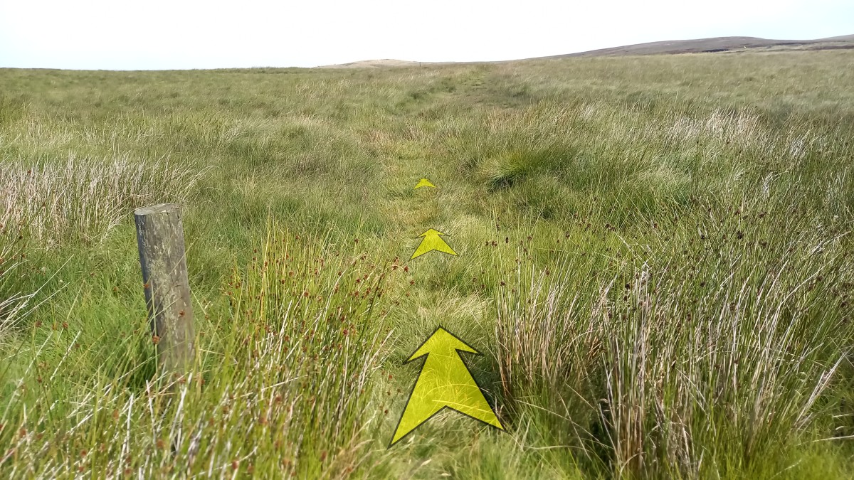
After about 30 metres you’ll reach a junction with a larger track, but should immediately bear right off of this (to the right of a wooden post which reminds you of the dog restrictions on the access land you’re about to enter) and continue northeast along a grassy track.

-
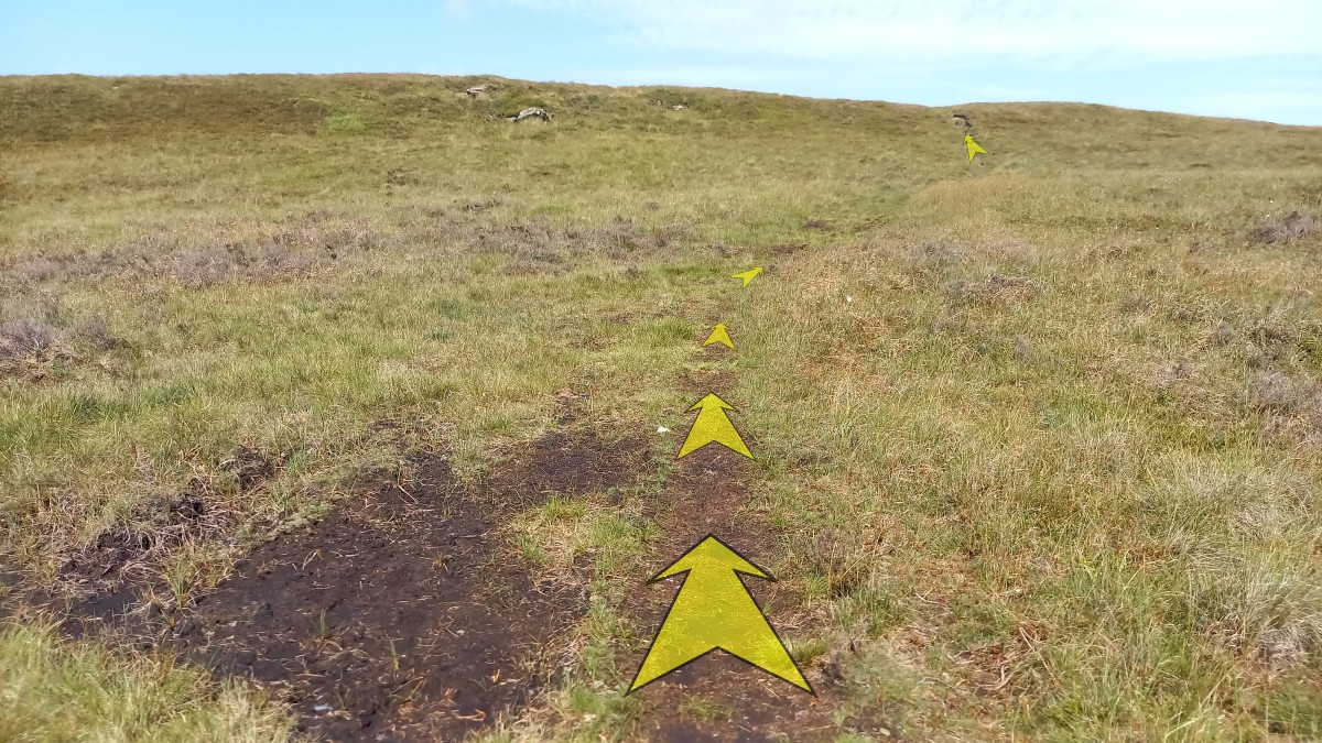
Continue along the pleasant grassy all-terrain vehicle track, gradually gaining height onto Axe Edge Moor.
Ignore a fainter path that branches off to the right.
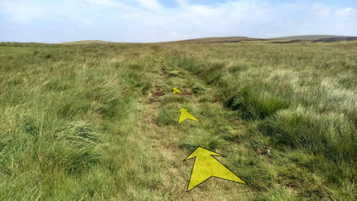
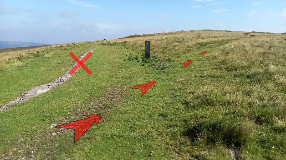
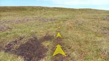
After about 300 metres, you’ll pass an obvious grassy, circular pit – just off the track to your right (pictured). This is an indication that you’ll soon need to be looking out for a turning on your right.

-
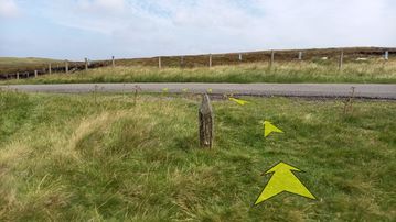
After another 100 metres the track levels off, and you’ll see a post-and-wire fence to your right that parallels the track.
Look out for a faint grassy path that branches off to the right, just before the fence turns away from the track.
This is the path you need to take.
-
From the fence corner follow this smaller grassy path slightly downhill, with the post-and-wire fence close at hand to your right. This section of the path can get a little boggy, but is easy to follow.
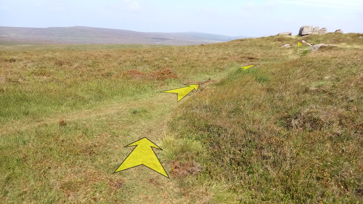
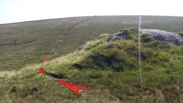
After about 100 metres you’ll reach another corner in the fence, where the path bends to the right – leaving the fence behind – and then back to the left as it starts climbing gently once again.
After a further 200 metres, you’ll reach the crest of the rise at a rock outcrop (pictured).
Drop down to the left of the outcrop into a depression with a wooden post (which sports the number “9”). Again, this section of the path can be a little boggy, so you might need to search for the driest line.
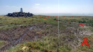
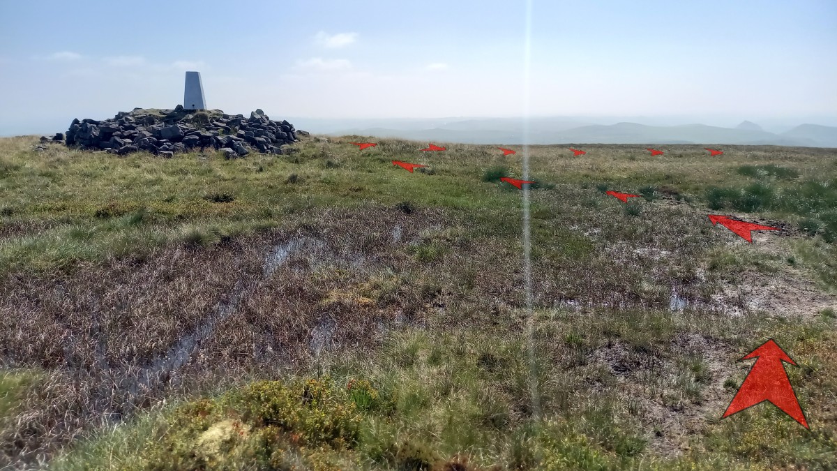
Once you’ve crossed the depression, continue uphill on a faint but broad grassy path, heading for the triangulation pillar (white-painted stone pillar) clearly visible on the horizon ahead.
-
There’s some boggy ground close to the triangulation pillar (which sits on a stone-bordered plinth), but you can easily avoid this by passing it to the right.
On a clear day, the view from 551 metre-high Axe Edge Moor summit is fantastic. In particular, Chrome Hill is very prominent to the southeast – its sharp triangular profile is unmistakable. To the west, the moor stretches away towards Whetstone Ridge, beyond which the Cat & Fiddle (former pub, now a distillery) and nearby communications mast are prominent with Shining Tor beyond.
Continue with the walk by turning right and heading roughly south along a clear grassy path.
-
The next section is a delight on a sunny day as you follow the grassy path southwards along Axe Edge Moor for the best part of a kilometre, with far-reaching views in most directions.
The path is never too boggy, and always reasonably clear – but remains soft underfoot throughout.
There aren’t really any landmarks close at hand on this section, and the path continues in roughly the same direction until it approaches the edge of the moor above Cistern’s Clough, where it starts to bend to the right and drops a little towards a fence and minor road below.
-
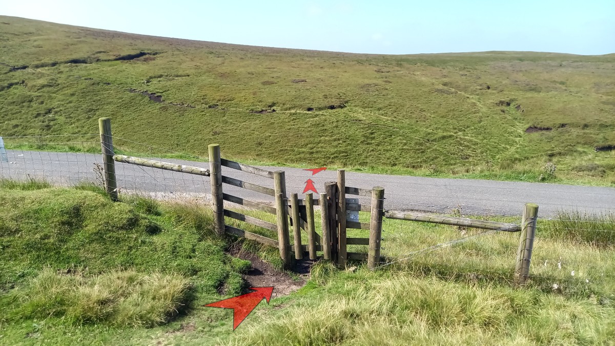
Go through the small wooden gate in the fence, and cross straight over the minor road to pick up a grassy path that heads straight down the bank on the other side.
Note that, if you wish to cut the walk short here, you can turn right onto the minor road and follow it for approximately 3¾ kilometres back to the parking area at Dane Head. This is a pleasant enough walk, but do keep an eye out for traffic as this road is frequently used to cut between the A53 and A54.

-
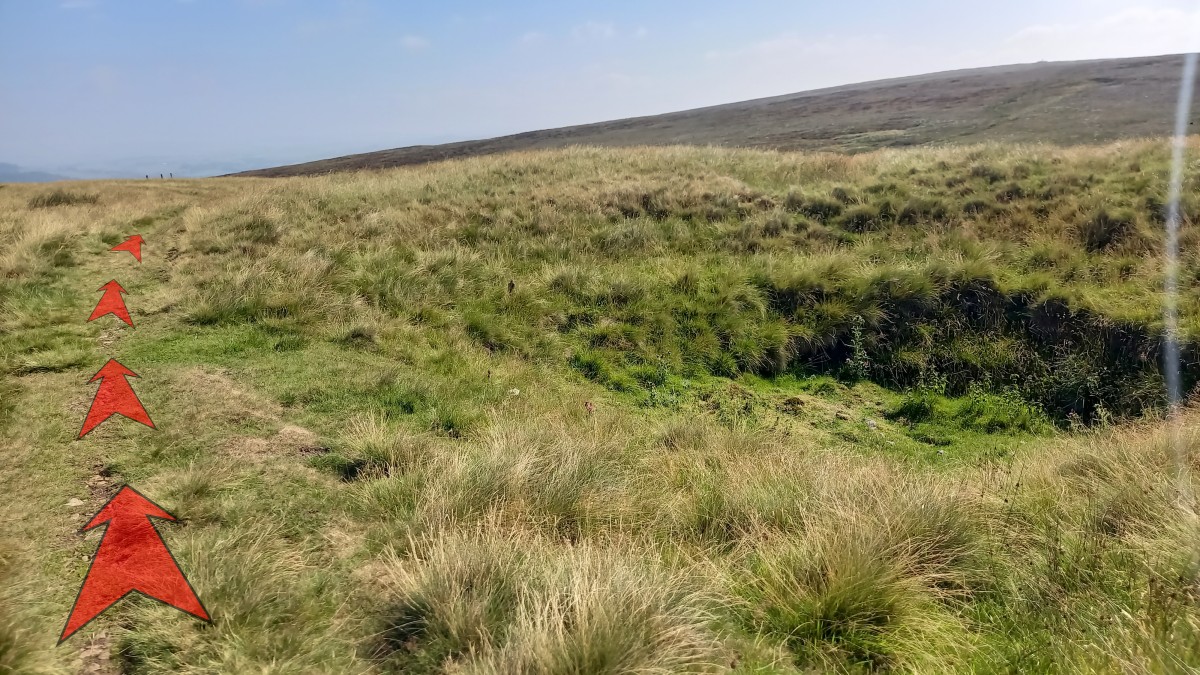
At the foot of the bank turn right onto a wider grassy track, then immediately left onto a narrower grassy path that bends to the right and drops down towards the stream in Cistern’s Clough.
From here you can see the path you’ll be taking up to Axe Edge as it crosses the hillside on the far side of the clough.

-
Follow the narrow path down to the stream, and cross it via a couple of small rocks.
-
Once across the stream, bear left and follow the grassy path uphill.
Ignore a broader path off to the left that heads down Cistern’s Clough towards the A53 road.
-
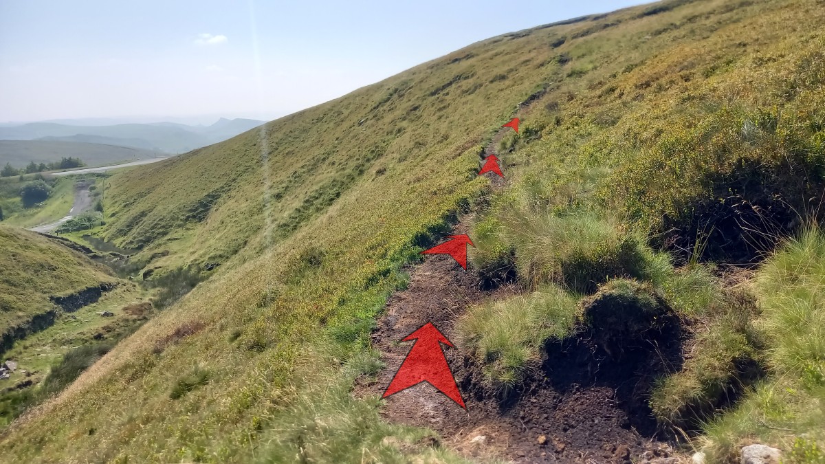
The narrow path climbs steadily uphill, but is easy to follow.
As you climb, the views out over Cistern’s Clough and the A53 gradually improve.

-
Continue uphill, passing a small gritstone boulder along the way.
-
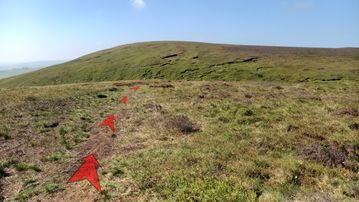
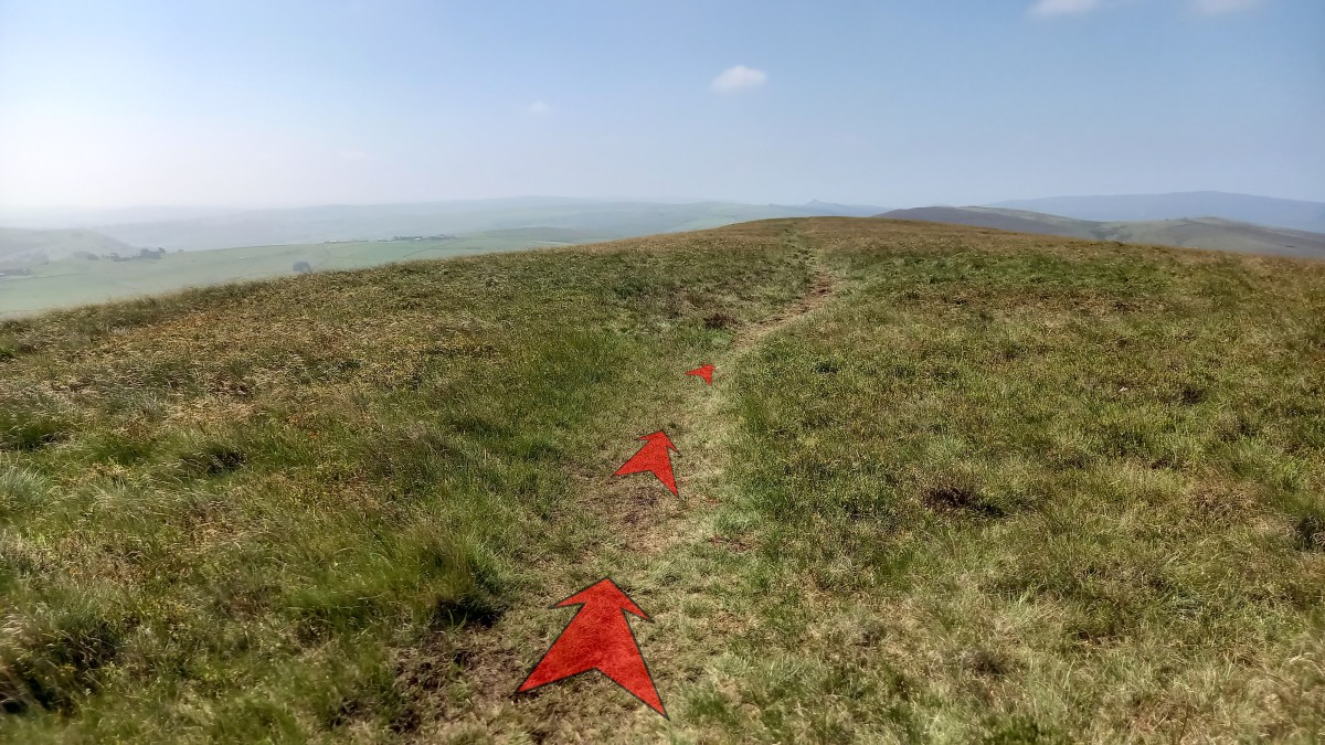
The grassy path levels off as you pass the highest point of Axe Edge. Unlike Axe Edge Moor, there’s no triangulation pillar or cairn marking the summit here, but the views are still excellent.
Continue along the grassy path, which moves closer to the edge on your left (Axe Edge).
-
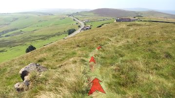
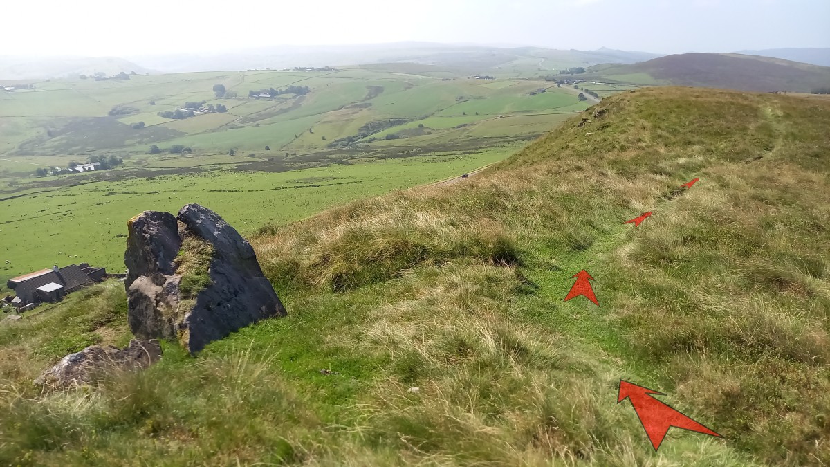
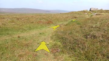
The path continues along Axe Edge, with a steepish drop to your left.
You’ll also pass a small rock outcrop (pictured).
The obvious pointed hill on the horizon, in the direction you’re heading, is Hen Cloud.

-
Continue to follow the grassy path along Axe Edge.
About 500 metres from where you reached the high-point of the path you’ll see a farmhouse below, almost directly ahead (Hilltop Cottage).
-
Continue along the grassy path until you reach a stony farm track adjacent to Hilltop Cottage.
Turn right onto this track (don’t go through the gate).


Stage 2: Axe Edge End to Dane Head
-
Follow the stony farm track as it climbs slightly (passing behind Hilltop Cottage), then descends and starts curving round to the right.
-
Continue along the stony farm track as it bends around to the north and starts heading back towards the moorland.
About 400 metres from Hilltop Cottage, you’ll reach a metal gate across the track.
Don’t go through the gate, but instead turn off right through some reeds (about 5 metres before the gate) and pick up an indistinct path that passes above and to the right of the gate. This path may be hard to find at first, but once you’re established on it becomes a lot easier to follow.
-
Once you’re a little beyond the gate, move slightly left to find the earthy path which now starts heading out across the moorland.
The path crosses a small stream not far after leaving the main track.
-
The path is now easier to follow, and has both grassy and earthy sections.
Look out for the narrow drainage trenches dug alongside the path, as you could easily turn an ankle in one of these.
It’s also best to keep children close at hand, as there are some large holes in the peat, close to the path.
-
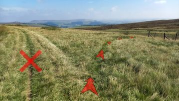
Continue to follow the path across the moorland until you reach a steeper rise.
This is about 300 metres from the metal gate, and takes you up onto a low ridge.
-
Just beyond the top of the rise, reach a junction with another grassy path and turn right.
A few metres further on, you’ll reach the rocky outcropping known as “Five Stones”.
-
Continue past Five Stones, still following the path. This section can get a bit boggy in wet weather.
The path descends a little, and about ½-a-kilometer from Five Stones you’ll reach a junction with a broader grassy path – marked by a wooden post.
Turn right onto the path.
-
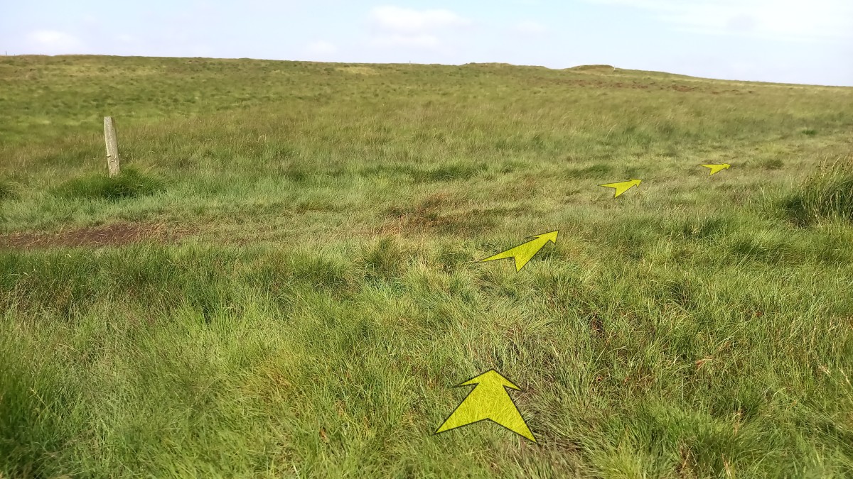
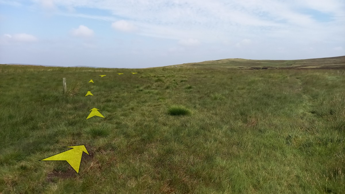
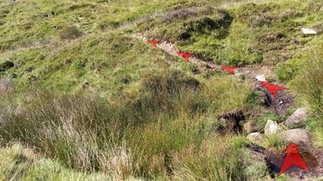
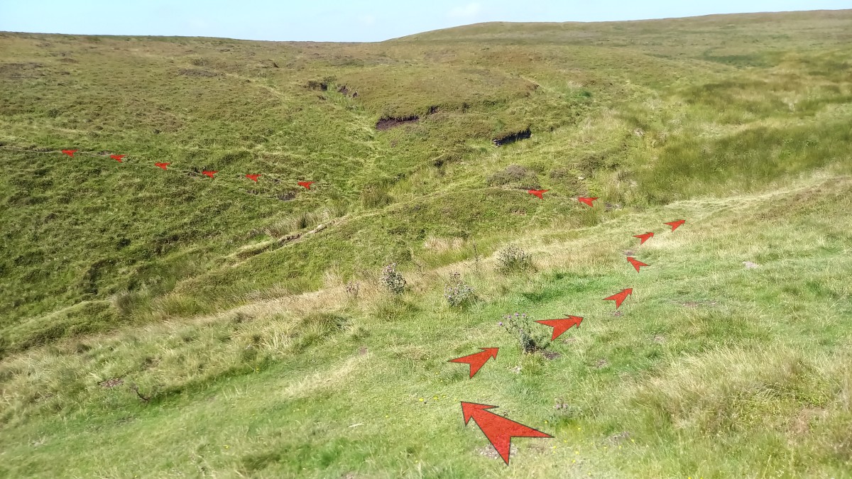
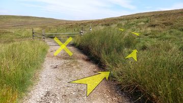
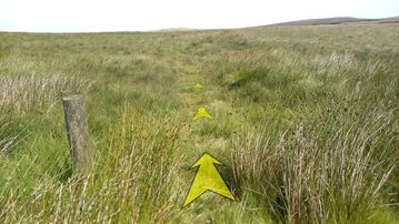
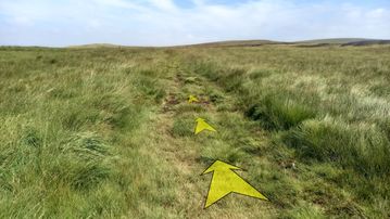
This next section is a little indistinct on the ground, and often quite boggy.
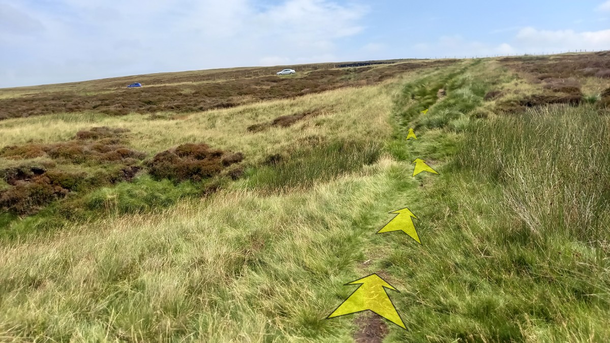
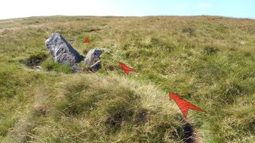
Follow the broad path through the grass for about 25 metres, until you meet a boggy area with some reeds directly ahead. Bear right here (shown by the arrows in the photo) and then immediately left to pick up a very narrow path heading through the reeds.

-
In a short distance (only about 10 metres) you should pass very close to a wooden marker post on your left. Unfortunately, this marker post is well hidden by the reeds, so you may not see it until you’re almost on top of it.
From this point, the grassy path broadens and becomes clearer.
-
Continue along the broad grassy path, which again can be quite boggy in places.
Another wooden marker post is visible in the distance, slightly off to the left.
-
As you approach the wooden marker post, head over to it, and then back to the right. By doing so you will avoid a particularly boggy piece of ground.

-
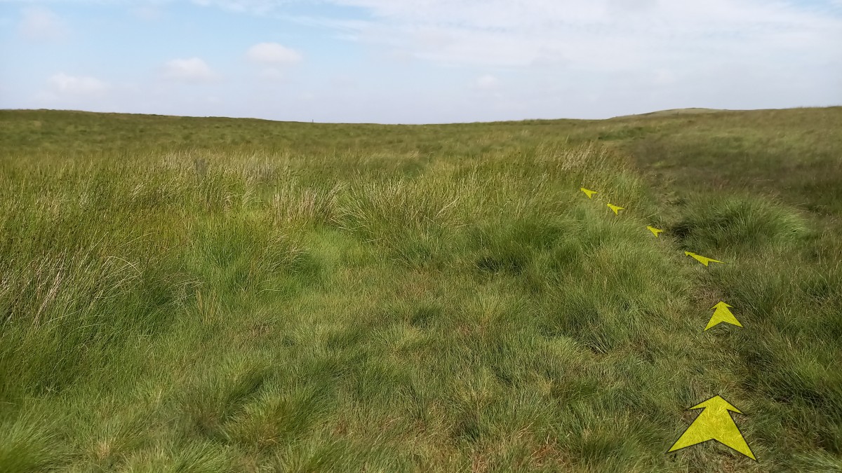
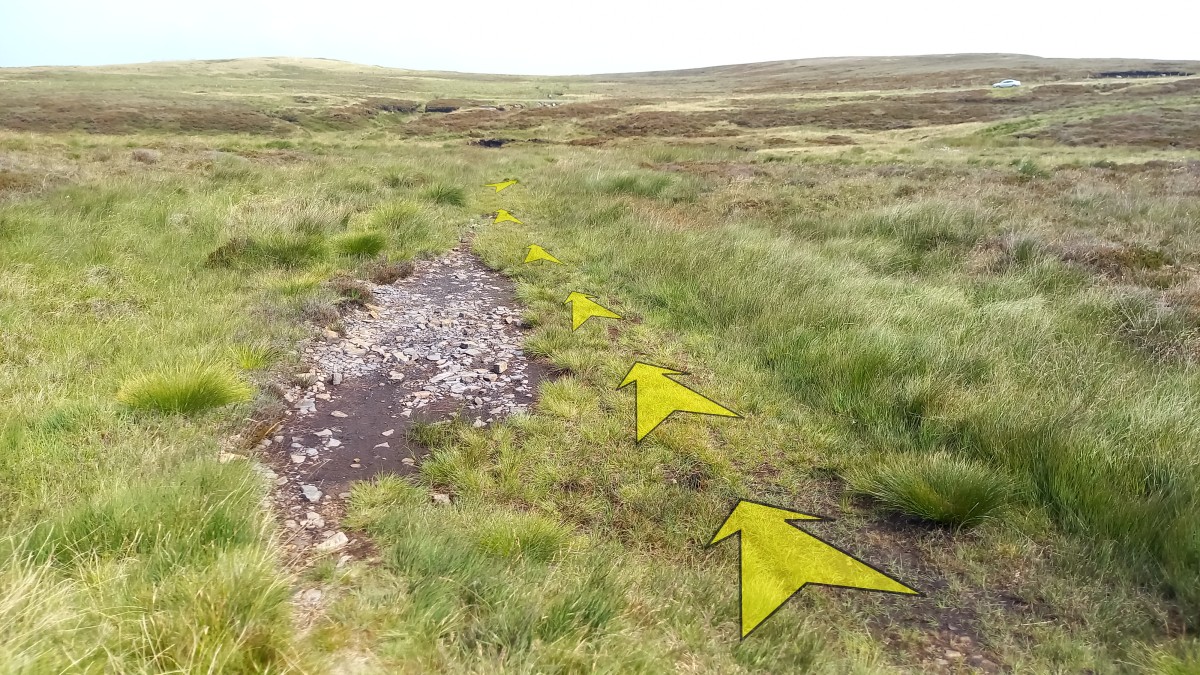
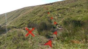
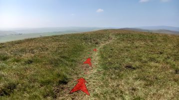
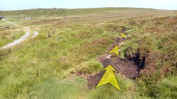
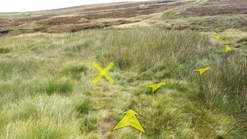
Continue to follow the grassy track.
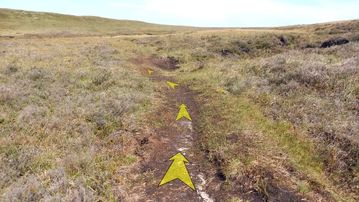
Within about 50 metres, you’ll pass an exposed section of stony ground alongside the path (pictured).
It’s important to notice this, because you’ll need to turn off to the right very soon.
You should also be able to see the minor road ahead at this point (and your car, parked at Dane Head over to your left).

-
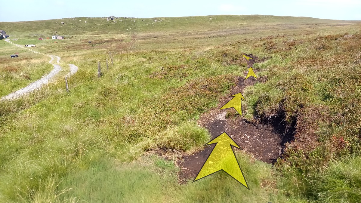
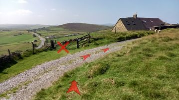
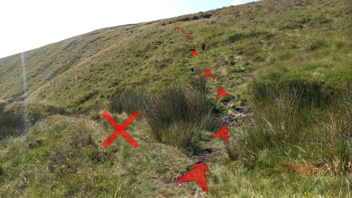
Within 10 metres of the exposed stony ground, look out for a narrow passage through the reeds on your right. This is just before the main grassy path swings to the left ahead.
It is important that you take this narrow route through the reeds, as the main grassy path – although it appears to be heading more directly towards the parking area – ends up crossing a very boggy area indeed, and is not recommended.
The passage through the reeds here can be quite wet, but is over quickly.
Once through the reeds, bear left to pick up and follow the clear grassy path on the other side.
-
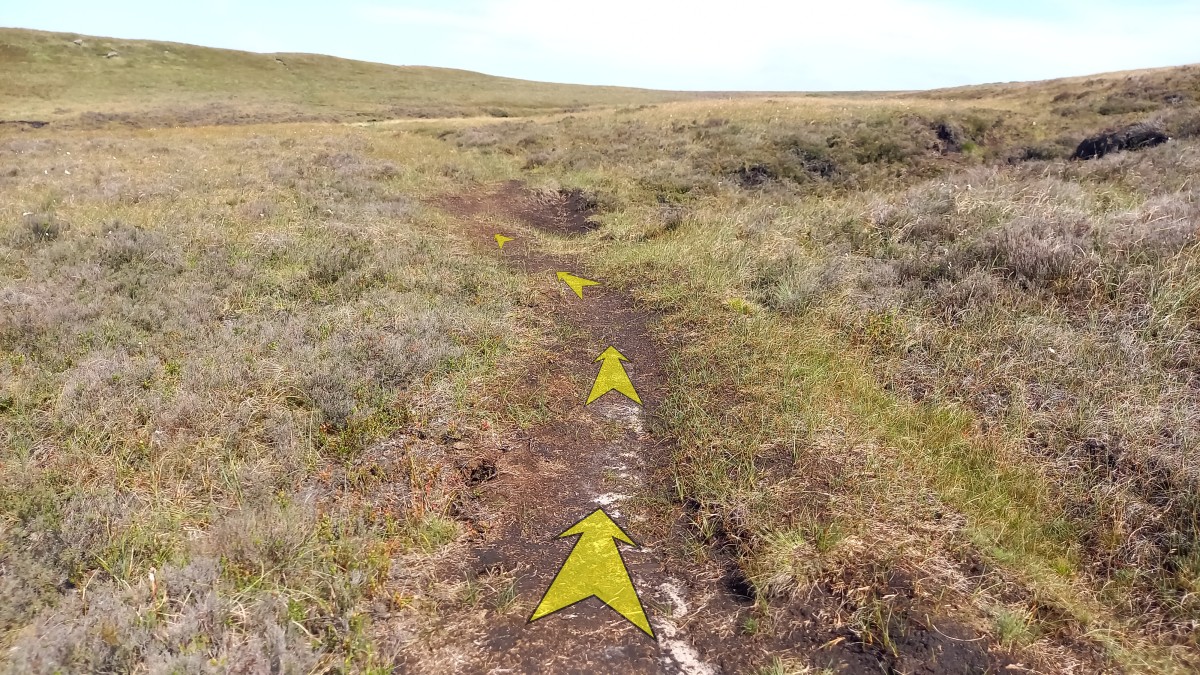
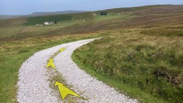
Continue on the grassy path, now much clearer, as it heads uphill towards the minor road.

-
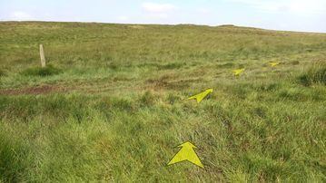
Upon reaching the minor road at a wooden stake (pictured), turn left and follow the road back to the parking area at Dane Head.