Cats Tor Walk
Visit the easy summit of Cats Tor for extensive views over the Cheshire Plain
About the walk
Cats Tor rises to the west of the Goyt Valley, on the same ridge as Shining Tor. By starting from the high Pym Chair car park at 461 metres, the climb up to Cats Tor at 519 metres is much reduced. Indeed, the views from the car park alone are worth the visit, with an extensive vista over to the southern edges of Kinder Scout, and the hills above Chinley and Edale.
1¼ miles in total, this “there and back” walk to Cats Tor should take 40 minutes to 1 hour at a leisurely pace, though provided the wind is light and weather’s fair, you’ll likely want to dally along the way and make the most of the beautiful scenery.
The views from the top of Cats Tor are superb on a clear day. The distinctive hill that comes into view as you near the top is Shutlingsloe, with Shining Tor also visible close at hand a little further along the ridge.
Need-to-know
- Free parking (approx. 30 spaces; no toilet facilities; no height restriction; no overnight parking or camping). Sadly, there’s NO PUBLIC TRANSPORT to this location.
- 1¼ miles (2 kilometres) there-and-back walk.
- Just short of 200 feet (60 metres) of ascent and descent.
- 40 minutes to 1 hour at a leisurely pace.
- Mostly a good path (including one short but moderately steep slope and some boggy ground after rain, though most of this is avoidable); not suitable for wheelchair users or for pushchairs.
- No stiles.
- Dogs are welcome on this Open Access Land, but do make sure they’re kept under effective control to avoid disturbing free-roaming sheep and ground-nesting birds.
Getting there
Start and finish at Pym Chair Car Park (arrowed on the following map).
The following may help if you use a satnav:
- nearest postcode: SK17 6GJ (this postcode is actually for the Errwood Sailing Club (private), which is about 3 kilometres by road from Pym Chair Car Park. You should enter the latitude/longitude, Ordnance Survey grid reference , or what3words code into your satnav for a more precise location).
- what3words: starters.lanes.converged
- Latitude, Longitude: 53.288, -2.010
- Ordnance Survey grid reference: SJ 994 767
Map & directions
This simplified map provides guidance for the route described – the numbers refer to the numbered steps in the walk description. This map is not suitable for detailed navigation, for which you should use a copy of the relevant Ordnance Survey map.
The Ordnance Survey map covers a bigger area along with important information such as place names, official rights of way, and areas of Access Land.
For this walk, the ideal map is the Explorer Series Number OL24: The Peak District - White Peak Area (Buxton, Bakewell, Matlock & Dove Dale), which includes the whole area of the walk at 1:25 000 scale (4 centimetres to 1 kilometre).

Contour interval: 10 metres; index contours, 50 metres. North at top (approximate).
Map data from OpenStreetMap (available under the Open Database Licence). Contains Ordnance Survey data © Crown copyright & database right 2010–2023.
Base map generated by OpenOrienteeringMap (created by Oliver O'Brien). OpenOrienteering map is supported by British Orienteering.
BAD WEATHER ALTERNATIVE If the weather's poor, the low-level walk around Fernilee Reservoir would be a better option.
Stage 1: Pym Chair Car Park to Cats Tor summit
-
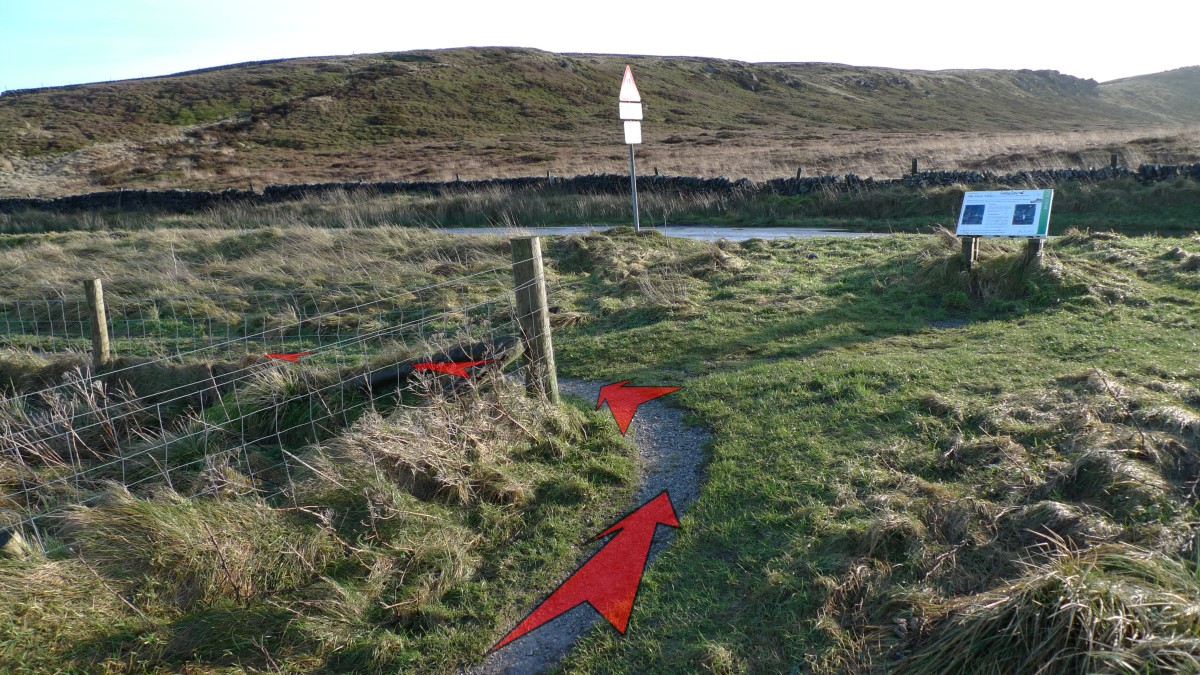
From the car park entrance, take the grassy path along the verge, heading south until you reach the road junction (50 metres).

-
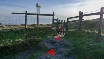
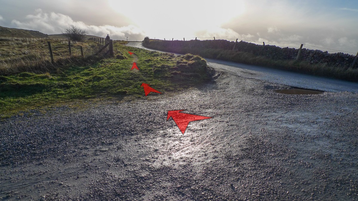
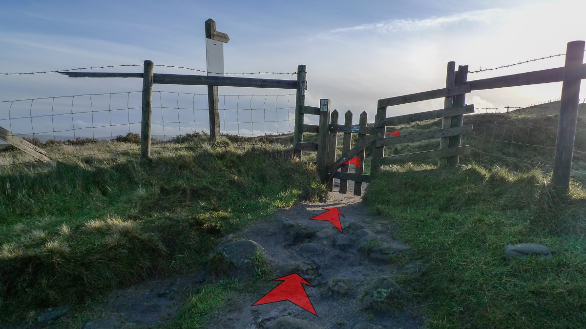
Turn left at the road junction (passing an information board about Pym Chair ahead), then after about 25 metres go through the gate alongside a cattle grid.
This short section of path can get very wet after rain, in which case it may be easier to cross the verge and walk along the road to reach the cattle grid and gates.

-
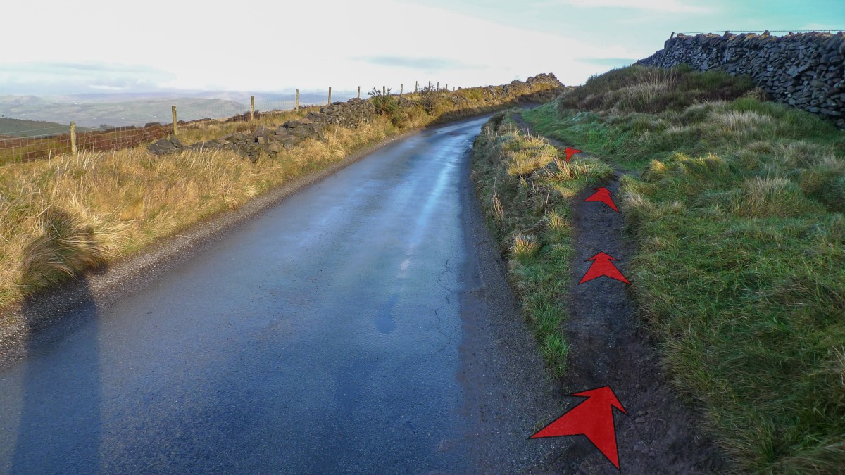
Shortly after the cattle grid, take the earthy path along the verge on the right hand side of the road. Alternatively, you can continue walking along the road, but this will leave you with a steeper scramble up the bank ahead.
After about 25 metres, stay on the earthy path (now more rocky) as it rises up to the right, away from the road.

-
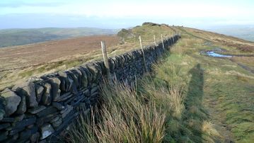
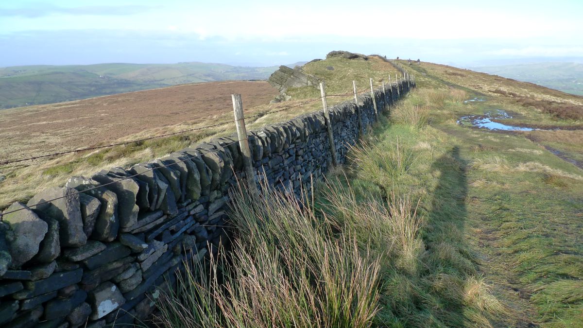
Continue a short distance up the track (quite rocky here) away from the road, and soon reach a gate. Go through the gate, following a finger post pointing to "Shining Tor", then continue ahead on a clear track up the open hillside, with a wall to your right.
This initial section is steeper and rockier than the remaining track to the top of Cats Tor. After about 50 metres, you’ll pass a second finger post, pointing back to "Windgather". Ignore this, and continue on up the hill.
-
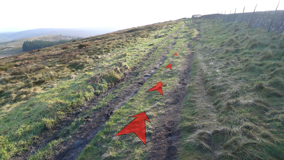
The grassy track is usually easy going, but can get a bit boggy in places after heavy rain. As you climb higher, be sure to take the time and enjoy the stunning views out over the Goyt Valley to your left. The views out west (to your right) are just as good, but you’ll need to walk over to the wall to take in the scenery in that direction.
After about ½ a kilometre (⅓ mile), you’ll reach the top of the first rise on the ridge.

-
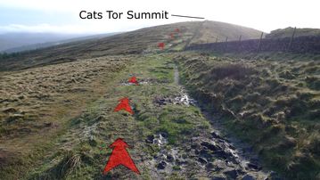
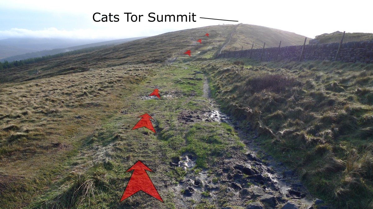
From here, Cats Tor summit comes into view. Head slightly downhill to the col (a gap between two peaks – named as "Oldgate Nick" on Ordnance Survey maps, but also the name given to the small crag just to the west) then continue to follow the track up to the summit of Cats Tor, about 400 metres from the low point on the ridge.
Again, some sections of the track can get quite boggy after rain, though the wettest bits should be relatively easy to avoid.
-
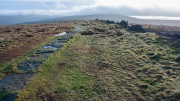
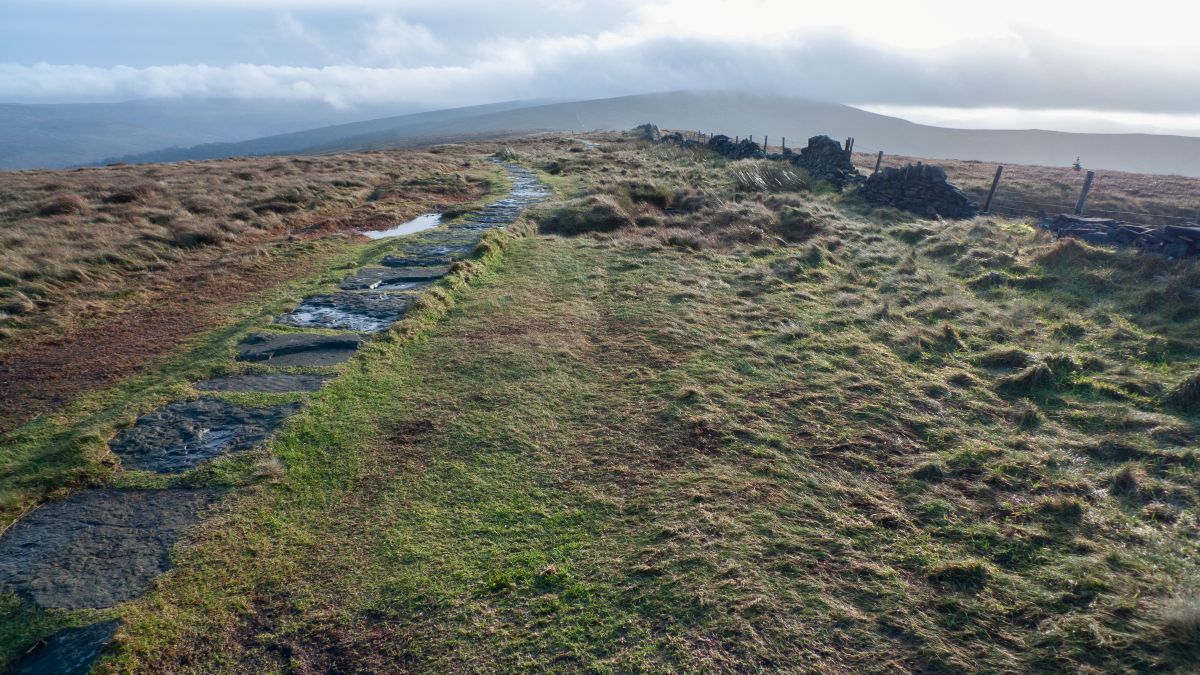
You’ll know you’ve reached the top of Cats Tor, as a line of flagstones starts here, and heads south all the way to Shining Tor. There’s also a prominent 2-metre tall pole (white, with a red tip) that marks a buried high-pressure gas pipline.
The view opens out to the south, with Shining Tor being the closest and most obvious hill further along the ridge. The distinctive shape of Shutlingsloe is clearly visible to the right of Shining Tor, though somewhat more distant.
In fine weather, this is a great spot to tarry and take in the view, more extensive than lower down the hill, and just as beautiful.
Stage 2: Cats Tor summit to Pym Chair Car Park
-
From Cats Tor summit, you simply need to retrace your steps back to the car park, thereby completing this short walk. On the way back you’ll get a good view of the rock outcrop (pictured) known as Oldgate Nick, that you may have missed on your way past earlier. This crag has nearly 20 named rock climbs ranging in difficulty from Moderate (M) to Extremely Difficult (E5).
According to the information board near the car park, Pym Chair was a formation of rocks that once stood on the ridge close to this point. “Pym” is theorised to be a preacher who preached from the rocks, or a highwayman that used the rocks as cover to attack passing packhorse trains.