Chee Dale
· Discover this exquisite river gorge on the Wye, hidden away just 3 miles from Buxton ·
About the walk
Chee Dale is an absolute gem, secreted in the deep folds and curves of the Upper Wye Valley. You could drive along the A6 between Bakewell and Buxton any number of times, and have no knowledge of the delights of the river, hidden as it is from the A6 passing over Taddington Moor. The eastern end of this incredibly picturesque stretch of the Wye bares all to motorists that make the short side trip to the famous viewpoint at Monsal Head. Chee Dale offers no such enticement from afar—you've actually got to walk into the gorge itself to appreciate what lies within.
This is a walk to take your time over, there being so much to see. Even though it's only 4 miles (5 miles if you use the alternative start accessible by bus), it's well worth allowing a whole morning or afternoon if the weather's set fair. A circular walk, you'll travel through two distinct landscapes: the secretive, deep-cut gorge of Chee Dale, followed by the higher, much more open farmland typical of the White Peak.
IMPORTANT: This is not a walk for when the river is high, and even in fine weather, following the length of the gorge involves some easy scrambling up and down rock steps.
Need-to-know
-
Free parking at Topley Pike layby (no toilets; no height restriction; no overnight parking or camping).
If you're travelling by BUS, see the notes on "Public transport (BUS)" in the "Getting there" section, then refer to the alternative start described in the walk directions.
The alternative start also offers the Pay & Display Wydale car park (£1.50 up to 1 hour, £3.50 up to 4 hours, £4.50 all day), and wheelchair access to the track alongside the River Wye, as far as Blackwell Mill cottages.
- 4 miles (6½ kilometres) circular walk (or 5 miles (8 kilometres) if you use the alternative start)
- 2 to 2½ hours at a leisurely pace (or 2½ to 3 hours is you use the alternative start)
-
A wide variety of terrain, from easy walking across fields, to scrambling up and down rock steps close to the river. In winter, or after prolonged rain, some sections can get very muddy, or may be flooded.
Other than the easy track from the alternative start alongside the River Wye as far as Blackwell Mill cottages (a little over 1 kilometre), this route is not suitable for wheelchair users, pushchairs, or small children.
- 4 stiles
- Refreshments are available at the Blackwell Mill Cycle Hire and Tuck Shop, which you'll pass on this walk (close to point "6" on the following map; open seven days a week from 1st March to 3rd November, 09:30–17:00). Also, there's often a mobile burger van parked-up in the Topley Pike layby (times vary).
Bad weather alternative
If there has been recent heavy rain, the river Wye may swell to flood the stepping stones. In that case, you would be well advised to avoid the track along the Wye altogether, and stick to an easier stroll along the Monsal Trail (which follows the track of a disused railway line, and is marked with a dashed grey line on the following map).Getting there
By bus: see below
By car: start and finish at Topley Pike layby, A6 road (arrowed on the following map). The following may help if you use a satnav:
- nearby postcode: SK17 9TE (this postcode is actually for the Topley Pike Quarry, which is about 1 kilometre west of the Topley Pike layby, off the A6. There is no public access to the quarry—you should enter the latitude/longitude or Ordnance Survey grid reference figures into your satnav for a more precise location).
- Latitude, Longitude: 53.249, -1.833
- Ordnance Survey grid reference: SK 113 725
Public transport (BUS)
Bus numbers 65 (Sheffield - Eyam - Tideswell - Buxton), and 66/66A (Chesterfield - Brampton - Eyam - Tideswell - Buxton) service the "Topley Pike" stop, which is at the entrance to the Topley Pike quarry, and adjacent to the Wyedale car park (Pay & Display) near the start of the Monsal Trail. Refer to the alternative start described in the walk directions if starting your walk here.
You can download timetables for Derbyshire public transport from www.derbysbus.info/times
Map & directions
This simplified map provides guidance for the route described — the numbers refer to the numbered steps in the walk description. This map is not suitable for detailed navigation, for which you should use a copy of the relevant Ordnance Survey map.
The Ordnance Survey map covers a bigger area along with important information such as place names, official rights of way, and areas of Access Land.
For this walk, the ideal map is the Explorer Series Number OL24: The Peak District - White Peak Area (Buxton, Bakewell, Matlock & Dove Dale), which includes the whole area of the walk at 1:25 000 scale (4 centimetres to 1 kilometre).

Contour interval: 10 metres; index contours, 50 metres. North at top (approximate).
Map data © OpenStreetMap and available under the Open Database Licence. Contains Ordnance Survey data © Crown copyright & database right 2015.
Base map generated by OpenOrienteeringMap (created by Oliver O'Brien). OpenOrienteering map is supported by British Orienteering.
IMPORTANT The route through Chee Dale is very rough in places, and involves some easy scrambling up and down rock steps. Even on flat sections, the polished limestone rock can be extremely slippery, especially when coated in mud. After prolonged, heavy rain, it may not be possible to complete this walk at all. The River Wye can rise, flooding the stepping stones, and may also cover short sections of the river bank. In such conditions, you should choose a different walk.
Stage 1: Topley Pike layby to East end of Chee Dale
-
After you've parked in Topley Pike layby, take a look over the low stone wall before you start walking. There's a great view from here down to Blackwell Mill cottages, nestled by the River Wye. You'll be passing by the cottages fairly soon.
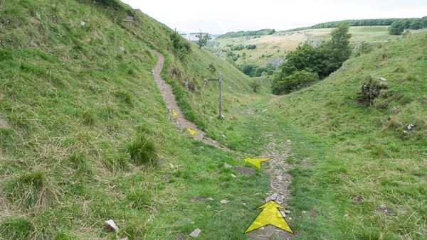
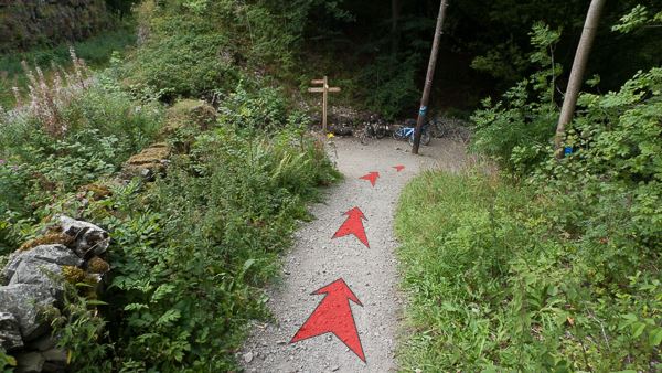
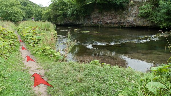
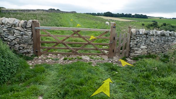
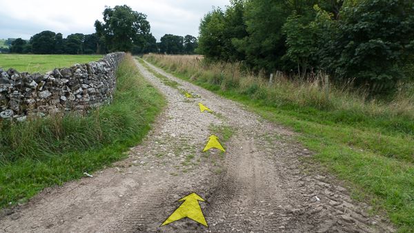
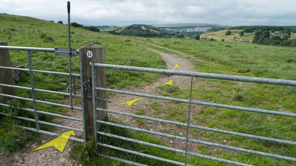
Head to the top end of the layby, then along the grass for a few metres, and go through a small wooden gate in the stone wall. A fingerpost points to "Monsal Trail, Chee Tor & Dale", and a Derbyshire Wildlife Trust information board marks your entry into the Chee Dale Nature Reserve. Pass an "Erosion Control" sign on your left, and follow the narrow, earthy concession footpath—mostly on the level—for about 100 metres. The path then starts to descend into the narrow valley visible ahead (with a few steps built into the track).
(If you used the alternative start (from the Topley Pike bus stop, or parked in the adjacent Pay & Display Wydale car park), simply walk along the obvious broad vehicle track that runs alongside the river Wye. After a little over 1 kilometre, once you reach the Blackwell Mill Cycle Hire and Tuck Shop, rejoin the main walking route, and jump to Step 6 in the following directions.)
-
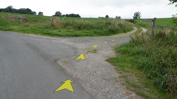
When you reach a T-junction with a broader, stony track in the small valley—turn left. A fingerpost points to "Monsal Trail and Chee Dale" in this direction.
(Note that you'll be returning to this point from the right (signed "A6") when you've almost completed the walk.)
-
Follow the broad, stony track downhill along the narrow valley floor. Take care when it's wet, as the limestone rock can be very slippery. You are now in part of the Wye Valley SSSI (Site of Special Scientific Interest), internationally recognised for its limestone grassland flora and insects. After about 300 metres, you'll bend round to the right a little, pass an information board, and meet a stone wall and gate across the track.
-
Pass through the gate (the post sports a marker for the "Pennine Bridleway", and the gate fastener is extended to make it easier for horse riders to operate), passing across the bridge over the Monsal Trail (the disused railway below), then bear left at the trees.

-
Follow the clear loose-stone track down a few metres to the junction with a broader track. A fingerpost at the junction points to various destinations. You should turn right, following the direction of "Pennine Bridleway, Wormhill".
-
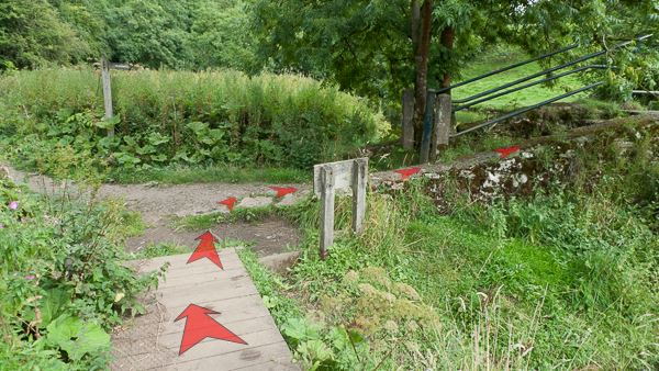
Now on a wide loose-stone track, a sign warns of the steep downhill ahead (mainly for the benefit of cyclists). Follow the track downhill for about 30 metres, bending round to the left and flattening out in a small car park (no public access—this is for the residents of Blackwell Mill Cottages), next to the Cycle Hire Centre and Tuck Shop. Another finger post points you towards "Pennine Bridleway, Wormhill".
(If you used the alternative start, continue reading the directions from here). Cross the long, narrow wooden bridge ahead, towards the cottages, and over the River Wye. A sign at the start of the bridge reads "Cheedale. Difficult footpath & likely to flood in wet weather. Alternative routes via Blackwell or Wormhill". You've been warned!
Interestingly, by crossing the wooden bridge, you've reached the very edge of the Peak District National Park — the cottages themselves are outside the park boundary, but you'll remain within the national park for the duration of this walk.

-
Turn right at the far end of the bridge (a post shows the way—marked "PBW" for "Pennine Bridleway", and with other markers attached), and follow the level, loose stone track alongside the River Wye. After about 200 metres, where the track forks (another post marked "PBW" is at the fork), take the right-hand path, staying on the level track beside the river, and leaving the route of the Pennine Bridleway behind.
Don't take the left-hand path, or you'll be heading steeply up zig-zags out of Chee Dale!
-
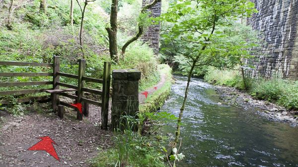
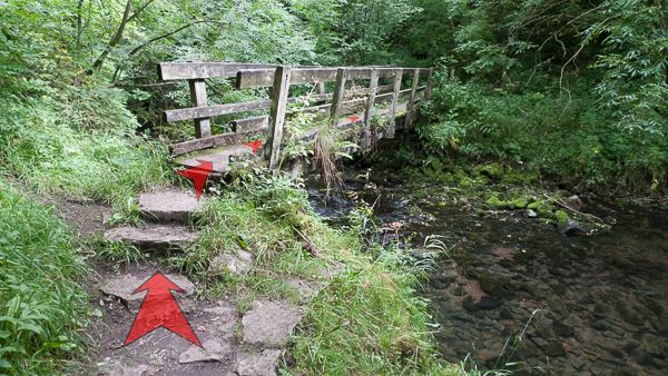
After leaving the fork, follow the track around the end of a dilapidated stone wall (or climb over it), and then alongside the river for just over 100 metres, until you reach a footbridge alongside a high stone arch (which carries a disused railway line that branches off the Monsal Trail).
Once you reach the viaduct arch, don't cross the footbridge, but instead turn left just before the bridge, heading down the stone steps beneath the arch to reach the riverside path again.
As with many sections of this riverside path, after prolonged wet weather, this section can get quite muddy. This section of the Wye (and, indeed, other sections downstream) is also frequented by Dippers. Look out for these small birds with a white bib—they can often be seen perched on rocks in the river, bobbing up and down.
If you've decided that you've walked far enough already, and want to return to the start, crossing the bridge will take you to a path that leads you onto the Monsal Trail, which you can follow back to return to the Cycle Hire Centre and Tuck Shop.

-
Continue along the riverside path—quite narrow here, and right next to the river. After a few tens of metres, the path moves slightly left away from the river, and reaches a small wooden gate. Go through the gate, and continue along the path.
The next section can be very overgrown with Butterbur late in the summer (the giant leaves of which look very much like Rhubarb), but you should be able to push your way through fairly easily. The path beneath any vegetation is normally clear.
As the path moves back towards the river, you'll need to step over a small fallen tree which has been left in place here, and seems to be a permanent riverbank feature. Continue along the path, mostly close to the river, but at one point climbing slightly on a rockier section as the river bank rises up.
-
About 400 metres from the small wooden gate, a second high stone-arched viaduct crosses the river ahead (carrying the Monsal Trail), just before which you'll reach a stile. Cross the stile, and continue along the riverside path, passing through the arch beneath the viaduct.
-
Continue along the riverside path for a good half-kilometre. Again, the path stays close to the river, but there's one slightly rockier section where the path climbs up as the riverbank rises steeply above the river. Keep your eyes peeled for Dippers all along this stretch.

-
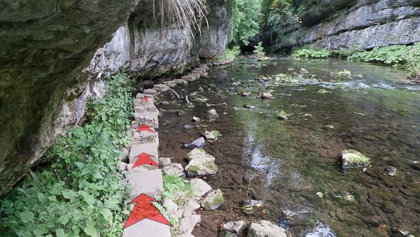
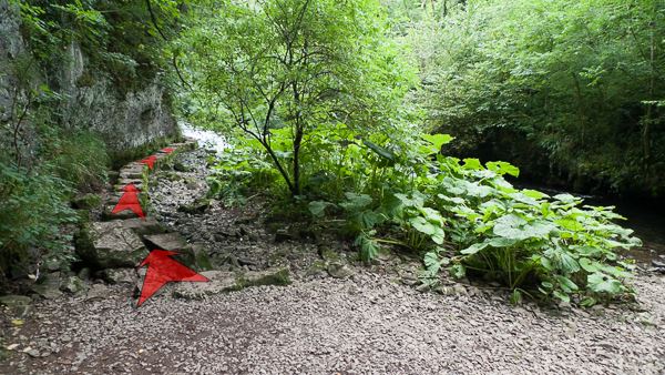
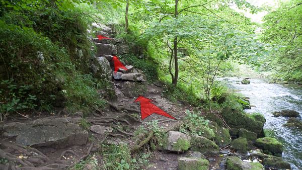
A couple of hundred metres further on, and the gorge-like nature of Chee Dale becomes more marked, as the valley sides start to close in forming steep limestone cliffs. Just after a broad earthy section of the path, you'll reach the start of the first set of stepping stones. These are unusual in that they don't take you across the river, but rather carry you along the left edge of the river. The cliffs here plunge directly down to the river, and actually overhang the stepping stones—watch your head!
If the water levels are particularly high, this is likely to be the first point at which you may experience difficulties continuing. The stepping stones may be over-topped if the river is in flood, and in that case you'd be well advised to turn around and return the way you came.
-
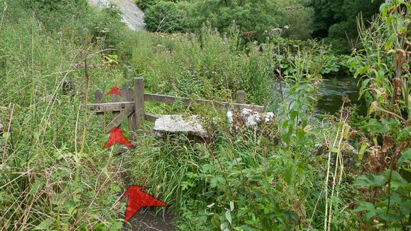
After the stepping stones, another hundred metres or so of delightful gorge and riverbank will see you to a footbridge over the river. Cross this, and bear left on the path at the far side, which climbs away from the river up stone steps.
-
As the path flattens out at the top of the steps, you'll reach a path junction marked by a fingerpost. Continue along the path (in the direction signed "Millers Dale"), ignoring the path off to the right which climbs up stone steps. Your way lies down a few stone steps, then along the earthy path, gradually descending towards another high stone arch carrying a viaduct (atop which runs the Monsal Trail).
If you've had enough of a walk by now, this is a good point from which to make your way back to the start—take the right-hand path at the junction (signed "Monsal Trail to Blackwell Mill"), up the steps, whence you'll pop out on the Monsal Trail, at the west end of Chee Tor Tunnel. You may wish to explore the tunnel (which was reopened to pedestrians, cyclists and horse riders in 2011) before returning along the trail to the Cycle Hire Centre and Tuck Shop.
-
Pass beneath the arch (alongside the river), and then turn sharp left and cross the wooden bridge. Continue right for a short distance, to reach the start of the next set of stepping stones.
-
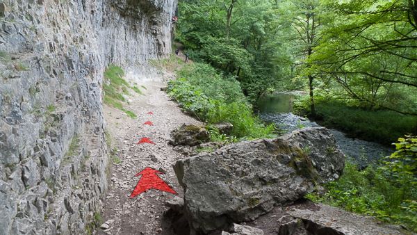
Once again, these stepping stones pass along the river, rather than across it. Follow the stepping stones to the far end, then take in the scene of the most impressive limestone cliffs yet on the walk, rising steeply (and even overhanging) in front of you and to the left.
-
Continue to follow the earthy track, which becomes stonier, close by the bottom of the cliffs. This is a popular area with rock climbers during the warmer months, when the rock is reasonably dry. You'll also pass several large boulders on the path that must have fallen from the cliffs at some point in the past.
If you happen to be passing this way after a long spell of cold weather, you may experience the cliffs bedecked in tiers of icicles, some several metres in length!
-
Towards the far end of the cliffs, bear right along the track as it gradually moves away from the cliff base, and then drops back down towards the river. There's a short rocky step here—take care if the rock's wet.
-
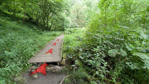
The track now continues through woodland, close by the river. After a while, you'll reach a long section of boardwalk, followed by a shorter section. These boardwalks were installed in 2011, and make this section much easier compared to the very muddy ground that was here before (now covered by verdant undergrowth).
-
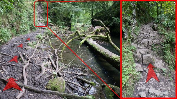
Not far after the sections of boardwalk, you'll reach a muddy section of track right next to the river (this floods when the river is particularly high), which ends with a short rock step (see inset photo).
Scramble up the rock step (about 10 feet high), and then follow the earthy path around to the left, where it passes over a rocky outcrop, and then descends back down to river level.
-
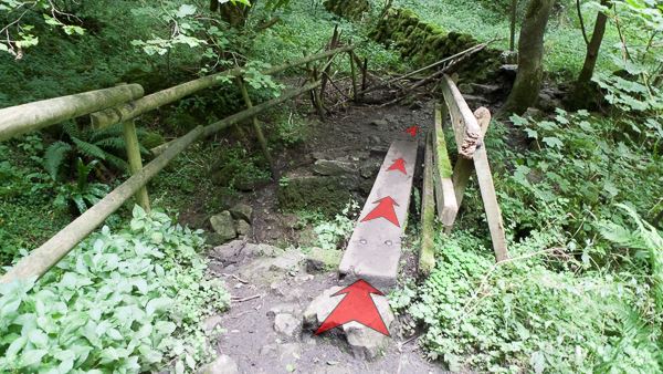
As the track reaches river level again, follow it right across a plank bridge (pictured), and then immediately through a gap in a dilapidated stone wall.
-
Shortly after crossing the wall, the track forks. Take the right-hand fork, heading back towards the main river channel.
Shortly after the fork, pass over a second plank bridge, and then across a short rocky area (a little boulder hopping may be in order!)—look out for the springs that erupt beneath the rocks in this area.
-
Continue along the track for a little way—quite rocky in places—and soon arrive at another rocky step (pictured). Scramble up this (the last rocky section of the route), and continue along the track on the other side.
-
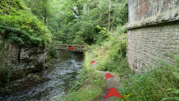
It's now pleasant and straightforward walking along the riverside track (which can be muddy in parts after prolonged wet weather), aided by a short section of boardwalk, and crossing a small stream along the way. You'll pass a weir in the main river channel as you approach a concrete and steel footbridge crossing the Wye.
-
A short section of boardwalk takes you to the path junction next to the bridge. There's a fingerpost here—turn right (signed "Blackwell") and cross the bridge.
This marks the end of the outbound leg of the walk—you'll shortly be leaving Chee Dale behind, and climbing up away from the valley floor. There's an idyllic grassy picnic spot, to your left, on the riverbank at the far side of the bridge—worth stopping here for a well earned rest on a bright summer day :-)
Stage 2: East end of Chee Dale to Topley Pike layby
-
After crossing the bridge, bear left and follow the grassy path slightly uphill, towards a fingerpost (about 100 metres away).
-
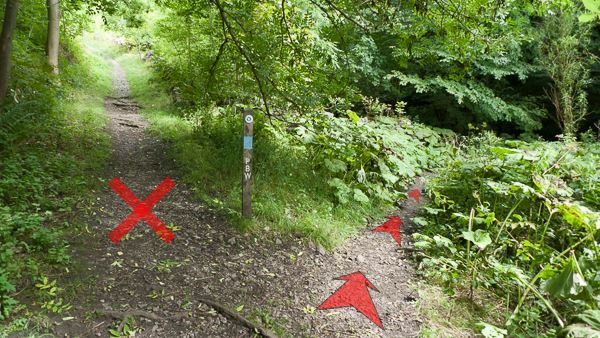
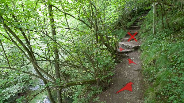
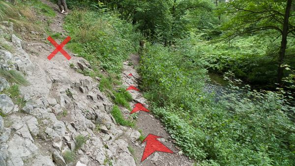
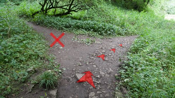
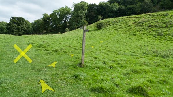
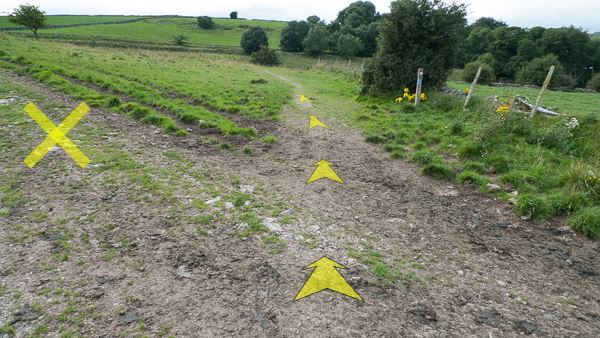
At the fingerpost, turn right off the main path, onto a less distinct grassy track, and continue heading uphill. This direction is signed "Blackwell".
If you're feeling tired, and would rather get back to the start of the walk the easiest way (without a steep pull uphill on the slopes to your right), continue straight ahead at the fingerpost (in the direction marked with a cross in the photo), signed to "Monsal Trail, Blackwell Dale". You'll soon reach the broad track of the Monsal Trail. Turn right onto the trail, go through Chee Tor tunnel, and this will take you back to the Cycle Hire Centre and Tuck Shop.
-
After a few yards you'll join another narrow track—bear right onto this, and continue the fairly steep climb up out of Chee Dale. The track isn't always very clear on the ground, but occasional marker posts show the general direction you should be heading (uphill!) if this isn't clear.

-
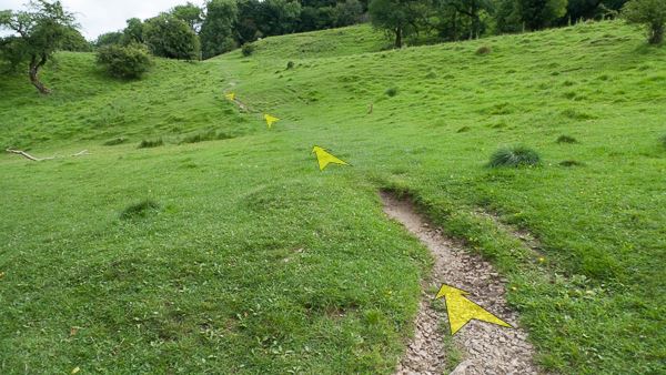
Continue on up the grassy slope. You'll see a marker post on the horizon ahead—this is the steepest part of the climb, so once you reach that marker post, things will start to get a little easier. Take your time to look back down to Chee Dale, which is particularly impressive here when clothed in autumn leaves.

-
Continue on up the grassy slope, until the hill starts to ease, and finally flattens. When you reach a stone wall across the track, go through the small wooden gate (alongside a larger field gate).
-
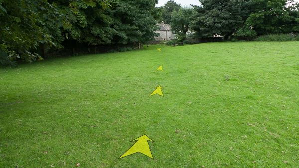
Continue across the grassy field (usually full of grazing sheep)—you'll soon reach a second stone wall with a small wooden gate (circled in the photo). Go through the gate, and enter a larger field on the other side of the wall.
-
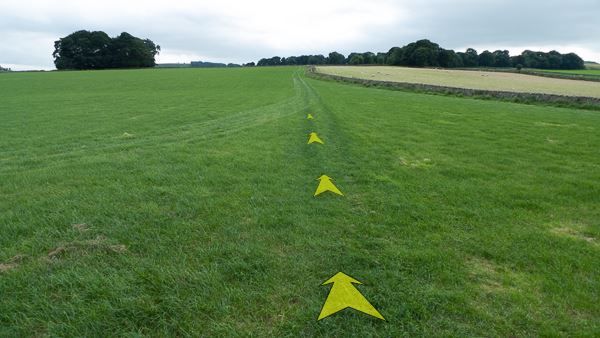
Once in the larger field, head in a straight line towards the bend in the wall ahead of you, then follow close by this wall, keeping it on your right. There's usually a visible track through the field, but it isn't always very obvious.
-
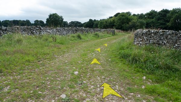
After about 300 metres, you'll reach the end of the large field. Follow the wall round to the right, joining a larger farm track which you should now follow. This track is firm underfoot when dry, but this area can get very muddy after prolonged rain.
-
After about 50 metres, bear back left on the farm track, now heading straight towards a large isolated tree (with more extensive woods behind), with a stone wall on your left.
-
Head along the straight farm track, reaching a gate by the isolated tree after a few hundred metres. Go through the gate, and after another 200 metres, you'll reach the edge of a farmyard, and a number of gates. Be sure to firmly close any gates that were closed when you reached them.
Once you've entered the farmyard proper (the main farm buildings are on your right) and reached the surfaced road, bear slightly right across the yard to reach a gap in the wall at the edge of the woods (circled in the photo). A marker post indicates the right of way. Be sure not to follow the road to the left here (marked with a cross in the photo).

-
Pass through a small clump of trees, to soon reach a wooden gate on the edge of a field. Go through the gate, and head diagonally-right across the field to reach a second wooden gate (marked with a circle in the photo).

-
Go through this second gate, and cross the next field diagonally-left, heading for a stone step-stile in the wall ahead (marked with a fingerpost, and circled in the photo).

-
Once over the step-stile, head diagonally-left again across the corner of the next grassy field, towards the buildings visible through the trees. Bear left as you near the edge of the field, and head towards a wooden gate.
-
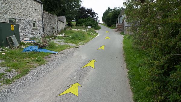
Climb over the stone step-stile alongside the wooden gate, then carry on a few metres to reach a junction with the minor road ahead. Turn right here, and follow the road.

-
Follow the road for a little over 200 metres, passing Cottage Farm on your right, Beech Croft Farm on your left, and Beech Croft Camping & Caravan Park on your right.
-
When the road takes a bend to the left, bear slightly right to leave the road and join a farm track. There's a fingerpost here, signed "Pennine Bridleway, Chee Dale ¾", in the direction you're taking.
-
Head along the track, passing through a number of gates, and signposts with markers indicating the route of the Pennine Bridleway (which you're now following). After about ½ a kilometre, you'll reach a pair of gates fairly close together, at which point the large Tunstead Quarry, just outside Buxton, will come into view in the middle distance ahead.
Go through both gates, still on the Pennine Bridleway, and continue to follow the main track as it bends round to the left.
-
Continue to follow the track, now on fairly open hillside. You'll pass through another gate (wooden, with a large stone gatepost to your left), and then follow the track alongside a wall and fence to your right. After about 300 metres from the pair of gates, be sure to continue following the track straight ahead—don't bear left on the farm track (marked with a cross in the photo). Another marker post for the Pennine Bridleway shows the way.
-
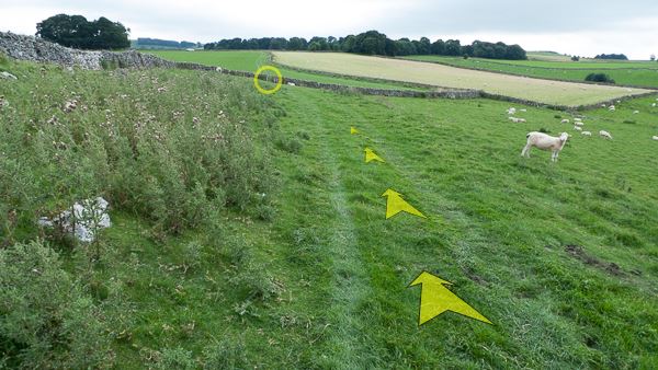
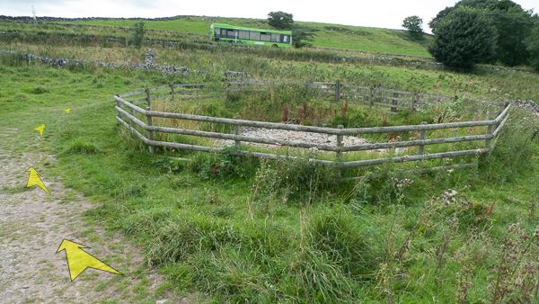
Follow the track as it bends round to the left, and after about 100 metres, reach a circular dewpond (fenced) ahead and to your right. The A6 road is very close by here. Follow the track around the back of the dewpond, and go through the large wooden gate (signed "Nature Reserve").
Another sign just through the gate shows that you are re-entering the Chee Dale Nature Reserve and SSSI. An information board next to the pond explains its importance as a potential habitat for Great Crested Newts.
-
Follow the grassy track down the narrow valley ahead, and after about 150 metres you'll reach a path junction (and fingerpost, signed "Concession Path, Topley Pike Layby") where you should bear left to reach the layby where you started the walk (about 150 metres).
(If you used the alternative start (from the Topley Pike bus stop, or parked in the adjacent Pay & Display Wydale car park), continue down the narrow valley ahead (described in steps 3 to 6 of these directions). After about 400 metres, you'll reach the Monsal Trail, and the Blackwell Mill Cycle Hire and Tuck Shop, from where you can return along the broad riverside vehicle track to the Wydale car park and Topley Pike bus stop.)